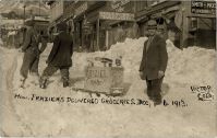
Scanned items: Postcards from My Collection
This Category: Victor Town, has a total of 65 images, as of 21.02.2023 (21:51:32).
Most Recent added/changed image is on top.
Most Recent added/changed image is on top.
Media Info Last Updated:
16.02.2023 (11:17:37)
Title (on) Image:
View Up at Independence and Portland Mines From Near Short Line Victor YardsPhotographer [Date]:
Date Guestimates, Earliest:
Date Guess, No Later Than:
1919-09-01; Give 1 week process time for PostcardPublished By:
Source ID, My Collection:
P-04682 [#8172]
Shareable Link to PC Info:
www.cripplecreekrailroads.com/04library/scnd_postcards_all.php#8172Description:
Not much to say to this card, I find it quite self-explaining. It is a view looking uphill at a couple of Battle Mountain mines; the Stratton's Independence mine at foreground right and the Portland No. 2 Shaft against the sky in background left. View is taken from around the Short Line yard in Victor, Colorado, and on top of the rock-wall seen in lower left is the old railroad yard of the Florence & Cripple Creek, most likely gone by the time this card was photographed, impossible to tell for sure in this view here, all I can see in my 1200dpi scan is rails, the gauge can't be picked up due to the angle.Sorting Categories:
Florence & Cripple Creek Related Midland Terminal Related Victor Town Mining Enties visible:
Stratton's Independence No. 1 - 270 Portland No. 2 - 259 I've seen copies of this Card sell at eBay on/for:
18.12.2021 at USD 25.53Media Info Last Updated:
09.02.2023 (07:31:46)
Title (on) Image:
Granite Mine, Cripple Creek, Colo. No. 2---February 1st. '07.Photographer [Date]:
Date Guestimates, Earliest:
Date Guess, No Later Than:
Published By:
Henry Sachs, Stocks and BondsSource ID, My Collection:
P-04743 [#8950]
Shareable Link to PC Info:
www.cripplecreekrailroads.com/04library/scnd_postcards_all.php#8950Description:
Sorting Categories:
Midland Terminal Related Victor Town Mining Enties visible:
Strong Mine - 271 I've seen copies of this Card sell at eBay on/for:
01.02.2023 at USD 19.95Media Info Last Updated:
16.01.2023 (01:57:25)
Title (on) Image:
A View at the Strong Mine on the Southeastern Part of VictorPhotographer [Date]:
William Henry Lehr [aka Bill Lehr]Date Guestimates, Earliest:
Date Guess, No Later Than:
Published By:
Source ID, My Collection:
P-04743 [#8944]
Shareable Link to PC Info:
www.cripplecreekrailroads.com/04library/scnd_postcards_all.php#8944Description:
Based on the ending price on this card I can see I was too crazy for it, as the other fellow was more keen then I had imagined and I should have respected that one, but I feel for the need to have feel as I do feel this image is helpful to me to understand better how the railroads changed over the years as this view do show how the old narrow gauge yard of the F. & C.C. has three lines of standard gauge tracks on them, filling in some blanks I have got after some other views from further west, looking more like southernly while this view is more westerly. Sadly, the left side of this view is more blurred then the rest, seen very easily on the higher resolution scans. I can see there are some railroad spurs there, and it looks like there is only a road surface on Diamond Avenue which dates this to be after the street track of the Trolley was ripped out, otherwise I should have been able to get a glimpse of tracks on left-hand edge about 1/3 up from bottom left.
 The Strong Mine is easily seen with its exposed Head frame and Ore-House in the foreground right, showing mine tracks crossing the Midland Terminal between the Head-Frame and the Ore-House.
 In the background, high up on Squaw Mountain is seen the dump of the Nellie V. Mine, about 1/8 down from top, while the huge dumps to the upper right belongs to the massive operations at the Ajax Mine.
Sorting Categories:
Midland Terminal Related Victor Town Mining Enties visible:
Strong Mine - 271 I've seen copies of this Card sell at eBay on/for:
16.01.2023 at USD 40.0Media Info Last Updated:
15.01.2023 (14:43:40)
Title (on) Image:
A View at the Strong Mine on the Southeastern Part of VictorPhotographer [Date]:
William Henry Lehr [aka Bill Lehr]Date Guestimates, Earliest:
Date Guess, No Later Than:
Published By:
Source ID, My Collection:
P-03597 [#6242]
Shareable Link to PC Info:
www.cripplecreekrailroads.com/04library/scnd_postcards_all.php#6242Description:
Based on the ending price on this card I can see I was too crazy for it, as the other fellow was more keen then I had imagined and I should have respected that one, but I feel for the need to have feel as I do feel this image is helpful to me to understand better how the railroads changed over the years as this view do show how the old narrow gauge yard of the F. & C.C. has three lines of standard gauge tracks on them, filling in some blanks I have got after some other views from further west, looking more like southernly while this view is more westerly. Sadly, the left side of this view is more blurred then the rest, seen very easily on the higher resolution scans. I can see there are some railroad spurs there, and it looks like there is only a road surface on Diamond Avenue which dates this to be after the street track of the Trolley was ripped out, otherwise I should have been able to get a glimpse of tracks on left-hand edge about 1/3 up from bottom left.
 The Strong Mine is easily seen with its exposed Head frame and Ore-House in the foreground right, showing mine tracks crossing the Midland Terminal between the Head-Frame and the Ore-House.
 In the background, high up on Squaw Mountain is seen the dump of the Nellie V. Mine, about 1/8 down from top, while the huge dumps to the upper right belongs to the massive operations at the Ajax Mine.
Sorting Categories:
Midland Terminal Related Victor Town Mining Enties visible:
Strong Mine - 271 I've seen copies of this Card sell at eBay on/for:
Media Info Last Updated:
28.09.2022 (12:20:25)
Title (on) Image:
Street Scene Woodland Park, Colo.Photographer [Date]:
Date Guestimates, Earliest:
Date Guess, No Later Than:
1910-03-09; Seen a postcard stamped one week laterPublished By:
Source ID, My Collection:
P-04705 [#8223]
Shareable Link to PC Info:
www.cripplecreekrailroads.com/04library/scnd_postcards_all.php#8223Description:
Sorting Categories:
Victor Town Mining Enties visible:
I've seen copies of this Card sell at eBay on/for:
22.06.2022 at USD 43.88Media Info Last Updated:
28.09.2022 (12:20:19)
Title (on) Image:
Victor Ave - Looking West.Photographer [Date]:
Date Guestimates, Earliest:
Date Guess, No Later Than:
1907; Seen a postcard stamped that year.Published By:
Source ID, My Collection:
P-04704 [#8222]
Shareable Link to PC Info:
www.cripplecreekrailroads.com/04library/scnd_postcards_all.php#8222Description:
I've seen the base photo/negative be used for three postcard uses by the time of this writing [14.04.2018], this being the Real Photo one, with an another being in B&W and not filling the whole front of the card, and there is also a painted/colored version of this scene. The view is Looking West up on Victor Avenue in Victor, Colorado, looking up to the Intersection with Third Street, and beyond that, in right-hand side of street, the high structure seen is the Bank Block, today the Victor Hotel. The lady seen crossing the street about center sideways and about 1/3 up from bottom of card, is to cross the tracks for the Trolley, seen just in front of her.
Sorting Categories:
Victor Town Mining Enties visible:
I've seen copies of this Card sell at eBay on/for:
21.06.2022 at USD 37.0Media Info Last Updated:
12.09.2022 (18:15:16)
Title (on) Image:
Broncho Busting Labor Day Victor [Looking Northerly]Photographer [Date]:
Date Guestimates, Earliest:
Date Guess, No Later Than:
Published By:
Source ID, My Collection:
P-03139 [#5263]
Shareable Link to PC Info:
www.cripplecreekrailroads.com/04library/scnd_postcards_all.php#5263Description:
Just below top is the railroad grade of the M.T. with a passenger car partly obscured by a water tank roof about 1/5 in from right-hand side. Further below are several boxcars seen on the F. & C.C., from right-hand side to about middle of image, but many are obscured by the appearance of the Short Line Depot structure on the next railroad level down, several people are standing on a platform on the rear side of that structure, about 1/3 in from right-hand side and 1/5 down from top.
 I think top part of the ore-house of the Mary Cashen Mine is seen near upper left, about 1/5 in from left-hand side and 1/10 down from top.
Sorting Categories:
Florence & Cripple Creek Related Midland Terminal Related Short Line Related Victor Town Mining Enties visible:
Mary Cashen - 272 I've seen copies of this Card sell at eBay on/for:
Media Info Last Updated:
08.07.2022 (07:29:11)
Title (on) Image:
Gold Coin Mine, Cripple Creek DistrictPhotographer [Date]:
Date Guestimates, Earliest:
Date Guess, No Later Than:
1906-08-28; as in 1 week before seen post stamp of Sep. 4, 1906Published By:
Source ID, My Collection:
P-00239 [#306]
Shareable Link to PC Info:
www.cripplecreekrailroads.com/04library/scnd_postcards_all.php#306Description:
This is not the best views of the Gold Coin mine, due to the print type of process behind this postcard. It did not scan well and details are lost to the dots making up the image. But, it does show yet another image that at least at one time did exist out there as a negative, with three mines visible. Also, we see some train activity on the F. & C.C. tracks at the lower left part of the view. In the prominent place about center of view we of course see the massive brick structures of the Gold Coin mine!
 In foreground, lower part right-hand side of the view, we see part of the cribbing of the Mary Cashen mine, and its dump area inside the crib-wall.
 In lower right-hand corner one also see a piece of the Victor Public Sampler structure, rest is outside the view in this card.
 A little less than 1/3 left from the right-hand side, about 1/3 down from the top, behind the roof part of the engine room part of the Gold Coin, the head frame of the Golconda mine is poking up among the roof tops of the houses in the background.
Sorting Categories:
Victor Town Mining Enties visible:
Mary Cashen - 272 Golconda - 287 Gold Coin - 288 I've seen copies of this Card sell at eBay on/for:
04.04.2010 at USD 10.2515.09.2010 at USD 16.5906.12.2010 at USD 10.6102.07.2012 at USD 21.0104.08.2013 at USD 6.53511.05.2015 at USD 24.512.07.2015 at USD 26.6606.03.2016 at USD 9.4921.12.2016 at USD 13.49Media Info Last Updated:
04.07.2022 (19:01:31)
Title (on) Image:
Granite Mine, Formerly ''Gold Coin'', Cripple Creek DistrictPhotographer [Date]:
Date Guestimates, Earliest:
Date Guess, No Later Than:
Published By:
Source ID, My Collection:
P-00048 [#53]
Shareable Link to PC Info:
www.cripplecreekrailroads.com/04library/scnd_postcards_all.php#53Description:
This postcard view shows the Gold Coin Mine in Victor in all its glory. Sadly, being of the painted/colored printed type of postcard, the quality is not that great, but I've done what I can to make the view as best I can. Focusing more on the Ore-house than on the more commonly focused Shaft-house, as would have been seen from the more common view-angle looking into mine from the right-hand side of this view. One gets to see the stone foundation walls of the orehouse which still for the most part is still there in Victor, with its brick-based shaft-house with the stained-glass windows and tower like part over the top of the head frame. Sadly, the brick part of the structure is gone today, same is of course the smokestack which in this view is very visible.
 In the background, Squaw Mountain is seen, with the mainline of the M.T. visible with some boxcars and other railroad cars just behind the top of the orehouse, most on the left side of the card.
Sorting Categories:
Victor Town Mining Enties visible:
Gold Coin - 288 I've seen copies of this Card sell at eBay on/for:
04.06.2013 at GBP 1.7517.02.2014 at USD 4.510.12.2017 at USD 4.501.04.2018 at USD 5.006.07.2018 at USD 1.34Media Info Last Updated:
16.01.2022 (16:35:43)
Title (on) Image:
Cripple Creek, Colo. [Overview Victor From Squaw Mountain]Photographer [Date]:
Date Guestimates, Earliest:
1900; As the Bank Block structure is visible and that was completed by December 1899Date Guess, No Later Than:
1902; Image lacks the Catholic Church, which was started building in 1902Published By:
SanbornSource ID, My Collection:
P-01046 [#1667]
Shareable Link to PC Info:
www.cripplecreekrailroads.com/04library/scnd_postcards_all.php#1667Description:
Sadly, this is a printed view, but I feel it is an important view as it fails to show the brick Shaft House of the Gold Coin Mine, only the covered walkway from shaft to the ore house is standing there. The head frame though feels wrong for the one that was put up after the fire, inside the shaft house, which made me first think this is was a later image, after they tore down the shaft house of the Gold Coin around end of 1920. But then a friend, La Jean Greeson, pointed out to me that the Catholic Church, across from the Washington School – a church still standing in Victor – is not yet built in this view, and that dates this to be before they started building the church in 1902. Thanks La Jean! The before mention Washington School can be seen about 1/3 in from the right-hand side, and about half bottom/top, and the church shall be built left of this school structure, at the corner of 2nd Street and Portland Avenue.
 The use of this smaller head frame and wood structures for the Gold Coin tells how important it was to get the mine up and running again, but they certainly have changed things allot in the ground where Gold Coin was located. As I have a dated photo from July 1901 with a completed Gold Coin in brick, this image here must be from around 1900, not sure exact but the Bank Block structure, later to be Victor Hotel, was completed by end of December 1899 – this structure can be seen as the large 4 story corner building behind the smokestack of the Gold Coin, about 1/3 up from bottom and same in from the right-hand side.
 Up near the F. & C.C. railroad yard, depot, near lower left corner, the Elks Lodge structure at corner of 3rd street and Diamond Avenue, seems to either being rebuilt or built, as it is clearly in this view a more ruin looking structure then the nice-looking structure it is.
Sorting Categories:
Florence & Cripple Creek Related Victor Town Mining Enties visible:
Gold Coin - 288 Jefferson - 290 Maggie Mine - 893 I've seen copies of this Card sell at eBay on/for:
13.04.2011 at USD 35.55Media Info Last Updated:
25.11.2021 (05:36:41)
Title (on) Image:
Victor, Colo.Photographer [Date]:
Julia SkolasDate Guestimates, Earliest:
Date Guess, No Later Than:
Published By:
Source ID, My Collection:
P-00498 [#597]
Shareable Link to PC Info:
www.cripplecreekrailroads.com/04library/scnd_postcards_all.php#597Description:
This view is after the Victor fire as I see the Gold Coin mine is made of brick, and I see the large smokestack. Not the best view of the Gold Coin mine as it is only seen partly on the left-hand side under some smoke. But it helps tell the story on how the ground outside of it appeared at the time of this photo. Just too bad there is not a known date to this image.Sorting Categories:
Florence & Cripple Creek Related Victor Town Mining Enties visible:
I've seen copies of this Card sell at eBay on/for:
Media Info Last Updated:
21.11.2021 (15:56:57)
Title (on) Image:
North Third Street and Battle Mountain, Victor, Colo.Photographer [Date]:
Schedin & LehmanDate Guestimates, Earliest:
1899-09-11; Being only 3 weeks after the Victor fire I highly doubt Victor was looking this nice, but I had to find a date & this is the best guess.Date Guess, No Later Than:
1903-06-31; is my best guess as by July 10th the last rail up this street was put in for the Trolley, and it's not in this view.Published By:
H.H. RosserSource ID, My Collection:
P-01401 [#2211]
Shareable Link to PC Info:
www.cripplecreekrailroads.com/04library/scnd_postcards_all.php#2211Description:
This view looking up North Third Street in Victor from Intersection with Victor Avenue appears to be from before the Trolley line up the street was made in July 1903, as I see no signs of the tracks. In the background several of Battle Mountain Mines can be seen, for instance the one with all the smoke is the No. 1 Shaft of the Portland Gold Mining company.Sorting Categories:
Victor Town Mining Enties visible:
Portland No. 2 - 259 Portland No. 1 [aka Burns Shaft] - 262 Dillon [aka W.C. Dillon] - 268 Anna Lee [aka Anne Lee; Battle Mtn] - 1871 Victor Public Sampler - 1060 I've seen copies of this Card sell at eBay on/for:
15.11.2011 at USD 7.3319.01.2012 at USD 14.9914.06.2015 at USD 23.4913.11.2016 at USD 3.0Media Info Last Updated:
06.10.2021 (18:58:34)
Title (on) Image:
Victor, Colo. ''Two Miles High.''Photographer [Date]:
William Henry JacksonDate Guestimates, Earliest:
Date Guess, No Later Than:
Published By:
Detroit Publishing Co.Source ID, My Collection:
P-00287 [#362]
Shareable Link to PC Info:
www.cripplecreekrailroads.com/04library/scnd_postcards_all.php#362Description:
This view of Victor from Battle Mountain is a nice one when looking at the online sources of the non-postcard view. It holds so many goodies it is hard to describe them all. The Gold Coin mine is seen in quite a nice look, just to the left of the center of the view.
 Further up front is also seen the Ore-house of the Mary Cashen mine, with a near square head frame and part of the cribbing to hold the waste rock in place as they had not the same luxury as Gold Coin to transport waste away through a long tunnel.
 At left of the orehouse is the structures of the Victor Public Sampler, located just below the M.T. spurs and sort of sandwiched in between that and the switchback spur down to the orehouse of the Strong Mine further to the left, outside this view. Piece of the tail-end of that spur is seen along the cribbing and head frame of the Mary Cashen when looking near right hand side where the Victor depot of the M.T. is seen.
 Way of in the background, right of the Gold Coin but sort of just over the south part (left) part of the Gold Coin Club structure, the Golconda structures can be seen on the Internet sources when fully zoomed into the view. That mine is hard to find good images of.
Sorting Categories:
Florence & Cripple Creek Related Midland Terminal Related Victor Town Mining Enties visible:
Mary Cashen - 272 Gold Coin - 288 I've seen copies of this Card sell at eBay on/for:
03.01.2016 at USD 2.2901.06.2016 at USD 5.2516.05.2018 at USD 11.6124.03.2020 at USD 8.99Media Info Last Updated:
06.10.2021 (18:58:34)
Title (on) Image:
Victor, Colorado - ''The City Of Mines'' | Victor Colo. City of Mines.Photographer [Date]:
H. & H. Studio [Hileman & Hill]
[1909]
Date Guestimates, Earliest:
Date Guess, No Later Than:
Published By:
Noble Inc.Source ID, My Collection:
P-00305 [#391]
Shareable Link to PC Info:
www.cripplecreekrailroads.com/04library/scnd_postcards_all.php#391Description:
Part of a small Album of 10 Postcards one could rip out and send to someone. This view of Victor is looking north from Straub Mountain area. Photographed in 1909 by the H. & H. Studio in Cripple Creek, it was taken by either Hileman or Hill, impossible to tell for sure as the view is credited to them both. Being this is from a printed card in a small more modern postcard folder it is not the greatest quality, but one gets an idea of the town and the many mines in and around it.
 * Gold Coin, here marked as Granite Mine on the south facing ore-house, is seen about middle top/down and about 1/5 in from left-hand side.
 * Just behind the huge smokestack of the Gold Coin is the main shaft of the Dead Pine, named Oliver Shaft for some reason. The dump is much easier seen then the mine itself.
 * Straight up from the Gold Coin smokestack, in the distance; against the sky; sticking up from the hill, is the shaft-house of the American Eagle.
 * The Ajax Mine is about 1/4 down from top left, about 1/6 on from left-hand side.
 * Further to the right of the Ajax would been upper shaft of the Dead Pine, the Granite (original shaft/mine) - seen about 1/3 in from left-hand side - and the Burns (main) shaft of the Portland mines, with the Portland No. 2 seen just off to the right for the center of the upper quarter in this view.
 * Towards the right-hand side is seen the Strong Mine, about half top/down and 2/3 in from the left-hand side.
 * The Independence Mine is just right of the Strong mine, seen with its huge dumps and structures.
 * The Vindicator Mine, shaft 1, is seen above the Independence mine, about 1/3 down from top.
Sorting Categories:
Victor Town Mining Enties visible:
Gold Coin - 288 Dead Pine - Oliver Shaft - 274 American Eagle - 312 Ajax - 275 Granite - 261 Portland No. 1 [aka Burns Shaft] - 262 Portland No. 2 - 259 Strong Mine - 271 Stratton's Independence No. 1 - 270 I've seen copies of this Card sell at eBay on/for:
Media Info Last Updated:
26.09.2021 (19:22:13)
Title (on) Image:
4th Street, Victor - - Pub. By W. A. Loper, Cripple Creek, Colo.Photographer [Date]:
Date Guestimates, Earliest:
Date Guess, No Later Than:
Published By:
W.A. LoperSource ID, My Collection:
P-00975 [#1441]
Shareable Link to PC Info:
www.cripplecreekrailroads.com/04library/scnd_postcards_all.php#1441Description:
Sorting Categories:
Florence & Cripple Creek Related Victor Town Mining Enties visible:
I've seen copies of this Card sell at eBay on/for:
14.12.2011 at USD 52.9901.05.2015 at USD 14.9917.05.2015 at USD 20.529.09.2015 at USD 4.28512.11.2017 at USD 6.59Media Info Last Updated:
26.09.2021 (12:07:49)
Title (on) Image:
Washington School, Victor ColoradoPhotographer [Date]:
Date Guestimates, Earliest:
1902; This as the Catholic Church in Victor is seen and that has this as Build Year.Date Guess, No Later Than:
Published By:
Source ID, My Collection:
P-03624 [#6278]
Shareable Link to PC Info:
www.cripplecreekrailroads.com/04library/scnd_postcards_all.php#6278Description:
This is one of those views I know I just must have as it is so informative to show how one structure looked, in this case the Washington School in Victor! The brick Catholic Church is seen partly in background left, while on background right some houses are seen, but the focus is the side of the school lining the South Second Street – quite a handsome structure! Also, on the background right, hidden by the school except for a piece of the south eastern dump part, is the Fortuna Mine, but no indication of the mine itself as the school hides it, still, cool that I now know what that is, seen best in my 1200dpi scan, but can be seen about 1/3 up from bottom and about 1/8 in from right-hand side – between the school's backside and the houses seen at the right-hand side.
 26.09.2021; I did procure the colored version of this image, if that is what you see. Source was grayish, or in common speech black & white. Used an online service and tweaked and worked with image to get what looks best to my eyes at the moment.
Sorting Categories:
Victor Town Mining Enties visible:
I've seen copies of this Card sell at eBay on/for:
Media Info Last Updated:
26.05.2021 (08:38:07)
Title (on) Image:
CITY OF VICTOR, COLORADO. Colo. Springs & Cripple Creek Short Line. | CITY OF VICTOR, COLO.Photographer [Date]:
William Edward HookDate Guestimates, Earliest:
Date Guess, No Later Than:
1904; as the base image appears in a book Copyrighted 1904Published By:
Source ID, My Collection:
P-00002 [#2]
Shareable Link to PC Info:
www.cripplecreekrailroads.com/04library/scnd_postcards_all.php#2Description:
This photo is possible from 1904 as it appears in a book from that timeframe with a Copyright note of 1904 by Hook, the photographer. The town of Victor is seen from Battle Mountain, not exactly sure where, but located at the left-hand side is the Fourth Street. The Gold Coin Mine and Gold Coin Club is seen about 1/5 in from the left, and the mine structure partly hidden by the hill, with its double smokestack and head frame about 1/5 in from the right and 1/3 up from bottom is the north-east side of the Oliver shaft, or the main Dead Pine shaft, as confirmed by looking at the 1908 Sanborn Fire Insurance Map.
Sorting Categories:
Victor Town Mining Enties visible:
Dead Pine - Oliver Shaft - 274 Gold Coin - 288 I've seen copies of this Card sell at eBay on/for:
14.02.2010 at USD 4.9928.02.2010 at USD 5.9923.03.2010 at USD 3.2514.04.2010 at USD 2.66718.04.2010 at USD 6.9504.05.2010 at USD 0.9921.11.2010 at USD 3.027.03.2011 at USD 0.99525.10.2011 at USD 9.95Media Info Last Updated:
10.10.2020 (14:51:36)
Title (on) Image:
Victor High SchoolPhotographer [Date]:
Tomer Jacob Hileman
[1909]
Date Guestimates, Earliest:
1909-01-01Date Guess, No Later Than:
1909-12-31Published By:
Source ID, My Collection:
P-03104 [#5182]
Shareable Link to PC Info:
www.cripplecreekrailroads.com/04library/scnd_postcards_all.php#5182Description:
I felt this was a nice look at the High School Structure in Victor, and while it may not be that useful I do enjoy the fact the view is signed with a name and a year as a date on the view.Sorting Categories:
Victor Town Mining Enties visible:
I've seen copies of this Card sell at eBay on/for:
Media Info Last Updated:
17.09.2020 (10:45:31)
Title (on) Image:
Garfield School, Showing Houses Along 5th Street in VictorPhotographer [Date]:
William Henry Lehr [aka Bill Lehr]Date Guestimates, Earliest:
Date Guess, No Later Than:
Published By:
Source ID, My Collection:
P-03694 [#6351]
Shareable Link to PC Info:
www.cripplecreekrailroads.com/04library/scnd_postcards_all.php#6351Description:
Another Postcard View across houses along Fifth Street in Victor towards the Garfield School structure. I know about 4 editions of this view, three as postcards and the fourth is a photograph, and luck have made me the holder/owner of those for the foreseeable future! Card is damaged in upper right, on the sky part, no big issue, but is also rather light on the right-hand side of the card and that been hard to fix. There appears to be snow patches on the ground, but other then that there are no identification markers on this view as to when it was photographed by Lehr.
Sorting Categories:
Victor Town Mining Enties visible:
I've seen copies of this Card sell at eBay on/for:
Media Info Last Updated:
01.08.2020 (09:02:22)
Title (on) Image:
North Fourth Street Victor ColoradoPhotographer [Date]:
William Henry Lehr [aka Bill Lehr]Date Guestimates, Earliest:
Date Guess, No Later Than:
1924; There are what appears to be rails visible on Victor Avenue, Low Line was abandoned 1923, hence they would not last too long afterwards.Published By:
Source ID, My Collection:
P-03138 [#5262]
Shareable Link to PC Info:
www.cripplecreekrailroads.com/04library/scnd_postcards_all.php#5262Description:
I am pretty sure there is still Trolley tracks in Victor Avenue by the time this photo was taken as there appears to be some visible as the 4th street crosses over Victor Avenue, just above the text giving the title of the postcard view. There are several signs visible, like the one for the 'Monte Carlo Bar' hanging on the Bank Block Structure that is to be Victor Hotel in modern times. There is also a 'H.H. Rosser Pool Cigars' sign and into the view at right, large lettering on side of wall along Diamond Avenue is a lettering saying 'Victor Studio', seen about 1/4 up from bottom.Sorting Categories:
Trolley Related Victor Town Mining Enties visible:
I've seen copies of this Card sell at eBay on/for:
01.02.2017 at USD 29.99Media Info Last Updated:
22.06.2019 (20:33:53)
Title (on) Image:
Early Days Victor Colo 1895Photographer [Date]:
William Henry Lehr [aka Bill Lehr]
[1895]
Date Guestimates, Earliest:
Date Guess, No Later Than:
Published By:
Source ID, My Collection:
P-00974 [#1440]
Shareable Link to PC Info:
www.cripplecreekrailroads.com/04library/scnd_postcards_all.php#1440Description:
This reproduction card of an old about 1895 photo, possible by Bill Lehr as I think it say Lehr before the Foto part of the tittle written at bottom of this view, is a nice one of the pre-fire Gold Coin mine, showing a massive wood structure and crib-wall and all. The Ore-house also appears to be quite big. In the foreground is the old pre-fire Depot of the Florence & Cripple Creek, with lot of trains around it.
Sorting Categories:
Florence & Cripple Creek Related Victor Town Mining Enties visible:
Gold Coin - 288 I've seen copies of this Card sell at eBay on/for:
Media Info Last Updated:
23.07.2018 (14:55:02)
Title (on) Image:
Garfield School, 5th Street and Houses in Victor, ColoradoPhotographer [Date]:
William Henry Lehr [aka Bill Lehr]Date Guestimates, Earliest:
Date Guess, No Later Than:
Published By:
Source ID, My Collection:
P-03757 [#6416]
Shareable Link to PC Info:
www.cripplecreekrailroads.com/04library/scnd_postcards_all.php#6416Description:
My third Postcard View across houses along Fifth Street in Victor towards the Garfield School structure. I know about 4 editions of this view, three as postcards and the fourth is a photograph, and luck have made me the holder/owner of those for the foreseeable future! Card has some damages, like those hairs/spots seen, they all are part of the card and can only digitally be removed. Also, it is sort of faded, darker in spots like the north side of the School Structure, which appears in more shadows. There appears to be snow patches on the ground, but other than that, there are no identification markers on this view as to when it was photographed by Lehr.
 The view itself is a nice one towards the Garfield School in Victor, located along South 5th Street on the west side of the street, and West Spicer Avenue on the north side of the street. That avenue is behind the School structure in this view. Seeing several of the houses lining Fifth street, and two of them on the east side has clothes hanging on the back porch, while the front garden on some of the west side houses appears to have patches of snow on the ground. The School have a flag hanging from a pole standing along the street.
Extra Image Links:
⊞ Garfield School, 5th Street and Houses in Victor, Colorado {Enhanced; Straightened} Sorting Categories:
Victor Town Mining Enties visible:
I've seen copies of this Card sell at eBay on/for:
Media Info Last Updated:
23.07.2018 (14:52:52)
Title (on) Image:
Big Snow Victor Colo April 15, 1921Photographer [Date]:
William Henry Lehr [aka Bill Lehr]
[15.04.1921]
Date Guestimates, Earliest:
Date Guess, No Later Than:
Published By:
Source ID, My Collection:
P-03587 [#6232]
Shareable Link to PC Info:
www.cripplecreekrailroads.com/04library/scnd_postcards_all.php#6232Description:
This turned out to sadly be a very out of focus view, blurred and not good at all! Made me happy I lost the other copy I've seen of this the first time around, as that appeared to be a duplicate where I found no differences on neither side from this one, and that one sold even higher then I paid for my copy. Quality of view is not the best, but as I both can tell it is in Victor looking up towards Battle Mountain in the distance, and this being a dated view, I am happy enough with it. I see one sign I can read; J.E. Hardy Music Co., and from the background I think this is a view up Third Street, as that peaked roof shape seen about half 'Hardy sign' width to the left of the sign, looks very much like the Aerial Tram Terminal/Ore House of the Granite Gold Mining Company, where it is connected to their Shaft No. 2, which I think is the old Dillon Mine Shaft House.
Extra Image Links:
⊞ Big Snow Victor Colo April 15, 1921 {Large Pixels 600dpi; Enhanced} Sorting Categories:
Victor Town Mining Enties visible:
I've seen copies of this Card sell at eBay on/for:
05.03.2018 at USD 46.9909.04.2018 at USD 22.49Media Info Last Updated:
23.07.2018 (14:52:17)
Title (on) Image:
Swedish Church in Victor.Photographer [Date]:
William Henry Lehr [aka Bill Lehr]Date Guestimates, Earliest:
1905; as the cornerstone of the Swedish Church indicates it was built in 1905.Date Guess, No Later Than:
Published By:
Source ID, My Collection:
P-03720 [#6377]
Shareable Link to PC Info:
www.cripplecreekrailroads.com/04library/scnd_postcards_all.php#6377Description:
Yet another version of this Lehr photograph towards the Swedish Church at corner of Portland Avenue and Second Street in Victor, Colorado. In this version the whole scene is tilted way much to the right-hand side, with blank spot in upper left, indicating that this might be a copy card from way back then and not the best one made so to speak. Not much to describe, I see the crib-wall behind the church structure at right is coming to an end at the corner where it stops towards the edge of South 2nd Street, with what appears to be billboard advertisement hanging on the side towards the street. The cribbing belongs to the Rexall Mining Company, operating the Spicer lode claim.
Extra Image Links:
⊞ Swedish Church in Victor. {Cropped; Enhanced; Straightened; Twisted} Sorting Categories:
Victor Town Mining Enties visible:
Spicer lode [aka Rexall Mine; Victor Town] - 808 I've seen copies of this Card sell at eBay on/for:
Media Info Last Updated:
23.07.2018 (13:58:37)
Title (on) Image:
Automobile at Corner Where the Swedish Church is LocatedPhotographer [Date]:
Date Guestimates, Earliest:
1905; as the cornerstone of the Swedish Church indicates it was built in 1905.Date Guess, No Later Than:
Published By:
Source ID, My Collection:
P-03695 [#6352]
Shareable Link to PC Info:
www.cripplecreekrailroads.com/04library/scnd_postcards_all.php#6352Description:
Card is marked on the backside as 'Elks Parade Car', but there are no name/dates written. I had to try get this view I felt as while the flower decorated automobile with a smaller girl in the backside holding an umbrella is the main focus, I was more after the background view. Foreground right background is the Swedish Church at corner of West Portland Avenue and South Second Street, with some of the structure fronts that lined Portland Avenue seen on left side of card, views I've never seen before and hence I had to try get hold of this card!
Extra Image Links:
⊞ Automobile at Corner Where the Swedish Church is Located {Cropped; Enhanced; Straightened; Twisted} Sorting Categories:
Victor Town Mining Enties visible:
I've seen copies of this Card sell at eBay on/for:
Media Info Last Updated:
23.07.2018 (13:53:12)
Title (on) Image:
Victor Scene at Corner Of Victor Avenue and 4th Street, Looking at the Old Bank Block, Later Victor Hotel.Photographer [Date]:
Date Guestimates, Earliest:
Date Guess, No Later Than:
Published By:
Source ID, My Collection:
P-03692 [#6349]
Shareable Link to PC Info:
www.cripplecreekrailroads.com/04library/scnd_postcards_all.php#6349Description:
A view at the Bank Block on the corner of Victor Avenue and Fourth Street, in Victor, Colorado, somewhere around 1910/1920's I assume as I still see Trolley Tracks in the street in lower foreground, and as they belonged to the Low Line tracks, who services shut down around 1919 and tracks must have been ripped out sometime after that. In background left, about halfway up and just in from right-hand side, there is mining operations visible and my mind claim the one seen to be the Portland No. 2 Mine, mainly, as I do see some of the smokestacks of the No.2 shaft further into the view, at left of the structures of the No. 1.
 Lot of signs visible, from left to right the readable ones are:
 'Victor Studio'
 'Isis 10¢' or 'New Isis' as I think it say above the doorway
 'The Brunswick'
 'H.H. Rosser | Pool | Cigars'
 'Bar' -> other images indicates there should possible be the text of 'Monte Cristo' above it, but I've been unable to say for sure it is either there or not above the letters of the 'BAR' so maybe this is from before that name came into play?
 'Bank Blk Rooms'
 'Davis & Byler [?] Mining Engineers' as it stands in one of the windows out unto Victor Avenue
 '?. Freshw??' 'Diamonds' 'Jewelry'; Williams [?] seems to be written on one of those walkway covers which is coming out of the wall so to speak.
Extra Image Links:
⊞ Victor Scene at Corner Of Victor Avenue and 4th Street, Looking at the Old Bank Block, Later Victor Hotel. {Cropped; Enhanced; Straightened; Twisted} Sorting Categories:
Victor Town Mining Enties visible:
Portland No. 1 [aka Burns Shaft] - 262 I've seen copies of this Card sell at eBay on/for:
Media Info Last Updated:
23.07.2018 (13:43:22)
Title (on) Image:
Men Around Midland Terminal Motor Coach No. 101, In Victor [?]Photographer [Date]:
Date Guestimates, Earliest:
Date Guess, No Later Than:
Published By:
Source ID, My Collection:
P-03633 [#6290]
Shareable Link to PC Info:
www.cripplecreekrailroads.com/04library/scnd_postcards_all.php#6290Description:
Not sure if this is at Victor Depot grounds or up in Cripple Creek, or at a different location, as sadly the background is too faded away to tell for sure. But I think this view is photographed at the Victor Union Depot, as there appears to be a hill shape in background top-left that sort of fits.Sorting Categories:
Midland Terminal Related Victor Town Mining Enties visible:
I've seen copies of this Card sell at eBay on/for:
Media Info Last Updated:
23.07.2018 (13:43:05)
Title (on) Image:
Lots of Children of Victor Posing at/on the Steps to the Presbyterian ChurchPhotographer [Date]:
Date Guestimates, Earliest:
Date Guess, No Later Than:
Published By:
Source ID, My Collection:
P-03632 [#6289]
Shareable Link to PC Info:
www.cripplecreekrailroads.com/04library/scnd_postcards_all.php#6289Description:
The saddest part of this postcard view of a huge number of Victor Children on the step up to the Presbyterian Church in Victor is the fact there are no records of any names on the backside of the card, no nothing! No info about occasion, what year, who they were, why they are posing, the only thing I get from the view is that the same Pastor as on my other postcard view of the Presbyterian Church – Rev. M.G. Milligan - has his name on the sign up on the side of the church, and, I get to see a little bit closer details of the side of the house at right. Figured that was enough to buy the card and give it a home!Extra Image Links:
⊞ Lots of Children of Victor Posing at/on the Steps to the Presbyterian Church {Cropped; Enhanced; Straightened; Twisted} Sorting Categories:
Victor Town Mining Enties visible:
I've seen copies of this Card sell at eBay on/for:
Media Info Last Updated:
23.07.2018 (13:37:12)
Title (on) Image:
Victor Rodeo at Ballpark/Playgrounds with Lots of Spectators Around, Looking SoutheastPhotographer [Date]:
Date Guestimates, Earliest:
Date Guess, No Later Than:
Published By:
Source ID, My Collection:
P-03630 [#6287]
Shareable Link to PC Info:
www.cripplecreekrailroads.com/04library/scnd_postcards_all.php#6287Description:
A Victor, Colorado, Rodeo type of View, we are looking south from the west end of the Ballpark/playground area, and the banking/filling seen about 1/3 down from top on the left side, that is along Victor Avenue. It is hard to tell, even from my 1200dpi scan, but based on the way the man is posed/standing, I wonder if this event was not captured on a moving type of film as well, as there is a man standing with a camera on a stand – seen about middle top/down and at about 1/3 in from right-hand side.
Extra Image Links:
⊞ Victor Rodeo at Ballpark/Playgrounds with Lots of Spectators Around, Looking Southeast {Enhanced; Straightened} Sorting Categories:
Victor Town Mining Enties visible:
I've seen copies of this Card sell at eBay on/for:
Media Info Last Updated:
23.07.2018 (13:36:36)
Title (on) Image:
Prize Hand Drilling Contest Victor ColoPhotographer [Date]:
William Henry Lehr [aka Bill Lehr]Date Guestimates, Earliest:
Date Guess, No Later Than:
Published By:
Source ID, My Collection:
P-03631 [#6288]
Shareable Link to PC Info:
www.cripplecreekrailroads.com/04library/scnd_postcards_all.php#6288Description:
To me this was somewhat of an important view as at on the top, towards the right part, there is seen partly a mine named Jefferson Mine, and while not the best view it still provides a view towards a mine not often seen in images from the District. The focus of this view for the photographer Lehr was however the man with the hammer nailing down some stick another man kneeling is holding, I suspect, being this was a Hand-Drilling Contest scene. In the background a wood planked fenced is seen with lot of text on it, various advertisement messages, with houses up the hill east of that fence, as this is a view facing east. Victor Avenue can be seen at the cut north of the Victor Highschool.
Extra Image Links:
⊞ Prize Hand Drilling Contest Victor Colo {Enhanced; Straightened} Sorting Categories:
Victor Town Mining Enties visible:
Jefferson - 290 I've seen copies of this Card sell at eBay on/for:
Media Info Last Updated:
17.06.2018 (12:26:44)
Title (on) Image:
Strong MinePhotographer [Date]:
Tomer Jacob Hileman
[1909]
Date Guestimates, Earliest:
1909-01-01; Postcard scene dated only with 1909 opens up the whole year as a possible dateDate Guess, No Later Than:
1909-12-31; Postcard scene dated only with 1909 opens up the whole year as a possible datePublished By:
Source ID, My Collection:
P-03506 [#6063]
Shareable Link to PC Info:
www.cripplecreekrailroads.com/04library/scnd_postcards_all.php#6063Description:
This view of the Strong Mine is quite a good one to tell how it looked sometime in 1909 when T.J. Hileman took the photo which was the base for this postcard view presented here. Down left is the yard of the F. & C.C. railroad, while the mainline of the Victor branch of the M.T. is shown entering the scene along the right-hand side, where there is also a side-spur for delivering coal to the powerplant of the Strong Mine for their operations, seen here with a single M.T, boxcar (no. 211) parked on the trestle, while the mainline where passenger trains was running is this side of that trestle, dropping downgrade to reach the Depot not seen in this view due to be behind the Strong Mine Ore-house. Just behind the before mention ore-house is the Ore-house and headframe of the Mary Cashen Mine seen, with dumps around it and some of their cribbing's is seen behind the big truss bridge coming out of the Strong Mine Ore-House, extending across the F. & C.C. yard unto another smaller bridge and taking it to a rock-house outside this view which delivered dump ore to Short Line cars to be used as ballast, fill-mass and similar along the lines, from what I have understood it as.
 Up near right top corner the dumps and Shaft House of the Ajax Mine is seen poking up into the sky, and about center left-right and about 1/5 down from top, there is the dump of the Nellie V. Mine with a smaller two-post Head Frame and a hoist house and shed together as a long structure from what I can gather in a high dpi scan of this view. This do not match what Sanborn 1908 say the Nellie V. mine was to look like, as that say it is a shaft house type of structure.
 I wonder if I see the Columbine Tunnel or if it is another one which is seen a distance to the left of the extension of Diamond Avenue up to the M.T. tracks in the higher dpi scans. Seen about 1/5 in from the left-hand side and 2/5 down from the top, a dump is there in addition to a tunnel portal and some sheds to the left of the adit opening.
Sorting Categories:
Florence & Cripple Creek Related Midland Terminal Related Victor Town Mining Enties visible:
Strong Mine - 271 Ajax - 275 Nellie V. - 277 Mary Cashen - 272 I've seen copies of this Card sell at eBay on/for:
Media Info Last Updated:
04.06.2018 (08:17:26)
Title (on) Image:
The Swedish Church in Victor, at 203 Portland Avenue.Photographer [Date]:
William Henry Lehr [aka Bill Lehr]Date Guestimates, Earliest:
1905; as the cornerstone of the Swedish Church indicates it was built in 1905.Date Guess, No Later Than:
Published By:
Source ID, My Collection:
P-03581 [#6226]
Shareable Link to PC Info:
www.cripplecreekrailroads.com/04library/scnd_postcards_all.php#6226Description:
I can't help but find this little Church Structure cute, the Swedish Lutheran Church at 203 West Portland Avenue at the corner with South Second Street. Found it on the Sanborn 1908 Victor Fire Insurance Map, on Sheet 5, block 22. It also appears on the 1919 Sanborn Fire Insurance map, but not on the 1900. It seems to have occupied part of lot 15 & 16, with street number 203 along Portland Avenue. The structure to the left is Number 207 and is marked as a Dwelling on the Sanborn maps, making it most likely some form of an apartment building. The Ore-chute seen poking out of the crib-wall on the right-hand side is part of the mining operations done by the Rexall Gold Mining Company, which is linked to the Spicer claim (Survey No. 8682), but same ground is crossed by another claim named Mt. Rosa claim (Survey No. 7407).
Sorting Categories:
Victor Town Mining Enties visible:
Spicer lode [aka Rexall Mine; Victor Town] - 808 I've seen copies of this Card sell at eBay on/for:
Media Info Last Updated:
04.06.2018 (08:16:44)
Title (on) Image:
Swedish Church Victor ColoPhotographer [Date]:
William Henry Lehr [aka Bill Lehr]Date Guestimates, Earliest:
1905; as the cornerstone of the Swedish Church indicates it was built in 1905.Date Guess, No Later Than:
Published By:
Source ID, My Collection:
P-03105 [#5183]
Shareable Link to PC Info:
www.cripplecreekrailroads.com/04library/scnd_postcards_all.php#5183Description:
This small brick Church was the Swedish Lutheran Church according to the info on the Sanborn 1908 Victor Fire Insurance Map, found on Sheet 5, block 22. Located on the corner of West Portland Avenue and South Second Street, it also appears on the 1919 Sanborn Fire Insurance map, but not on the 1900. It seems to have occupied part of lot 15 & 16, with street number 203 along Portland Avenue. The structure to the left is Number 207 and is marked as a Dwelling on the Sanborn maps, making it most likely some form of an apartment building. The Ore-chute seen poking out of the crib-wall on the right-hand side is part of the mining operations done by the Rexall Gold Mining Company, which is linked to the Spicer claim (Survey No. 8682), but same ground is crossed by another claim named Mt. Rosa claim (Survey No. 7407).
Sorting Categories:
Victor Town Mining Enties visible:
Spicer lode [aka Rexall Mine; Victor Town] - 808 I've seen copies of this Card sell at eBay on/for:
Media Info Last Updated:
30.05.2018 (09:19:35)
Title (on) Image:
Garfield School in Victor, ColoradoPhotographer [Date]:
William Henry Lehr [aka Bill Lehr]Date Guestimates, Earliest:
Date Guess, No Later Than:
Published By:
Source ID, My Collection:
P-03549 [#6194]
Shareable Link to PC Info:
www.cripplecreekrailroads.com/04library/scnd_postcards_all.php#6194Description:
This is a nice view towards the Garfield School in Victor, located along South 5th Street on the east side and West Spicer Avenue on the south side, behind the structure in this view. Seeing several of the houses lining the street, and two of them on the east side has clothes hanging on the back porch, while the front garden on some of the west side houses appears to have patches of snow on the ground. The School have a flag hanging from a pole standing along the street.Sorting Categories:
Victor Town Mining Enties visible:
I've seen copies of this Card sell at eBay on/for:
Media Info Last Updated:
10.05.2018 (08:45:56)
Title (on) Image:
A View at Many Children Around Backyard of Houses with Sacks (Potatoes?) and Wagons, Laundry is Hanging on Lines.Photographer [Date]:
Date Guestimates, Earliest:
Date Guess, No Later Than:
Published By:
Source ID, My Collection:
P-03612 [#6266]
Shareable Link to PC Info:
www.cripplecreekrailroads.com/04library/scnd_postcards_all.php#6266Description:
There is a story to this image, but what it is I do not know. It appears to be in a back alley, most likely in Victor as it looks quite hilly/steep, lot of cloths hanging out in lines, and there are many children and almost grown-ups around with two wagons visible and at least one horse hitched to one of those. There appears to be lot of stuff on one of the wagons and there are many sacks around, including two on the other wagon. The backside of this card says this is potato sacks, but why all this buzz and crowd like feel? I wish I knew as it looks like it meant a lot to those posing for the photographer.Sorting Categories:
Victor Town Mining Enties visible:
I've seen copies of this Card sell at eBay on/for:
Media Info Last Updated:
08.05.2018 (17:33:12)
Title (on) Image:
A View at a Boy-Scout/Man on a Horse on Hillside Near Eastern End of Spicer Avenue, with Houses, High School, Mines in the BackgroundPhotographer [Date]:
Date Guestimates, Earliest:
Date Guess, No Later Than:
Published By:
Source ID, My Collection:
P-03609 [#6263]
Shareable Link to PC Info:
www.cripplecreekrailroads.com/04library/scnd_postcards_all.php#6263Description:
This is one of those images my mind say is important as it has a view up from a street in Victor to Battle Mountain in the background, giving some of the feel living in Victor must have had on those growing up and living there at the time frame this image is from. Something I can't imagine other than studying images like this one. But, figuring out exact where this view is taken, that has been a challenge! I think I am at the eastern end of Spicer Avenue, and that the mine seen with its Head-Frame behind the head of the rider in the foreground is the Fortuna Mine, but I might be off as this been hard to decode fully.
 In background top right, about 1/10 down from top and about 1/6 in from right-hand side there is seen a trestle type poking into the image, with an Ore-House further to the left, and this is belonging to the Independence Mine, and about same down from top but 1/3 in from right-hand side is the brick structure of the Victor High School seen blocking most of the view to the Shaft House of the Independence Mine.
 Even harder to see is the Strong Mine seen mention on the backside of this card where someone has really not known their town view very well as this is clearly not on neither Victor Avenue nor 7th Street… The Strong Mine upper part of the Shaft House with a small cupola or awning poking out of the roof can be seen behind the wood posts seen near upper left. About 1/6 in from left-hand side and about 1/7 down from the top that part can be plucked out due to the awning/cupola and the window+door+window part making sort of a face on the side facing the photographer – this makes it distinct and easy to pick out.
 The Rider in the foreground looks to me to a Boy-Scout but that is due to the hat and the scarf, might just be a man out in the snow getting his photo taken in this gulch where there are lot of garbage around, many tin-cans are seen in the snow at lower right.
 Along the top left-half there is seen the massive dumps of the Portland Mines and part of the Crib-wall below the No. 2 Shaft is seen, so yes, the mines really set their feel on town.
Sorting Categories:
Victor Town Mining Enties visible:
Stratton's Independence No. 1 - 270 Strong Mine - 271 Fortuna - 292 I've seen copies of this Card sell at eBay on/for:
Media Info Last Updated:
06.05.2018 (08:03:23)
Title (on) Image:
A View at 3 Men on Donkeys Along Victor Avenue in Victor, Looking WestPhotographer [Date]:
Date Guestimates, Earliest:
Date Guess, No Later Than:
Published By:
Source ID, My Collection:
P-03611 [#6265]
Shareable Link to PC Info:
www.cripplecreekrailroads.com/04library/scnd_postcards_all.php#6265Description:
I fell somewhat for this view as this is looking west on Victor Avenue in Victor, just not sure at which block. I see the Trolley tracks is visible on the street at left, and there is a slope on the street, so I wonder if it is between Third & Fourth Street, but I am not certain/sure.Sorting Categories:
Victor Town Mining Enties visible:
I've seen copies of this Card sell at eBay on/for:
Media Info Last Updated:
01.05.2018 (05:51:40)
Title (on) Image:
Big Snow Victor Colo April 15, 1921Photographer [Date]:
William Henry Lehr [aka Bill Lehr]
[15.04.1921]
Date Guestimates, Earliest:
Date Guess, No Later Than:
Published By:
Source ID, My Collection:
P-03583 [#6228]
Shareable Link to PC Info:
www.cripplecreekrailroads.com/04library/scnd_postcards_all.php#6228Description:
A view I had not intended to win really, as it is not that great, but it did end up with me where I did lose out on others I wanted more, but at least this is a dated view, which I am happy for, even of the background is not that great, and hard to tell where it is in Victor – lots of snow, that is for sure!Sorting Categories:
Victor Town Mining Enties visible:
I've seen copies of this Card sell at eBay on/for:
Media Info Last Updated:
30.04.2018 (10:31:02)
Title (on) Image:
A View at Southwestern Part of Victor, Looking Down South 5th StreetPhotographer [Date]:
Date Guestimates, Earliest:
1920; The Lack of Garfield School should help dating, I chose 1920 as I know the school Operated the 1919-1920 season, no idea if it lasted longer.Date Guess, No Later Than:
Published By:
Source ID, My Collection:
P-03582 [#6227]
Shareable Link to PC Info:
www.cripplecreekrailroads.com/04library/scnd_postcards_all.php#6227Description:
I felt I had to get this view as it is helpful in showing Victor on the western part of town and how it changes as in this view the Garfield School house is gone, but there are still many houses around and some of them still are there today and that is quite cool I think. I assume this view is into the 1920's or possible into the 1930's, hard to tell for me giving I have nothing I know date of that I can compare it with. In addition, there are blurred feel out on each of the sides, so image was not that great after all…
Sorting Categories:
Victor Town Mining Enties visible:
I've seen copies of this Card sell at eBay on/for:
Media Info Last Updated:
26.04.2018 (12:28:13)
Title (on) Image:
Presbyterian Church in Victor Colorado, Located at 213-215 South Second StreetPhotographer [Date]:
Date Guestimates, Earliest:
Date Guess, No Later Than:
Published By:
Source ID, My Collection:
P-03579 [#6224]
Shareable Link to PC Info:
www.cripplecreekrailroads.com/04library/scnd_postcards_all.php#6224Description:
While not the most interesting image it still is a useful one showing the street side of this Church structure that once was located at 213-215 South 2nd Street in Victor. I wish I had such views of every single structure in Victor, and of as many sides as possible, from back in the days and in more modern times. This structure no longer stands in Victor as per info I found through Internet in a pdf file about 'Historic Building Survey for Victor 1998', where I did learn that the Presbyterian Church, located at 213-215 South Second Street, was moved to Simla, Colorado. The Source just did not say when that happen.
Sorting Categories:
Victor Town Mining Enties visible:
I've seen copies of this Card sell at eBay on/for:
Media Info Last Updated:
25.04.2018 (09:51:03)
Title (on) Image:
View Up 5th Street in Victor Towards Battle Mountain MinesPhotographer [Date]:
Date Guestimates, Earliest:
Date Guess, No Later Than:
Published By:
Source ID, My Collection:
P-03578 [#6223]
Shareable Link to PC Info:
www.cripplecreekrailroads.com/04library/scnd_postcards_all.php#6223Description:
This was an important view to me as it has so many things in it, but sadly, it is not that sharp and on the higher dpi scans it is not that great to look at… Still, having this view up South Fifth Street in Victor from 1920's onward makes me happy, as it also allows me to share it with the world via my website, so others can maybe also get some use of it. About 1/3 up from bottom is the intersection with Portland Avenue and about 2/5 down from top and about center sideways is Victor City Hall shown, with the Ajax Mine operations just to the left and up against the sky behind the hall.
 The head-frame of the exposed/torn-down Gold Coin Mine is seen to the right of the City Hall, a little bit more then 1/3 in from right-hand side, while the Portland No. 2 Shaft is seen exposed against the sky about 1/6 in from right-hand side with the Portland No. 1 Shaft just below and to the right.
Sorting Categories:
Victor Town Mining Enties visible:
Ajax - 275 Gold Coin - 288 Portland No. 2 - 259 Portland No. 1 [aka Burns Shaft] - 262 I've seen copies of this Card sell at eBay on/for:
Media Info Last Updated:
16.04.2018 (05:03:23)
Title (on) Image:
Elks Building and Hall, Victor, Colo.Photographer [Date]:
Date Guestimates, Earliest:
Date Guess, No Later Than:
Published By:
H.H. RosserSource ID, My Collection:
P-01899 [#3280]
Shareable Link to PC Info:
www.cripplecreekrailroads.com/04library/scnd_postcards_all.php#3280Description:
Sadly, the quality of this card in terms of the image part of it quite poor, being first of all a rather raw printed type with clearly seen dots making up the image part! With that said however, I think the digital filter I put on it do help the looks of it, and while details are hard to pick out I can see the broader parts. By time of writing this [13.04.2018] I've not researched this image and where in Victor this was, if the structure still stands, and so on, but they sure look like someone put lot of effort in making them nice looking back then! Lot of styling, especially in the left one with those huge bay-like windows and the top sort of border at top of structure.
 * 16.04.2018, David Brant said via Facebook; P.S. this is building is no longer standing. It was located across from City Hall. The building on the left with Pruett sign is the Victor Mall.
Sorting Categories:
Victor Town Mining Enties visible:
I've seen copies of this Card sell at eBay on/for:
24.03.2020 at USD 73.87Media Info Last Updated:
15.04.2018 (13:39:57)
Title (on) Image:
View East on Victor Avenue with Trolley Tracks in Middle of Street, Some Form of Festivities Going on, Possible 4th of JulyPhotographer [Date]:
Date Guestimates, Earliest:
Date Guess, No Later Than:
Published By:
Source ID, My Collection:
P-03575 [#6220]
Shareable Link to PC Info:
www.cripplecreekrailroads.com/04library/scnd_postcards_all.php#6220Description:
The enhanced version of this postcard was made as the original was more sort of dull and this become a better-looking copy of it. Image shows Victor Avenue, Victor, looking east along the single Trolley track in the middle of the street, there are some form of festivities going on – someone wrote 4th of July on the backside of the card but I do not know if that is correct as all those strange-looking banner-like flags hanging down make it feel more like something else. Sadly the image is not very sharp, it did not scan that well, but a look at a higher resolution scan do not give more answers as while there appear to be someone walking for some form of banner along the tracks about 1/3 up from bottom of view, I wonder if that not is a form for flag hanging on some of the wires crossing the street instead, I can't fully make it out but see not clear legs so I don't think it is a person walking. That would make all those people lining the street waiting for something else, I wonder what that else was.
 The Gold Coin Mine is seen in upper left, with a flag at top of the Shaft House, and that dates this image to be before the mine was tore down at least, but I see no smoke from the huge smokestack, so it may not run, or at least burn something that produces smoke the day this image was made! Sadly, a pole covers the side of the Ore-House, so I can't see of there is any lettering on it, so can't tell if this is marked Granite or not.
Sorting Categories:
Low Line Victor Town Mining Enties visible:
Gold Coin - 288 I've seen copies of this Card sell at eBay on/for:
Media Info Last Updated:
14.04.2018 (10:54:42)
Title (on) Image:
Broncho Busting Labor Day Victor [Looking Southeast]Photographer [Date]:
Date Guestimates, Earliest:
Date Guess, No Later Than:
1911-10-03; Day before the dated text on a postcard.Published By:
Source ID, My Collection:
P-03140 [#5264]
Shareable Link to PC Info:
www.cripplecreekrailroads.com/04library/scnd_postcards_all.php#5264Description:
I think it is Jefferson Mine that is partly seen at top left, with the road cut going up passed Victor High School structure just to the right and behind the Head-frame seen. That would mean that the crowd of people seen about 1/3 down from top and in from right-hand side into the image is standing on Victor Avenue.Sorting Categories:
Victor Town Mining Enties visible:
I've seen copies of this Card sell at eBay on/for:
Media Info Last Updated:
14.04.2018 (08:59:18)
Title (on) Image:
Victor Ave - Looking West.Photographer [Date]:
Date Guestimates, Earliest:
Date Guess, No Later Than:
1907; Seen a postcard stamped that year.Published By:
Source ID, My Collection:
P-03137 [#5261]
Shareable Link to PC Info:
www.cripplecreekrailroads.com/04library/scnd_postcards_all.php#5261Description:
I've seen the base photo/negative be used for three postcard uses by the time of this writing [14.04.2018], this being the Real Photo one, with an another being in B&W and not filling the whole front of the card, and there is also a painted/colored version of this scene. The view is Looking West up on Victor Avenue in Victor, Colorado, looking up to the Intersection with Third Street, and beyond that, in right-hand side of street, the high structure seen is the Bank Block, today the Victor Hotel. The lady seen crossing the street about center sideways and about 1/3 up from bottom of card, is to cross the tracks for the Trolley, seen just in front of her.
Sorting Categories:
Victor Town Mining Enties visible:
I've seen copies of this Card sell at eBay on/for:
01.02.2017 at USD 44.99Media Info Last Updated:
13.04.2018 (11:53:38)
Title (on) Image:
Steer Roping Contest Victor Colo. [Rodeo and Bronco Riding in Victor Below the Strong Mine]Photographer [Date]:
Victor StudioDate Guestimates, Earliest:
Date Guess, No Later Than:
1912-09-06; This as card is post stamped the day after and taking the photo and creating the card takes some time.Published By:
Victor StudioSource ID, My Collection:
P-03046 [#5074]
Shareable Link to PC Info:
www.cripplecreekrailroads.com/04library/scnd_postcards_all.php#5074Description:
This view, from possible 1912 Labor Day Festivities, or earlier, is taken in what I look upon as eastern Victor, with several houses seen. Also, many spectators are looking from behind a fence in safety while several men on horses rides around working so to speak. Up in upper left corner a small part of the Independence Mine can be picked out from the dumps seen, possible part of the Ore-House, while a long string of F. & C.C. Boxcars lines the hillside further down.Sorting Categories:
Florence & Cripple Creek Related Short Line Related Victor Town Mining Enties visible:
I've seen copies of this Card sell at eBay on/for:
Media Info Last Updated:
11.04.2018 (15:51:15)
Title (on) Image:
Looking Towards Victor and the Mines on the Hills Surrounding Her, From Near Phantom Canon RoadPhotographer [Date]:
[1918]
Date Guestimates, Earliest:
Date Guess, No Later Than:
Published By:
Source ID, My Collection:
P-02996 [#4976]
Shareable Link to PC Info:
www.cripplecreekrailroads.com/04library/scnd_postcards_all.php#4976Description:
I think of this view as from the former grade of the Florence & Cripple Creek, here used as the Phantom Canon road, looking ahead at the town of Victor as she lies along Squaw Mountain at left and Battle Mountain at sideways center of this view, with Bull Hill making up the rest against the sky in the distance right. Lots of dots marking out dumps for the many mines in the area, but quality of postcard is so bad they are all useless and out of focus and not sharp at all so nothing useful can be pulled out from this far away.Sorting Categories:
Victor Town Mining Enties visible:
I've seen copies of this Card sell at eBay on/for:
Media Info Last Updated:
11.04.2018 (15:45:11)
Title (on) Image:
Looking Up Towards a Short M.T. Train Along Squaw Mountain as Seen From 7th Street in VictorPhotographer [Date]:
[1918]
Date Guestimates, Earliest:
Date Guess, No Later Than:
Published By:
Source ID, My Collection:
P-02958 [#4901]
Shareable Link to PC Info:
www.cripplecreekrailroads.com/04library/scnd_postcards_all.php#4901Description:
This must be along 7th Street in Victor, as there is a hanger for a trolley wire clipped off by the damaged part of this postcard. Sadly, it got damaged either in the photographing or in the making process, but still quite nice to have... Not the sharpest view but still a link back to days long gone. In background left, up on Squaw Mountain a short Midland Terminal train is out with 3 ore gondola type of cars, and just in front of that train there is a smaller Head-Frame poking up, which I believe is part of the Golconda Mine, as that is the only mine I know about in that area.
Sorting Categories:
Victor Town Mining Enties visible:
Golconda - 287 I've seen copies of this Card sell at eBay on/for:
Media Info Last Updated:
10.04.2018 (13:05:03)
Title (on) Image:
Victor Avenue, Victor, ColoradoPhotographer [Date]:
Date Guestimates, Earliest:
Date Guess, No Later Than:
1907; Seen a postcard stamped that year.Published By:
Source ID, My Collection:
P-01908 [#3289]
Shareable Link to PC Info:
www.cripplecreekrailroads.com/04library/scnd_postcards_all.php#3289Description:
I've seen the base photo/negative be used for three uses using postcards by the time of this writing [10.04.2018], this being one, and there is also a painted/colored version of this, but I also own a real photo type of postcard where most of this scene is shown. The view is Looking West up on Victor Avenue in Victor, Colorado, looking up to the Intersection with Third Street, and beyond that, in right-hand side of street, the high structure seen is the Bank Block, today the Victor Hotel.
Sorting Categories:
Victor Town Mining Enties visible:
I've seen copies of this Card sell at eBay on/for:
07.09.2016 at USD 9.99Media Info Last Updated:
09.04.2018 (02:59:58)
Title (on) Image:
Elk's Club Building, Victor, Colorado.Photographer [Date]:
Date Guestimates, Earliest:
Date Guess, No Later Than:
Published By:
H.H.T. Co.Source ID, My Collection:
P-00795 [#1160]
Shareable Link to PC Info:
www.cripplecreekrailroads.com/04library/scnd_postcards_all.php#1160Description:
I've seen by time of this writing [09.04.2018] seven editions of this photo/negative used for postcards, whereas five of them is variations of this colored/painted printed image postcard and two is real photo type of postcards. They all have small differences along the edges from each other, like a millimeter or two type of cropped differently from the source compared to the others. I've decided to show this card straight along the short sides right & left, as those was closest to see the structure straight, even if that made the text title of this card look rather strange being all angled as it is more parallel with the top/bottom edges.
 The structure itself still stands in Victor, Colorado, located at the intersection of North Third Street and Diamond Avenue, and was at one time also known as the 'Tomkins Hardware Supply Company'.
Sorting Categories:
Victor Town Mining Enties visible:
I've seen copies of this Card sell at eBay on/for:
05.08.2010 at USD 2.0Media Info Last Updated:
02.04.2018 (18:25:36)
Title (on) Image:
City of Victor Colo, Altitude 9747 Ft.Photographer [Date]:
William Henry Lehr [aka Bill Lehr]Date Guestimates, Earliest:
Date Guess, No Later Than:
Published By:
Source ID, My Collection:
P-02931 [#4769]
Shareable Link to PC Info:
www.cripplecreekrailroads.com/04library/scnd_postcards_all.php#4769Description:
This view of Victor from Battle Mountain up near the Ajax mine is possible from the 1930's, I am not sure, as there are no dates to go from. The postcard has a EKC stamp box on the backside, and Google gives info that this is from the 1939-1950 timespan, so late 1930's might be a safe bet. There are still rails seen, with railroad cars, so I would guess the M.T. is still running, making this also fit the late 1930's and very early 1940's timeframe. In foreground towards lower left is the head frame and hoist house of the Oliver Shaft of the Dead Pine mine seen, with its big dump stretching out towards the town and the rails of the M.T., which depot can be seen left of the head frame.
 An exposed more modern version of the Gold Coin head frame can be seen about middle top/down and about 1/3 in from the right-hand side of the card, with the ruins of the brick walls seen around it, check out the image in the Gold Coin base image view, as number 7.
 In a sort of continued line from the head frame of the Dead Pine through the Gold Coin, one can see the dump area of the St. Patrick mine about 2/7 in from right-hand side and about 2/5 from top. Best seen as a cropped version of a higher resolution scan of this card, check out view 7 in the St. Patrick Base page image view.
Sorting Categories:
Victor Town Mining Enties visible:
Dead Pine - Oliver Shaft - 274 Gold Coin - 288 St. Patrick - 297 I've seen copies of this Card sell at eBay on/for:
Media Info Last Updated:
02.04.2018 (15:27:54)
Title (on) Image:
Birdseye View of Victor, ColoradoPhotographer [Date]:
Date Guestimates, Earliest:
Date Guess, No Later Than:
Published By:
H.H.T. Co.Source ID, My Collection:
P-00066 [#70]
Shareable Link to PC Info:
www.cripplecreekrailroads.com/04library/scnd_postcards_all.php#70Description:
Yet another interesting view from Battle Mountain towards the Gold Coin mine in Victor, as it is getting rebuilt after the 1899 fire that destroyed the old mine and lot of the town itself. Just too bad that all edition of this view that I've seen is from printed sources, from the bad quality printed postcard this view is from, to an even worse in a Souvenir folding book published to promote the Midland Terminal. While it is really hard to tell, it appears possible that in this view not even the Ore-house has been rebuilt yet, but it is too darn hard to tell for sure. I see the smokestack, the head frame can be picked out as exposed, and it looks like there is a wooden frame around the area where brick walls are known to have been. It may also be in the time frame around 1920/1921 when they tore down the Gold Coin, I really can't tell from this single image!
 In the foreground, right, is the distinctive Ore-house of the Mary Cashen seen, and outside the view to the right would the head frame for that mine be.
  Victor Public Sampler is the long structure just left of the Mary Cashen, with its cupola on the roof and with part of it outside the view at right.
 The mine seen with its small head frame and hoist house at lower left is for the moment a mystery to me at the time of this writing [19.02.2017].
Sorting Categories:
Victor Town Mining Enties visible:
Gold Coin - 288 Mary Cashen - 272 I've seen copies of this Card sell at eBay on/for:
14.11.2010 at USD 5.16722.07.2011 at USD 3.91Media Info Last Updated:
02.04.2018 (13:21:10)
Title (on) Image:
Birdseye View of Victor.Photographer [Date]:
Date Guestimates, Earliest:
Date Guess, No Later Than:
1908-07-12; Seen a postcard dated the day after this day, and as making the card takes time it must be at least a day earlier this was photographed.Published By:
Source ID, My Collection:
P-00470 [#569]
Shareable Link to PC Info:
www.cripplecreekrailroads.com/04library/scnd_postcards_all.php#569Description:
As the postcard is dated July 13, 1908 on the backside this photograph must be older than that date... Sadly the image itself is rather dark and while it is a photo type of card, it has lots of reflections to it and is hard to clean up. The view itself is yet another view of the town of Victor from up on Squaw Mountain, this time the Gold Coin mine is not as centered as it often was.
 Off to the right hand-hand side, a little further up then 1/3 from the bottom, is the largest edition of the Shaft House of the St. Patrick mine that I have seen, with a growing dump north of it, which will say to the left.
Sorting Categories:
Florence & Cripple Creek Related Victor Town Mining Enties visible:
Gold Coin - 288 St. Patrick - 297 Maggie Mine - 893 Jefferson - 290 I've seen copies of this Card sell at eBay on/for:
Media Info Last Updated:
02.04.2018 (11:40:46)
Title (on) Image:
City of Victor - Colo.Photographer [Date]:
Date Guestimates, Earliest:
Date Guess, No Later Than:
Published By:
H.H. RosserSource ID, My Collection:
P-02827 [#4619]
Shareable Link to PC Info:
www.cripplecreekrailroads.com/04library/scnd_postcards_all.php#4619Description:
Another view of Victor from Squaw Mountain, with the Gold Coin mine nearly in center of view. Photo is from before April 1906 as I have seen a postcard with the date using this view.Sorting Categories:
Victor Town Mining Enties visible:
I've seen copies of this Card sell at eBay on/for:
30.08.2015 at USD 16.0Media Info Last Updated:
02.04.2018 (02:30:32)
Title (on) Image:
Victor, Colo. Elevations 9735 Feet.Photographer [Date]:
Date Guestimates, Earliest:
Date Guess, No Later Than:
Published By:
H.H. RosserSource ID, My Collection:
P-01872 [#3248]
Shareable Link to PC Info:
www.cripplecreekrailroads.com/04library/scnd_postcards_all.php#3248Description:
Another view of Victor from Squaw Mountain, with the Gold Coin mine nearly in center of view. Photo is from before April 1906 as I have seen a postcard with the date using this view.Sorting Categories:
Victor Town Mining Enties visible:
I've seen copies of this Card sell at eBay on/for:
Media Info Last Updated:
01.04.2018 (19:51:17)
Title (on) Image:
Victor City of MinesPhotographer [Date]:
William Henry Lehr [aka Bill Lehr]Date Guestimates, Earliest:
Date Guess, No Later Than:
Published By:
Source ID, My Collection:
P-00626 [#931]
Shareable Link to PC Info:
www.cripplecreekrailroads.com/04library/scnd_postcards_all.php#931Description:
The right part of this image is so blurred it is impossible to get anything useful out of it. Overall it is not a very sharp photo when scanned in high resolution, but it is among the better ones. The date of this is after the sale of the Gold Coin Mine to the Granite company, as the ore house of the Gold Coin has Granite written on it, making this after 1905 if memory serve me right.
 One fun thing is that you can actually see a glimpse of the American Eagle Mine, seen about 2/9 in from left-hand side and about 1/6 down from top of image, against the sky. In addition, lots of mines are seen and it is easy to see why Victor is dubbed City of Mines!
Sorting Categories:
Florence & Cripple Creek Related Midland Terminal Related Victor Town Mining Enties visible:
Gold Coin - 288 Dead Pine - Oliver Shaft - 274 I've seen copies of this Card sell at eBay on/for:
Media Info Last Updated:
31.03.2018 (12:01:53)
Title (on) Image:
Victor, Colo., City of MinesPhotographer [Date]:
Tomer Jacob HilemanDate Guestimates, Earliest:
Date Guess, No Later Than:
Published By:
Source ID, My Collection:
P-00511 [#612]
Shareable Link to PC Info:
www.cripplecreekrailroads.com/04library/scnd_postcards_all.php#612Description:
This view of Victor town is taking from east, looking west, sometimes after December 1905 as that month saw the sale of the Gold Coin Mine to the Granite Gold Mining Company, which in this photo is now marked as Granite Mine. The mine is seen about 1/5 in from right hand side, and about 1/3 down from the top. Further down from the Gold Coin is seen the tracks of the Short Line/High Line and the Florence & Cripple Creek, and the Golden Circle track is also seen. The Short Line is the left most, on a big fill after crossing the F. & C.C. track outside the view at right lower about 1/4 up from bottom. The yard of the Short Line is seen better in my postcard copy then in this bad print view. The Golden Circle track leaves the F. & C.C. at left of the text reading the title of this view, and is the part first seen under the title text at right hand side of this view.
 The group of buildings/houses inside the fence in the foreground right is the Stratton's Home when he was staying in the District after making his millions as per Mr. Spell in his book.
 Somewhere at left of center of the photo is the dump of the Spicer/Rexall mine seen, in my postcard view I can see it a little bit better but not that easy, appears to be a crib wall around it. It would be located just below a line between the Garfield School (the large structure with the tower about 1/4 in from left-hand side and 1/3 from top) and the Gold Coin mine so to speak, about 1/4 on that line towards the Gold Coin.
Sorting Categories:
Florence & Cripple Creek Related Golden Circle Related Short Line Related Trolley Related Victor Town Mining Enties visible:
Gold Coin - 288 Spicer lode [aka Rexall Mine; Victor Town] - 808 I've seen copies of this Card sell at eBay on/for:
27.10.2011 at USD 36.0Media Info Last Updated:
18.03.2018 (08:15:32)
Title (on) Image:
Strong Mine [at Victor]Photographer [Date]:
Tomer Jacob Hileman
[1909]
Date Guestimates, Earliest:
1909-01-01; Postcard scene dated only with 1909 opens up the whole year as a possible dateDate Guess, No Later Than:
1909-12-31; Postcard scene dated only with 1909 opens up the whole year as a possible datePublished By:
Source ID, My Collection:
P-02145 [#3677]
Shareable Link to PC Info:
www.cripplecreekrailroads.com/04library/scnd_postcards_all.php#3677Description:
This view of the East & south side of the Strong Mine is quite a good one to tell how it looked sometime in 1909 when T.J. Hileman took the photo which was the base for this postcard view presented here. Down left is the yard of the F. & C.C. railroad, with its dual gauge tracks connected with the M.T. running passed the Ore-House of the Strong Gold Mining Company. Also, the mainline of the Victor branch of the M.T. is shown entering the scene along the right-hand side, where there is shown most of the side-spur for delivering coal to the powerplant of the Strong Mine for their operations, seen here with a single M.T, boxcar (no. 211) parked on the trestle, while the mainline where passenger trains were running is seen this side of that trestle, dropping downgrade to reach the Depot not seen in this view due to being behind the Strong Mine Ore-house. The Ore-House also has an open-air Ore-Bin type of structure to the east, where Gondola & Hopper type of railroad cars was run under to collect dump materials to be used for railroad work I assume. Also shown is the big truss bridge coming out of the Strong Mine Ore-House, extending across the F. & C.C. yard unto another smaller bridge and taking it to a rock-house outside this view which delivered dump ore to Short Line cars to be used as ballast, fill-mass and similar along the lines, from what I have understood it as.
 Just left of the single boxcar at the Coal-room part of the Strong mine, out on the crib-wall part left of the M.T. mainline is seen a small stone structure which Sanborn Fire Insurance Maps for Victor 1908 (sheet 0) say is the Powder Thawing House.
 Just behind the Strong ore-house is the Ore-house and headframe of the Mary Cashen Mine seen, with dumps around it and some of their cribbing's is seen behind the big truss bridge coming out of the Strong Mine Ore-House.
 Up near the right-top-corner the dumps and Shaft House of the Ajax Mine is seen poking up into the sky, and about center left-right and about 1/5 down from top, there is the dump of the Nellie V. Mine with a smaller two-post Head Frame and a hoist house and shed together as a long structure from what I can gather in a high dpi scan of this view. This do not match what Sanborn 1908 say the Nellie V. mine was to look like, as that say it is a shaft house type of structure.
 I wonder if I see the Columbine Tunnel or if it is another one which is seen a distance to the left of the extension of Diamond Avenue up to the M.T. tracks in the higher dpi scans. Seen about 1/5 in from the left-hand side and 2/5 down from the top, a dump is there in addition to a tunnel portal and some sheds to the left of the adit opening.
Sorting Categories:
Florence & Cripple Creek Related Midland Terminal Related Victor Town Mining Enties visible:
I've seen copies of this Card sell at eBay on/for:
Media Info Last Updated:
17.03.2018 (23:15:33)
Title (on) Image:
Elks Home Victor, Colo.Photographer [Date]:
Date Guestimates, Earliest:
Date Guess, No Later Than:
Published By:
Source ID, My Collection:
P-00918 [#1298]
Shareable Link to PC Info:
www.cripplecreekrailroads.com/04library/scnd_postcards_all.php#1298Description:
Sorting Categories:
Victor Town Mining Enties visible:
I've seen copies of this Card sell at eBay on/for:
Media Info Last Updated:
17.03.2018 (22:42:20)
Title (on) Image:
Union Depot, Victor, Colo.Photographer [Date]:
[1904]
Date Guestimates, Earliest:
Date Guess, No Later Than:
Published By:
H.H. RosserSource ID, My Collection:
P-00453 [#552]
Shareable Link to PC Info:
www.cripplecreekrailroads.com/04library/scnd_postcards_all.php#552Description:
Backside of card has a mention of the card being made in 1904 while the text itself is dated August 24, 1948 and talks about a trip down the Elkton Mine. At least that helps in dating the photo, if that 1904 date is to be trusted that is. This is a photo of the Midland Terminal Depot in Victor, also known as the Union Depot after the Short Line started using it after 1905, when a connection between the Short Line and the Midland Terminal was made east of Victor, and the M.T. was running on Short Line tracks from a place called Vindicator Junction, but as that is entirely on the High Line route, there must been a connection from someplace at Victor Pass area from the M.T. tracks over unto the Short Line tracks.
 The Head Frame seen behind the depot roof in the left side is from the Mary Cashen Mine.
Sorting Categories:
Midland Terminal Related Short Line Related Victor Town Mining Enties visible:
Mary Cashen - 272 I've seen copies of this Card sell at eBay on/for:
26.01.2011 at USD 34.017.11.2013 at USD 15.521.03.2020 at USD 37.0Media Info Last Updated:
17.03.2018 (16:28:01)
Title (on) Image:
Elk's Club Building, Victor, Colorado.Photographer [Date]:
Date Guestimates, Earliest:
Date Guess, No Later Than:
Published By:
H.H.T. Co.Source ID, My Collection:
P-03407 [#5919]
Shareable Link to PC Info:
www.cripplecreekrailroads.com/04library/scnd_postcards_all.php#5919Description:
Different crop on the sides from my other known versions.Sorting Categories:
Victor Town Mining Enties visible:
I've seen copies of this Card sell at eBay on/for:
13.11.2017 at USD 0.99Media Info Last Updated:
17.03.2018 (16:20:13)
Title (on) Image:
View at the Victor Roller Rink Structure Front after the Granite Mine Explosion Janurary 8th, 1911Photographer [Date]:
[01.1911]
Date Guestimates, Earliest:
1911-01-08; Newspaper articles about an Explosion at Granite Mine wrecking all windows in Victor, has to be from this accident!Date Guess, No Later Than:
1911-01-20; They can't have used that long to board up the windows so 8-days from Granite Mine Exploding should be long enoughPublished By:
Source ID, My Collection:
P-03496 [#6053]
Shareable Link to PC Info:
www.cripplecreekrailroads.com/04library/scnd_postcards_all.php#6053Description:
Comparing this to a view of the Tomkins Hardware to me say this is the same structure as I know as the Elks Home in Victor, located at the corner of Third Street and Diamond Avenue, today those brick columns I think has a porch behind them and the front is further in from the street. Sorting Categories:
Victor Town Mining Enties visible:
I've seen copies of this Card sell at eBay on/for:
Media Info Last Updated:
17.03.2018 (16:19:25)
Title (on) Image:
Snow Scene in Front of Bank Block Victor at Corner of Victor Avenue & 4th Street, Probably Snow After Great Storm of December 4-6, 1913Photographer [Date]:
[12.1913]
Date Guestimates, Earliest:
1913-12-06; aftermat of the Great Snowstorm of 1913Date Guess, No Later Than:
1913-12-07; aftermat of the Great Snowstorm of 1913Published By:
Source ID, My Collection:
P-03497 [#6054]
Shareable Link to PC Info:
www.cripplecreekrailroads.com/04library/scnd_postcards_all.php#6054Description:
Sorting Categories:
Victor Town Mining Enties visible:
I've seen copies of this Card sell at eBay on/for:
Media Info Last Updated:
17.03.2018 (16:05:41)
Title (on) Image:
Labor Day Victor [Scene Street Interestion Just West of the F. & C.C. Depot, Setting Up or a Drill Contest]Photographer [Date]:
[04.09.1911]
Date Guestimates, Earliest:
Date Guess, No Later Than:
Published By:
Source ID, My Collection:
P-03509 [#6066]
Shareable Link to PC Info:
www.cripplecreekrailroads.com/04library/scnd_postcards_all.php#6066Description:
This scene from Labor Day 1911 show a large crowd of people on the Intersection of West Diamond Avenue and North Fourth Street, where sort of a larger angled area exists, where a platform is set up for what the backside of this postcard said was a Drilling Contest with a Price of USD 1,000 could be won. Just above middle top/down and center right/left is the Florence & Cripple Creek Railroad Depot structure scene in a good view, and the large crib-wall of the Mary Cashen mine is holding back lot of dump materials from that mine operation behind the depot and to the left. The Drilling Contest are still going on, as while the men on the platform looks down to the floor part, and a man kneels there, supporting himself with his left arm, another man is seen as a blurred figure holding some tool over his hand and about to drop it down, but on to what is a detail hiding behind the group of men on the platform, and even on a high dpi (2400dpi) scan of this scene, I can't pick out any particular from the platform happenings.
Sorting Categories:
Florence & Cripple Creek Related Victor Town Mining Enties visible:
I've seen copies of this Card sell at eBay on/for:
Media Info Last Updated:
16.03.2018 (03:27:14)
Title (on) Image:
How Fraziers Delivered Groceries. Dec., 6, 1913. Victor Colo.Photographer [Date]:
[06.12.1913]
Date Guestimates, Earliest:
1913-12-06; as that is written on the cardDate Guess, No Later Than:
1913-12-06; as that is written on the cardPublished By:
Source ID, My Collection:
P-01233 [#1942]
Shareable Link to PC Info:
www.cripplecreekrailroads.com/04library/scnd_postcards_all.php#1942Description:
The backside mention 407 South 4th street in Victor, Colorado, and how the sender's Grocery Story used the sleight as that was the only way they could manage to drag a few things off to their customers. Lot of snow, but while city structures them self has useful info, I needed this card due to the fact that in the upper left corner one can see a mine shaft structure. That is the Dillon Mine Shaft House, and it is marked as part of the Granite Gold Mining Company. Seen much better in a 2400dpi cropped & enhanced view, but sadly not very sharp. Still, while not a sharp view it is one of the best views I have of this shaft house, and is a good companion to a stereoview from nearly the opposite direction.Sorting Categories:
Victor Town Mining Enties visible:
Dillon [aka W.C. Dillon] - 268 I've seen copies of this Card sell at eBay on/for:
18.09.2011 at USD 149.5
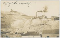

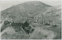
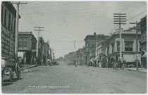
![click to enlarge Broncho Busting Labor Day Victor [Looking Northerly]](http://www.cripplecreekrailroads.com/04library/postcards/p-03139_tbn_broncho_busting_labor_day_victor,view_north_frmd.jpg)
![click to enlarge backside of Broncho Busting Labor Day Victor [Looking Northerly]](http://www.cripplecreekrailroads.com/04library/postcards/p-03139_tbn_broncho_busting_labor_day_victor,view_north_bck.jpg)
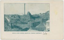
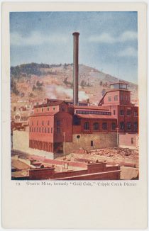
![click to enlarge Cripple Creek, Colo. [Overview Victor From Squaw Mountain]](http://www.cripplecreekrailroads.com/04library/postcards/p-01046_tbn_nx-1340_cc,colo_victor-aerial-view_frmd.jpg)
![click to enlarge backside of Cripple Creek, Colo. [Overview Victor From Squaw Mountain]](http://www.cripplecreekrailroads.com/04library/postcards/p-01046_tbn_nx-1340_cc,colo_victor-aerial-view_bck.jpg)
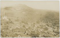
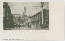
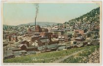
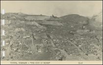
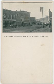
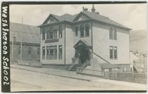
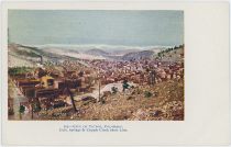
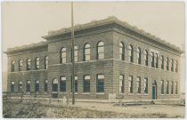
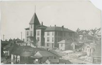
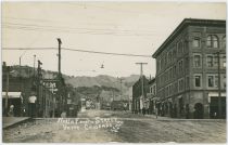
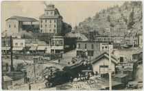
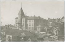
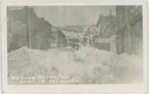
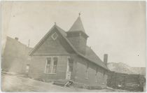
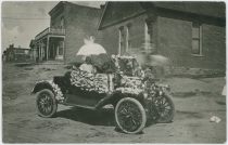
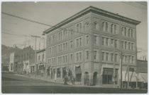
![click to enlarge Men Around Midland Terminal Motor Coach No. 101, In Victor [?]](http://www.cripplecreekrailroads.com/04library/postcards/p-03633_tbn_people_around_mt_motorcar_no101_frmd.jpg)
![click to enlarge backside of Men Around Midland Terminal Motor Coach No. 101, In Victor [?]](http://www.cripplecreekrailroads.com/04library/postcards/p-03633_tbn_people_around_mt_motorcar_no101_bck.jpg)
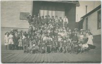
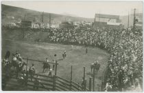
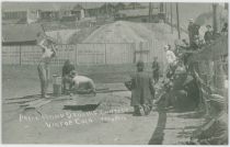
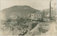
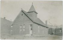
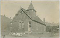
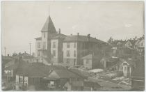
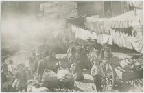

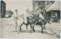
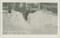
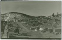
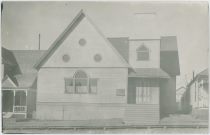
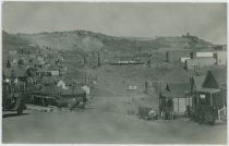
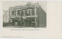
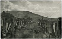
![click to enlarge Broncho Busting Labor Day Victor [Looking Southeast]](http://www.cripplecreekrailroads.com/04library/postcards/p-03140_tbn_broncho_busting_labor_day_victor,view_northeast_1911_frmd.jpg)
![click to enlarge backside of Broncho Busting Labor Day Victor [Looking Southeast]](http://www.cripplecreekrailroads.com/04library/postcards/p-03140_tbn_broncho_busting_labor_day_victor,view_northeast_1911_bck.jpg)
![click to enlarge Steer Roping Contest Victor Colo. [Rodeo and Bronco Riding in Victor Below the Strong Mine]](http://www.cripplecreekrailroads.com/04library/postcards/p-03046_tbn_steer_roping_contest_victor_colo_victor_studio_frmd.jpg)
![click to enlarge backside of Steer Roping Contest Victor Colo. [Rodeo and Bronco Riding in Victor Below the Strong Mine]](http://www.cripplecreekrailroads.com/04library/postcards/p-03046_tbn_steer_roping_contest_victor_colo_victor_studio_bck.jpg)
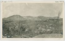
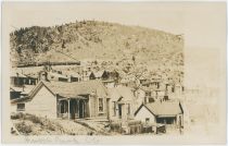
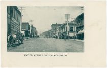
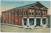
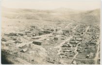
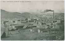
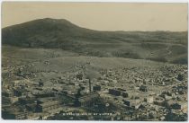
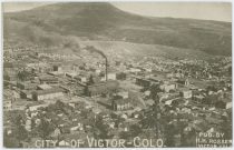
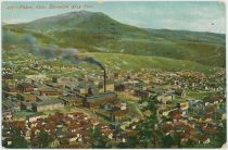
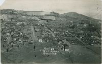


![click to enlarge Strong Mine [at Victor]](http://www.cripplecreekrailroads.com/04library/postcards/p-02145_tbn_strong_mine_at_victor_hileman_1909_frmd.jpg)
![click to enlarge backside of Strong Mine [at Victor]](http://www.cripplecreekrailroads.com/04library/postcards/p-02145_tbn_strong_mine_at_victor_hileman_1909_bck.jpg)
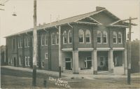
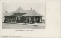
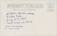
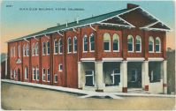
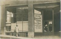
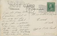
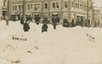
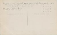
![click to enlarge Labor Day Victor [Scene Street Interestion Just West of the F. & C.C. Depot, Setting Up or a Drill Contest]](http://www.cripplecreekrailroads.com/04library/postcards/p-03509_tbn_labor_day_victor,scene_on_street_just_west_of_fcc_depot_frmd.jpg)
![click to enlarge backside of Labor Day Victor [Scene Street Interestion Just West of the F. & C.C. Depot, Setting Up or a Drill Contest]](http://www.cripplecreekrailroads.com/04library/postcards/p-03509_tbn_labor_day_victor,scene_on_street_just_west_of_fcc_depot_bck.jpg)
