Scanned items: Postcards from My Collection
This Category: Short Line Related, has a total of 93 images, as of 21.02.2023 (21:51:32).
Most Recent added/changed image is on top.
Most Recent added/changed image is on top.
Media Info Last Updated:
21.02.2023 (21:16:45)
Title (on) Image:
View Index Mine & Ore House on Gold HillPhotographer [Date]:
H. & H. Studio [Hileman & Hill]Date Guestimates, Earliest:
Date Guess, No Later Than:
1916-04-16; one week before stamped cardPublished By:
Source ID, My Collection:
P-03658 [#6315]
Shareable Link to PC Info:
www.cripplecreekrailroads.com/04library/scnd_postcards_all.php#6315Description:
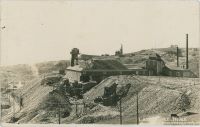
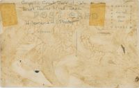
This view here of the surface structures for the Index Mining & Milling Company is a view that has some fame to it as it has been used in several postcards crop-versions and I have seen it used in one postcard folder during the timeframe from when it was taken sometime before April 1916 when this postcard was mailed. From one of the other postcards I've seen the stamp box has a look that dates it around 1910. In regard to the view itself; I personally love it as it shows the former Mint mine on Gold Hill in all its glory! This mine was connected to the Low Line/Short Line branch through a spur that might have been meant to go all the way up to a connection at the Anchoria-Leland mine, seen a map that even drew the rails all the way but as far as I know it only came to be a roadbed without rails, with rails only at each end serving the mines there. This mine had its connection down along the Low Line at the so-called Alamo Junction, about halfway between Cripple Creek and Anaconda, named so from the nearby Alamo mine, which never really grew big...
 I did procure the colored version of this image, if that is what you see, as I think it is nicer. Source is gray-toned, or in common speech black & white. Used an online service and tweaked and worked with image to get what looks best to my eyes for the moment.
Sorting Categories:
Short Line Related Mining Enties visible:
Mint (aka Index Mine) - 69 I've seen copies of this Card sell at eBay on/for:
Media Info Last Updated:
05.02.2023 (21:17:59)
Title (on) Image:
Ajax Mine & MillPhotographer [Date]:
Victor Studio
[1911]
Date Guestimates, Earliest:
1911-06; Mill estimated to be in operationDate Guess, No Later Than:
1912-01-01; Seen Published Date Feb. 1, 1912Published By:
The Top of the World Foto CompanySource ID, My Collection:
P-00344 [#431]
Shareable Link to PC Info:
www.cripplecreekrailroads.com/04library/scnd_postcards_all.php#431Description:
The large sloped structure at upper left is the main structure of what was called the Colburn Mill, aka Colburn-Ajax Mill, and which was built on south slope near top of Battle Mountain at Victor, Colorado, in the Cripple Creek District. Located on the Ajax Mine grounds, which mine structure are seen almost at right hand side, with part of Portland No. 1 making up the background at right-hand side, and Portland No. 2 is hiding against the sky in the smoke above the Ajax Mine structure. Also, in background right is the upper shaft of the Dead Pine mine operations. The mill was built in 1911, but seems to be gone by the time the Sanborn Fire Insurance people visited the area in preparations for the last set of Fire Insurance maps in 1919 as I have not found it on any such map. I've seen not many images of this mill, but the few I have seen shows that the smaller mill structure between the large sloped one and the mine itself, that structure grows in size over the time of existence, in this view it is how it originally was built. I think, from reading a text description, that this was the Sampler/Crusher for the mill, with a covered belt conveyor running on the ground connecting it to the upper part of the mill.
 In addition to the various structures seen in this view there is also shown two aerial tramway towers used for operating the dump, most likely both for scooping it up in the original setup and later for dumping from the mill as I seen text description of the mill giving me that impression.
 A lone boxcar is parked along a spur from the 3-foot narrow gauge Golden Circle mainline passing this operation in front of the boxcar. Houses linked to the Ajax is on the slope and various water tanks are seen also on the slope.
 I did procure the colored version of this image, if that is what you see, as I think it is nicer. Source is gray-toned, or in common speech black & white. Used an online service and tweaked and worked with image to get what looks best to my eyes for the moment.
Sorting Categories:
Golden Circle Related Short Line Related Mining Enties visible:
Ajax - 275 Colburn Mill [aka Colburn-Ajax; Ajax Mill] - 925 Dead Pine - North Incline Shaft - 1037 Portland No. 2 - 259 Portland No. 1 [aka Burns Shaft] - 262 I've seen copies of this Card sell at eBay on/for:
Media Info Last Updated:
05.01.2023 (18:55:21)
Title (on) Image:
Lake Broadmoor from Point Sublime, Cripple Creek Short Line, Colorado.Photographer [Date]:
Andrew James HarlanDate Guestimates, Earliest:
Date Guess, No Later Than:
Published By:
Source ID, My Collection:
P-03324 [#5830]
Shareable Link to PC Info:
www.cripplecreekrailroads.com/04library/scnd_postcards_all.php#5830Description:
[B] LAKE BROADMOOR FROM POINT SUBLIME, CRIPPLE CREEK SHORT LINE. A fashionable suburb three miles southwest of Colorado Springs, with its public casino, where dances, concerts, boating and polite flirtations flow on unceasingly as the brock, and quite as happily.
Sorting Categories:
Short Line Related Mining Enties visible:
I've seen copies of this Card sell at eBay on/for:
Media Info Last Updated:
15.12.2022 (18:40:25)
Title (on) Image:
The Depths of North Cheyenne, from Point Subline, Cripple Creek Short Line.Photographer [Date]:
Date Guestimates, Earliest:
Date Guess, No Later Than:
Published By:
E.C. Kropp Co.Source ID, My Collection:
P-03651 [#6308]
Shareable Link to PC Info:
www.cripplecreekrailroads.com/04library/scnd_postcards_all.php#6308Description:
I'm not familiar enough with the area to tell where this view is, but I wonder if it might be taken near the Point Sublime, which then would be outside the view at right? The painted in train at right-hand side about 1/4 down from top right gives me that feel.Sorting Categories:
Short Line Related Mining Enties visible:
I've seen copies of this Card sell at eBay on/for:
Media Info Last Updated:
14.12.2022 (12:25:07)
Title (on) Image:
St. Peter's Dome on the C.S. & C.C. Short Line, ColoradoPhotographer [Date]:
William Henry Jackson
[1901]
Date Guestimates, Earliest:
1901-01-01; Having a 1901 Copyright to the card indicates this to be a 1901 imageDate Guess, No Later Than:
1901-12-31; Having a 1901 Copyright to the card indicates this to be a 1901 imagePublished By:
Detroit Publishing Co.Source ID, My Collection:
P-00513 [#613]
Shareable Link to PC Info:
www.cripplecreekrailroads.com/04library/scnd_postcards_all.php#613Description:
While I am not 100% certain this photo is by W.H. Jackson, I still put his name down as the company having the copyright on this image is linked to him, so I assumed it was he that did this image of a Short Line Passenger Train steaming uphill after passing the siding with the same name as that massive St. Peter's Dome looming in the background.Sorting Categories:
Short Line Related Mining Enties visible:
I've seen copies of this Card sell at eBay on/for:
Media Info Last Updated:
28.11.2022 (14:01:02)
Title (on) Image:
Lake Broadmoor from Point Sublime, Cripple Creek Short Line, Colo.Photographer [Date]:
Louis Charles McClureDate Guestimates, Earliest:
Date Guess, No Later Than:
Published By:
Great Western Post Card & Novelty CompanySource ID, My Collection:
P-03180 [#5320]
Shareable Link to PC Info:
www.cripplecreekrailroads.com/04library/scnd_postcards_all.php#5320Description:
Yet another of the many slightly different postcard editions of this base photo/negative whereas I only have like 1mm difference at top/down edges from another know postcard to me, but which to me makes this into a different postcard made at a different time from the other known one. Scene is the same, at Point Sublime along the Short Line, looking across the roadbed down into the Plains where the Lake Broadmoor can be seen about center of the card. From what I been able to gather, the trestle partly seen, indicated, on the left part of the view, that would be Bridge No. 6-B, and also known as the Second Twin Bridge at Point Sublime. Trestle was according to page 156 in the Colorado Rail Annual No. 16 book 119 feet long and 13 feet high.
Sorting Categories:
Short Line Related Mining Enties visible:
I've seen copies of this Card sell at eBay on/for:
Media Info Last Updated:
28.11.2022 (13:54:48)
Title (on) Image:
Devil's Slide, Cripple Creek Short Line, Colo.Photographer [Date]:
Louis Charles McClureDate Guestimates, Earliest:
Date Guess, No Later Than:
Published By:
Source ID, My Collection:
P-03323 [#5829]
Shareable Link to PC Info:
www.cripplecreekrailroads.com/04library/scnd_postcards_all.php#5829Description:
This card appears to have been cropped a mm or two above the bottom of the other known card, hence I make it a different copy.Sorting Categories:
Short Line Related Mining Enties visible:
I've seen copies of this Card sell at eBay on/for:
Media Info Last Updated:
28.11.2022 (13:52:53)
Title (on) Image:
Devil's Slide, Cripple Creek Short Line, ColoradoPhotographer [Date]:
Louis Charles McClureDate Guestimates, Earliest:
Date Guess, No Later Than:
Published By:
The Great Western Post Card Co.Source ID, My Collection:
P-03351 [#5861]
Shareable Link to PC Info:
www.cripplecreekrailroads.com/04library/scnd_postcards_all.php#5861Description:
This location was also a common one used for views of the Short Line. I've seen some variations of it, but mainly it is this angle showing the Devil's Slide in the background, about 1/4 in from left-hand side and middle top/down. -> This card edition is at minimum 1mm less at the bottom part, compared to at least one of the other know postcard editions from the source negative.
Sorting Categories:
Short Line Related Mining Enties visible:
I've seen copies of this Card sell at eBay on/for:
24.09.2017 at USD 1.0Media Info Last Updated:
28.11.2022 (13:41:50)
Title (on) Image:
Mountain Top to Mountain Top on Cripple Creek Short LinePhotographer [Date]:
Date Guestimates, Earliest:
Date Guess, No Later Than:
Published By:
Homemade; Pasted Brochure Image on PostcardSource ID, My Collection:
P-03792 [#6452]
Shareable Link to PC Info:
www.cripplecreekrailroads.com/04library/scnd_postcards_all.php#6452Description:
This turned out to NOT be a regular postcard, which I thought it to be, bought with 7 other cards, where they all came from a Cripple Creek Short Line Brochure where there are views on one side and maps and info text on the other side, and where the image parts have been cut and pasted unto some unknown postcard and the saved for posterity in that way. This particular card is pasted unto a postcard marked on the backside as 'CARDINELL VINCENT CO MFG. SAN FRANCISCO', and hand written in a pencil the number 169. Looking at other cards, I think this was done as a memory of a trip to some form of California Exposition.
 -> This view is a doctored view from a view near top of Stove Mountain, I think, looking towards St. Peter's Dome seen about 1/4 down from top and about 2/5 in from right-hand side. A train is painted in to the left of that top, coming out if tunnel 8 going uphill, and the line of the Short Line is seen as various levels down the mountains sides, with the portal of tunnel 6 seen as a small black hole about 1/3 down from top and about 2/5 in from left-hand side.
Extra Image Links:
⊞ Mountain Top to Mountain Top on Cripple Creek Short Line {Large Pixels 600dpi} Sorting Categories:
Short Line Related Mining Enties visible:
I've seen copies of this Card sell at eBay on/for:
Media Info Last Updated:
13.10.2022 (21:22:42)
Title (on) Image:
Birds-Eye View of Elkton, Colo.Photographer [Date]:
Date Guestimates, Earliest:
Date Guess, No Later Than:
1908; As postcard is mailed sometime that year.Published By:
Source ID, My Collection:
P-03287 [#5704]
Shareable Link to PC Info:
www.cripplecreekrailroads.com/04library/scnd_postcards_all.php#5704Description:
While the image quality is not that great due to the age and distance and all that, it still is a very important image to have! I struggle a little dating it as while it has a post stamp of 1908, I am unable to find the switchback from the M.T. up to the coal bins of Elkton Mine, which is shown on a USGS topographic map dated 1902/1903, which together with the showing of the Low Line which dates this after 1900, should narrow the timeframe down quite much, but the Elkton Mine structures gives me the impression this is way later then near 1900. This due to the fact Sanborn 1900 (CC Sheet 17) shows a different structure here, while photo matches better with Sanborn 1908 map (CC Sheet 30). But then again, that later map fails to show some of the mine structures seen here so that suggest this view predates it. And as my USGS map show a spur not here I must admit that this is from a timeframe of less than 3-years. More research is needed.
 Near bottom of this view lays a row of houses which forms the upper part of the settlement know as Eclipse, along Eclipse Gulch, stretching from about where F. & C.C. crosses the gulch and to around where the Economic Mill was further down the gulch at left, as far as I know.
 The grade of the F. & C.C. is seen about 1/4 up from the bottom, with a passenger train near right-hand side, heading towards Cripple Creek. There are several mine operations seen below and above that grade, but my knowledge is way too limited to tell anything about any of them.
 The town of Elkton is seen on the lower slope of Raven hill in the right-most half of the photo around middle of view top/down, where the large Elkton Mine makes up about center of this card, with the railroad grade of the M.T. running just left of the mine.
 The Low Line is seen about 1/3 up from bottom near right-hand side, climbing the hill towards left and about middle top/down and about 1/3 in from left-hand side it changes directions and goes towards right, cross over the M.T. on trestle and passes the Elkton mine on the right side.
 The Thompson large Shaft House (I think) is seen about center of view top/down and about 1/5 in from left-hand side, sadly I don't know of any Sanborn map of this structure, not that I can recall at the time of this writing [08.08.2017].
 There is also another mine structure at right foreground of the Thompson, left of the Low Line grade, but I dare not guestimate a name for that mine, nor do I dare take a stab at the name of the ones seen inside the town of Elkton either. One is easy to spot, just right of the mainline of M.T. with a large dump area, the other is more hidden among houses, still with a dump though. One day I hope to learn all this, one day.
 Raven Hill has it shares of mines as well, but the one I sort of care about is the Bostwick Shaft House, seen about 1/3 down from top and slightly right of center of view sideways, up from right-hand side of the Elkton mine.
 08.08.2018; Elkton Public School is seen about 1/3 in from right-hand side and about middle top/down, seen as a lighter painted structure with space around it and built upon over the years so roof is in various directions.
 26.09.2021; I did procure the colored version of this image, if that is what you see. Source was grayish, or in common speech black & white. Used an online service and tweaked and worked with image to get what looks best to my eyes at the moment.
 13.10.2022; Don Mine is seen somewhat as an headframe and dump almost at corner of the lower street coming from the Elkton Mine area and towards Eclipse Gulch, just before road dips down to cross the M.T. tracks.
Sorting Categories:
Eclipse Townsite Elkton Townsite Florence & Cripple Creek Related Midland Terminal Related Short Line Related Trolley Related Mining Enties visible:
Elkton Mine - 156 Bostwick - 155 Thompson Mine [aka Thomson lode] - 157 Don Lode/Mine [Elkton Townsite] - 2477 I've seen copies of this Card sell at eBay on/for:
Media Info Last Updated:
30.09.2022 (18:38:37)
Title (on) Image:
The Black Sampler or Cripple Creek Sampler of the Cripple Creek Sampling & Ore Co., Up on Victor PassPhotographer [Date]:
H. & H. Studio [Hileman & Hill]Date Guestimates, Earliest:
Date Guess, No Later Than:
Published By:
H. & H. StudioSource ID, My Collection:
P-00346 [#440]
Shareable Link to PC Info:
www.cripplecreekrailroads.com/04library/scnd_postcards_all.php#440Description:
This postcard view shows the Cripple Creek Sampler, aka Black Sampler, of the Cripple Creek Sampling and Ore Company at Victor Pass on Bull Hill. Photo is taken from Goldfield side, looking uphill in a north direction from a spot just above the Short Line yard which was below the T. & B. Sampler who would have been about 100 degree to the right. The Black Sampler was connected to all railroads of the District so there where dual gauge rails at this sampler so the 3-foot narrow gauge Golden Circle could bring cars here, as well as serving both the Midland Terminal and the Short Line tracks. Both samplers at this location had dual gauge, as seen on the parked boxcars about middle top/down on the right-half part of this view, where there are a C.M. boxcar, a F. & C.C. boxcar and a Short Line boxcar visible at the yard that was part of the T. & B. Sampler.
 I did procure the colored version of this image if that is what you see. Source is gray-toned, or in common speech black & white. Used an online service and tweaked and worked with image to get what looks best to my eyes for the moment.
Sorting Categories:
Florence & Cripple Creek Related Golden Circle Related Midland Terminal Related Short Line Related Mining Enties visible:
Black Sampler [aka CC Sampler Bull Hill] - 230 I've seen copies of this Card sell at eBay on/for:
Media Info Last Updated:
28.09.2022 (11:57:00)
Title (on) Image:
Anaconda A Mining Town In the Cripple Creek Dist.Photographer [Date]:
Date Guestimates, Earliest:
Date Guess, No Later Than:
1909-08-01; Postage Stamp used was Issued from December 1908, and 190(9?) appears barely to lower right of stamp.Published By:
Source ID, My Collection:
P-03319 [#5824]
Shareable Link to PC Info:
www.cripplecreekrailroads.com/04library/scnd_postcards_all.php#5824Description:
This is a GREAT view I JUST had to GET!!! Hopefully this is made of better paper than my 2012 edition of this card, as on that one, lots of small sort of bubbles and scan not so sharp and well. In addition there was alot of reflections in it, and, the image is way dark and do not enhance very well. But, for the view it shows, and the areas I can see it sure beats having no such view at all!! :-)
 And, this is still the first image I ever seen showing what I believe is the Anaconda Mill up on Gold Hill above the Low Line grade between the Anchoria-Leland and the Mary McKinney mine in this view!
Sorting Categories:
Anaconda Townsite Florence & Cripple Creek Related Midland Terminal Related Short Line Related Trolley Related Mining Enties visible:
Mary McKinney - 136 Le Claire or Sunset [aka Peggy Mine] - 334 Anaconda Mine - 92 E. Porter Gold King - 65 Anchoria-Leland - 61 Anaconda Mill [Gold Hill] - 1481 Lexington - 63 Rittenhouse - 66 I've seen copies of this Card sell at eBay on/for:
Media Info Last Updated:
12.09.2022 (18:15:16)
Title (on) Image:
Broncho Busting Labor Day Victor [Looking Northerly]Photographer [Date]:
Date Guestimates, Earliest:
Date Guess, No Later Than:
Published By:
Source ID, My Collection:
P-03139 [#5263]
Shareable Link to PC Info:
www.cripplecreekrailroads.com/04library/scnd_postcards_all.php#5263Description:
Just below top is the railroad grade of the M.T. with a passenger car partly obscured by a water tank roof about 1/5 in from right-hand side. Further below are several boxcars seen on the F. & C.C., from right-hand side to about middle of image, but many are obscured by the appearance of the Short Line Depot structure on the next railroad level down, several people are standing on a platform on the rear side of that structure, about 1/3 in from right-hand side and 1/5 down from top.
 I think top part of the ore-house of the Mary Cashen Mine is seen near upper left, about 1/5 in from left-hand side and 1/10 down from top.
Sorting Categories:
Florence & Cripple Creek Related Midland Terminal Related Short Line Related Victor Town Mining Enties visible:
Mary Cashen - 272 I've seen copies of this Card sell at eBay on/for:
Media Info Last Updated:
17.08.2022 (11:33:09)
Title (on) Image:
APPROACHING DUFFIELD. Colo. Springs & Cripple Creek Short Line.Photographer [Date]:
Louis Charles McClureDate Guestimates, Earliest:
Date Guess, No Later Than:
Published By:
The Souvenir Publishing and Mercantile CompanySource ID, My Collection:
P-00688 [#1015]
Shareable Link to PC Info:
www.cripplecreekrailroads.com/04library/scnd_postcards_all.php#1015Description:
This view is from a top of Tunnel No. 8 on the Short Line, looking uphill towards Duffields, and is a popular view to show off the Short Line railroad. This and similar vies have been used over and over in publications, postcards, image books etc., to sell the railroad trip to tourists.Sorting Categories:
Short Line Related Mining Enties visible:
I've seen copies of this Card sell at eBay on/for:
18.09.2010 at USD 2.3Media Info Last Updated:
17.08.2022 (11:33:09)
Title (on) Image:
Approaching Duffield on C.C. Short Line, Colo.Photographer [Date]:
Louis Charles McClureDate Guestimates, Earliest:
Date Guess, No Later Than:
Published By:
Source ID, My Collection:
P-03356 [#5866]
Shareable Link to PC Info:
www.cripplecreekrailroads.com/04library/scnd_postcards_all.php#5866Description:
Has at least 3-4mm less at the left-hand side from the other know card.Sorting Categories:
Short Line Related Mining Enties visible:
I've seen copies of this Card sell at eBay on/for:
24.09.2017 at USD 1.0Media Info Last Updated:
17.08.2022 (11:33:09)
Title (on) Image:
Duffields, Cripple Creek Short Line, Colorado.Photographer [Date]:
Louis Charles McClureDate Guestimates, Earliest:
Date Guess, No Later Than:
Published By:
The Great Western Post Card Co.Source ID, My Collection:
P-02115 [#3641]
Shareable Link to PC Info:
www.cripplecreekrailroads.com/04library/scnd_postcards_all.php#3641Description:
This view is from a top of Tunnel No. 8 on the Short Line, looking uphill towards Duffields, and is a popular view to show off the Short Line railroad. This and similar vies have been used over and over in publications, postcards, image books etc., to sell the railroad trip to tourists.Sorting Categories:
Short Line Related Mining Enties visible:
I've seen copies of this Card sell at eBay on/for:
06.07.2013 at USD 1.5424.09.2017 at USD 1.0Media Info Last Updated:
16.08.2022 (19:21:03)
Title (on) Image:
Cathedral Rocks, Clyde Park, C. C. Short Line, Colo.Photographer [Date]:
Louis Charles McClureDate Guestimates, Earliest:
Date Guess, No Later Than:
Published By:
Source ID, My Collection:
P-03355 [#5865]
Shareable Link to PC Info:
www.cripplecreekrailroads.com/04library/scnd_postcards_all.php#5865Description:
This is a very common view when it comes to views of the Short Line. I've seen some variations of it, but mainly it is this angle showing the trestle and the strange formations making up the background. Those are the famed Cathedral Park rocks, a very special rock formation, Google it to read up on the geology behind it if you want. BTW, this bridge was named Bridge No. 30-A, it crossed Bison Creek and was filled in prior to 1911 according to page 46 & 156 in Colorado Rail Annual No. 16.
 -> This card edition is at minimum 2mm less at the bottom part, compared to at least one of the other know postcard editions from the source negative.
Sorting Categories:
Short Line Related Mining Enties visible:
I've seen copies of this Card sell at eBay on/for:
24.09.2017 at USD 1.0Media Info Last Updated:
16.08.2022 (19:20:33)
Title (on) Image:
Cathedral Rocks, Clyde Park, C. C. Short Line, Colo.Photographer [Date]:
Louis Charles McClureDate Guestimates, Earliest:
Date Guess, No Later Than:
Published By:
H.H.T. Co.Source ID, My Collection:
P-03322 [#5828]
Shareable Link to PC Info:
www.cripplecreekrailroads.com/04library/scnd_postcards_all.php#5828Description:
[B] CATHEDRAL PARK. At Clyde, on the road to Cripple Creek, a most wonderful exhibition is seen at Cathedral Park. The mass of richly colored rocks, torn by tempests of a thousand years, rear their heads in all manner of fantastics shapes, towers, steeples, vaulted cones, leaping arches and the forms of mighty buildings brushing each other in wild disorder.
Sorting Categories:
Short Line Related Mining Enties visible:
I've seen copies of this Card sell at eBay on/for:
Media Info Last Updated:
16.08.2022 (19:17:14)
Title (on) Image:
Cathedral Rocks and Clyde Park, Colorado.Photographer [Date]:
Louis Charles McClureDate Guestimates, Earliest:
Date Guess, No Later Than:
Published By:
The W.H. Kistler Stat'y Co.Source ID, My Collection:
P-03308 [#5745]
Shareable Link to PC Info:
www.cripplecreekrailroads.com/04library/scnd_postcards_all.php#5745Description:
This is a very common view when it comes to views of the Short Line. I've seen some variations of it, but mainly it is views from his angle showing the trestle and the strange formations making up the background. Those are the famed Cathedral Park rocks, a very special rock formation, Google it to read up on the geology behind it if you want. BTW, this bridge was named Bridge No. 30-A, it crossed Bison Creek and was filled in prior to 1911 according to page 46 & 156 in Colorado Rail Annual No. 16.
Sorting Categories:
Short Line Related Mining Enties visible:
I've seen copies of this Card sell at eBay on/for:
24.09.2017 at USD 1.0Media Info Last Updated:
05.07.2022 (13:06:35)
Title (on) Image:
Summit Along the C.S. & C.C.D., on the Way to Cripple Creek, Colo.Photographer [Date]:
Date Guestimates, Earliest:
Date Guess, No Later Than:
Published By:
Source ID, My Collection:
P-03912 [#6589]
Shareable Link to PC Info:
www.cripplecreekrailroads.com/04library/scnd_postcards_all.php#6589Description:
This is a nice view of the Summit Lunch House along the Short Line to Cripple Creek. I've seen it before, so this was probably made as more then 1 card, even if the two girls posing gives it the feel of a more personal type of card. There is no publisher given, nor a photographer, but I think the card been displayed and sold there at the Lunch House for tourist to buy and send a note to friends just like the sender of this card has done, even if it lacks a stamp this card. There was a 10-minuttes stop for Lunch her at Summit, was also a meet place for East and West bound trains, as evidenced by the two sets of tracks seen here, making me believe the children seen are two living up here with their parents who runs the Lunch House as there are no trains visible making it less likely to be tourists.
Sorting Categories:
Short Line Related Mining Enties visible:
I've seen copies of this Card sell at eBay on/for:
13.11.2012 at USD 29.6904.08.2017 at USD 13.0Media Info Last Updated:
05.07.2022 (13:03:56)
Title (on) Image:
The Summit Lunch Room CS & CCD at Rosemont, ColoradoPhotographer [Date]:
Date Guestimates, Earliest:
Date Guess, No Later Than:
Published By:
Source ID, My Collection:
P-01806 [#2821]
Shareable Link to PC Info:
www.cripplecreekrailroads.com/04library/scnd_postcards_all.php#2821Description:
This is a nice view of the Summit Lunch House along the Short Line to Cripple Creek. I've seen it before, so this was probably made as more then 1 card, even if the two girls posing gives it the feel of a more personal type of card. There is no publisher given, nor a photographer, but I think the card been displayed and sold there at the Lunch House for tourist to buy and send a note to friends just like the sender of this card has done, even if it lacks a stamp this card. There was a 10-minuttes stop for Lunch her at Summit, was also a meet place for East and West bound trains, as evidenced by the two sets of tracks seen here, making me believe the children seen are two living up here with their parents who runs the Lunch House as there are no trains visible making it less likely to be tourists.
Sorting Categories:
Short Line Related Mining Enties visible:
I've seen copies of this Card sell at eBay on/for:
13.11.2012 at USD 29.6904.08.2017 at USD 13.001.11.2020 at USD 20.5Media Info Last Updated:
04.07.2022 (18:46:46)
Title (on) Image:
Scenes of the Col. Spgs. and Cripple Creek Dist. Ry., Portland and Independence Mines, Victor, Colo.Photographer [Date]:
Louis Charles McClureDate Guestimates, Earliest:
Date Guess, No Later Than:
Published By:
Source ID, My Collection:
P-03403 [#5915]
Shareable Link to PC Info:
www.cripplecreekrailroads.com/04library/scnd_postcards_all.php#5915Description:
This view by L. C. McClure from 'inside' 'half-loop' of the F. & C.C. entering the southeast slope of Battle Mountain to get to Victor, seems to be from around 1906-1907 as the large Independence Mill has yet to come into existence, but there area several structures that might be the test mill I've seen reported about in that timeframe. Also, it looks like the No. 1 shaft of the Portland mine is now an open Head frame and I've seen reports of all the surface structures of the Portland No. 1 burning in May 1906, dating this view to be after that timeframe. In the foreground the fill on the roadbed for the 3-foot gauge Florence & Cripple Creek railroad is seen, passing under the trestle bringing the High Line and the Short Line standard gauge track into Victor outside the view at left. The roadbed of the Golden Circle railroad is partly visible about middle top/down of this view, and then the Stratton's Independence Mine is seen taking up about half width on the left part of this view, while the Ajax Mine is seen with its single smokestack poking up against the sky on the left background.
 The Portland Nos. 1 & 2 make up the right half background part of this view, the no. 2 shaft being the upper one, with the long dumps out from each side of the mine structures.
Sorting Categories:
Florence & Cripple Creek Related Midland Terminal Related Short Line Related Mining Enties visible:
Sundown lode - 27_884 Portland No. 1 [aka Burns Shaft] - 262 Portland No. 2 - 259 Ajax - 275 I've seen copies of this Card sell at eBay on/for:
13.11.2017 at USD 0.99Media Info Last Updated:
15.04.2022 (13:04:24)
Title (on) Image:
A View at the Vindicator and Lillie Mines on Bull Hill, with the M.T. Independence Depot in Foreground RightPhotographer [Date]:
Julia SkolasDate Guestimates, Earliest:
Date Guess, No Later Than:
1908-07-03; Seen a printed/lithograph type of postcard dated July 10, which gives at least 1 week to process/create, hence the latest date used.Published By:
Source ID, My Collection:
P-03544 [#6189]
Shareable Link to PC Info:
www.cripplecreekrailroads.com/04library/scnd_postcards_all.php#6189Description:
This unmarked postcard view here is the same as marked postcard views by Julia Skolas in my possession, but this seems to be the best of the ones I've seen, even if it is a smaller crop from the source image then the other versions I've seen. In lower left part of the lower Independence town is seen, with the Midland Terminal Depot seen in lower right, and strangely enough, what appears to be dual gauge tracks on the curve closest to the depot structure, wonder if it is true dual or just guard rail for the curve…
 Above the M.T. depot at top right is the old Lillie Mine Shaft Structures seen in all its glory, but I can't tell if this is before or after it was closed as a mine and reused as a Mill for the Vindicator Mine, seen to the left, about center sideways and about 1/3 down from the top. Poking out from the Vindicator Ore-House is seen yet another structure and that leads to a chute down to the M.T. tracks and some form of Ore-Bin down there, presumable some form of mill operations.
 Near upper left a string of railroad cars appearing to be passenger cars can be seen, not quite understanding that as that should be on the High Line grade and if they are parked there, that makes this after the Trolley Services closed in 1919, but I am not sure why they are up there or not. Studying a 1200dpi scan it appears the cars may be located below the High Line tracks as there appears to be a line pole a little bit higher up, so maybe the cars are standing on what was a siding there, after all, the track appears to be level where the cars are standing.
Sorting Categories:
Independence Townsite Midland Terminal Related Short Line Related High Line Mining Enties visible:
Vindicator No. 1 - 233 Lillie - 234 I've seen copies of this Card sell at eBay on/for:
Media Info Last Updated:
30.10.2021 (09:43:23)
Title (on) Image:
The John A. Logan Mine. Cripple Creek, Colo.Photographer [Date]:
Tomer Jacob Hileman
[1908]
Date Guestimates, Earliest:
1908-01-01; Date is a guestimate due to postcard appearing to have that date on it as a Copyright Applied For entry.Date Guess, No Later Than:
1908-12-31; Date is a guestimate due to postcard appearing to have that date on it as a Copyright Applied For entry.Published By:
Source ID, My Collection:
P-03842 [#6517]
Shareable Link to PC Info:
www.cripplecreekrailroads.com/04library/scnd_postcards_all.php#6517Description:
Date is a guestimate, I have a card where there is written something about Copyright Applied for in bottom right, name Hileman and what appears to be an 8 in front of that, sadly that card is partly messed up in that area so can't read it fully. And this card here seems to have 08 barely visible on the backside where the stamp is, impossible to make out though… The focus is the large shaft House of the John A. Logan Mine, also known as the Logan Shaft of the Stratton Cripple Creek Mining & Development Company. I've often wondered why there was not a spur to the Ore House as the High Line/Short Line branch line to the Blue Bird Mine was just below it, but I never ever seen evidence for such a spur.
 To show how close they were, the Blue Bird Branch-line is partly seen climbing the hill in lower right, just above the title text of the card, and passing behind the small mine operation with the big trestle work in lower left. The trestle itself crosses the mainline of the High Line track, the two legs at left corner is across the tracks and they dumped their waste down the hill from the west (opposite) side of the Trolley and Steam train used track.
Extra Image Links:
⊞ The John A. Logan Mine. Cripple Creek, Colo. {Large Pixels 900dpi; Straightened} Sorting Categories:
Short Line Related High Line Mining Enties visible:
John A. Logan - 311 I've seen copies of this Card sell at eBay on/for:
23.06.2018 at USD 3.0Media Info Last Updated:
30.10.2021 (08:54:24)
Title (on) Image:
Poverty Gulch, Cripple Creek District, Colo.Photographer [Date]:
Julia SkolasDate Guestimates, Earliest:
Date Guess, No Later Than:
Published By:
The Great Western Post Card and Novelty Co.Source ID, My Collection:
P-00189 [#255]
Shareable Link to PC Info:
www.cripplecreekrailroads.com/04library/scnd_postcards_all.php#255Description:
This view looking up Poverty Gulch is credited to Julia Skolas but has had some text scratched out from the source negative making me wonder if this is one of those she bought the right for from an earlier photographer that I've seen evidence of before. It is an earlier view, the original High Line is still running up Poverty Gulch and I see no trace of the still to come Short Line grade up Gold Hill so this dates the view to be from before 1900, and she was not in the area then. Either way, it captures the feel of the area, how mining and living was on top of each other and there are many mines visible, whereas I only have names of a few of them.
 In foreground is the Lillie Mine, then a small windlass type of operation, before Abe Lincoln No. 2 and No. 1 can be picked up on the left side, with the Chicago Tunnel structures seen behind the named Shaft house of Abe Lincoln main shaft. Up to the left of those are the operations on the May Queen lode claim on the left and the Granite Hill lode claim on the right, more behind. Further up the larger Shaft house of the Rebecca Mine with its easy to recognize cupola on the roof is seen, with the C. O. D. Mine to the left hardly visible, and behind the bend at left, outside the view from this angle would the Gold King mine be.
 The Shaft houses at right, about 1/3 from top, I am not certain about as it is so cramped with claims in this area, but I know the Blue Chime, Clayton E. and T.E.M.O.M.J. lode claims was in this area so I assume it is one of those, but I do not know as per today so I dare not say so and so.
 So far, as of Oct. 26, 2021 I know of this view used as 10 postcard editions, where there are slightly differences in each card, from different backside, publisher, or any of the four sides can have variations of a millimeter or more where it is cropped from the source. Also, the coloring, paper quality or darkness in the view helps with differentiation these editions.;
 Colored view; print-type, not the best look (this postcard).
 B/W; photo-type, great quality look, not dark but a little washed out maybe, and the text put on by Julia Skolas is all visible. But card shows that source image is scratched and damaged a little on left side where the Orehouse of Abe Lincoln is shown.
 B/W; photo-type, dark view, 'Poverty' part of text at bottom cut off at bottom of y making 'Gulch' part more or less unreadable. Same damage left side and paper used makes the dark parts dark.
 B/W; photo-type, even darker view, hard to make more visible, 'Gulch' part of text at bottom partly cut off but is readable. Same damage left side and paper used makes the dark parts dark.
 B/W; photo-type, great quality look, not dark, and the text put on by Julia Skolas is all visible with about text height of space below. Same damage on left side.
 Colored view; print-type, not the best look, has a couple of millimeters more view at bottom, compared to my other card.
 B/W; photo-type, slightly brighter card, one gets to see some of the details a little better. The text put on by Julia Skolas is all visible with about half text height of space below. Same damage on left side.
 B/W; photo-type, card appears washed out somewhat, and paper used makes it appears not as a good quality card. The text put on by Julia Skolas is all visible with about half text height of space below. Same damage on left side, it actually appears to be prominent.
 Colored view; print-type, not the best look, colored differently, has a couple of millimeters less view at bottom, and the right, compared to the other cards.
 Colored view; print-type, appears to be brighter, maybe the best look, colored differently, and is cut at bottom a couple of millimeters below top of roofline.
Sorting Categories:
Short Line Related Trolley Related Mining Enties visible:
Abe Lincoln - 52 Lillie [aka Lilly or Lily]; Poverty Gulch - 53 Rebecca Mine - 1000 Chicago Tunnel [aka Chicago & Cripple Creek] - 51 May Queen lode - 870 Granite Hill lode - 871 C.O.D. [aka Cash On Delivery] - 29 I've seen copies of this Card sell at eBay on/for:
29.03.2011 at USD 8.7602.12.2012 at USD 2.9902.03.2013 at USD 5.9921.03.2013 at USD 3.3328.04.2013 at USD 3.99524.11.2014 at USD 15.013.07.2015 at USD 8.507.08.2017 at USD 35.0Media Info Last Updated:
06.10.2021 (18:58:35)
Title (on) Image:
St. Peter's Dome, Colorado Springs & Cripple Creek Short Line. ''The One Day Trip That Bankrupts the English Language.''Photographer [Date]:
Louis Charles McClureDate Guestimates, Earliest:
Date Guess, No Later Than:
Published By:
Source ID, My Collection:
P-02172 [#3704]
Shareable Link to PC Info:
www.cripplecreekrailroads.com/04library/scnd_postcards_all.php#3704Description:
Another print of this mighty popular and almost overused view along the Short Line with the mighty St. Peter's Dome looming in the background an a train climbing up the grades. This has to be the most common view along the Short Line, ever, countless postcards, folders, book images and so on tell that story!Sorting Categories:
Short Line Related Mining Enties visible:
I've seen copies of this Card sell at eBay on/for:
Media Info Last Updated:
06.10.2021 (18:58:34)
Title (on) Image:
Cripple Creek, Colo. ''Altitude 9505 feet.''Photographer [Date]:
William Henry JacksonDate Guestimates, Earliest:
Date Guess, No Later Than:
Published By:
Detroit Publishing Co.Source ID, My Collection:
P-01057 [#1678]
Shareable Link to PC Info:
www.cripplecreekrailroads.com/04library/scnd_postcards_all.php#1678Description:
This postcard is based on a photographic view that is from around 1900 as there is grading done on the Short Line grade which is to be climbing Gold Hill where the photographer is standing, overlooking central towards northern end of Cripple Creek town. The View is from two source images actually, about 1/4 of the right side is from one glass plate negative and the rest is from another one, and one can see the line running through the card of one look for it, it crosses the east side of the M.T. trestle across Poverty Gulch for instance.
Sorting Categories:
Cripple Creek Town Short Line Related Mining Enties visible:
I've seen copies of this Card sell at eBay on/for:
26.04.2012 at USD 7.508.11.2014 at USD 6.502.08.2015 at USD 8.7706.06.2018 at USD 0.99Media Info Last Updated:
06.10.2021 (18:58:34)
Title (on) Image:
Mines in Cripple Creek District | ''A Flock of Cripple Creek Mines''Photographer [Date]:
Tomer Jacob Hileman
[1908]
Date Guestimates, Earliest:
1908-01-01Date Guess, No Later Than:
1908-12-31Published By:
C.E. ColeSource ID, My Collection:
P-00989 [#1457]
Shareable Link to PC Info:
www.cripplecreekrailroads.com/04library/scnd_postcards_all.php#1457Description:
This view is not the best edition of this 1908 photo/negative by Hileman that I've seen, but it is one of the ten I so far has a record of [10.04.2018] and they all share the same view at western Slope of Bull Hill with the railroad cars seen near bottom being at the end of the Gold Sovereign branch/spur off the High Line/Short Line grade seen about 1/3 down from the top. Blue Bird Mine is at the top of the image, against the sky. Further down, to the right, along the Short Line/High Line grade is the Dante operations taking place with two boxcars seen below their Crib-wall, and then about center of view is the Trilby Mine operation and the Trilby Mill seen to the right of the mine.
 Near bottom left is one of the many Shafts on the gold Sovereign, where I so far have been unable to learn which shaft is where, so I dare not say other then that one of the shafts has been burned and only the left-overs are seen in this view.
Sorting Categories:
Short Line Related High Line Mining Enties visible:
Blue Bird - 209 Dante - 335 Trilby - 333 I've seen copies of this Card sell at eBay on/for:
06.03.2011 at USD 1.24527.01.2013 at USD 11.6123.04.2014 at USD 6.526.01.2016 at USD 23.518.06.2020 at USD 14.5Media Info Last Updated:
19.12.2020 (07:33:25)
Title (on) Image:
A Summer Snow on the Cripple Creek Trip, C.C. Short Line, Colorado.Photographer [Date]:
Date Guestimates, Earliest:
Date Guess, No Later Than:
1911-04-24; Which is 1 week before the earliest known postage stamp date on a postcard seen stamped May 1, 1911Published By:
Source ID, My Collection:
P-01542 [#2366]
Shareable Link to PC Info:
www.cripplecreekrailroads.com/04library/scnd_postcards_all.php#2366Description:
I've seen this scene marked both as ''Around the Mountain Tops - The Cripple Creek Trip'', ''Scene on the Cripple Creek Trip'', ''A Summer Snow Scene - The Cripple Creek Trip'', or variations of those. Whatever it is marked/titled, the view is still one that was photographed looking easterly back towards the tunnel known as Tunnel No. 8, near Duffields along the Short Line.Sorting Categories:
Short Line Related Mining Enties visible:
I've seen copies of this Card sell at eBay on/for:
21.03.2012 at USD 2.0724.09.2017 at USD 1.0Media Info Last Updated:
23.09.2020 (09:05:47)
Title (on) Image:
Cripple Creek Colo - Looking down Poverty Gulch At the Short Line Trestle By the Gold King MinePhotographer [Date]:
Date Guestimates, Earliest:
Date Guess, No Later Than:
Published By:
Source ID, My Collection:
P-01975 [#3386]
Shareable Link to PC Info:
www.cripplecreekrailroads.com/04library/scnd_postcards_all.php#3386Description:
This view across Poverty Gulch, towards the town of Cripple Creek, is photographed on Gold Hill a little uphill from the C.O.D. mine. The Short Line main line is climbing the hill via the curved trestle seen on left-hand side, and the original High Line electric trolley line is partly seen, after gone through the trestle, about 1/3 up from bottom and about 2/5 in from left-hand side, as it is going on its big climb up Gold Hill. * The Reno Mine is seen beyond the Short Line trestle, almost center bottom/top and about 2/5 in from left-hand side. Near the upper end/right-hand side of the Short Line trestle.
 * The old shaft house of the C.O.D. mine is seen from behind, about 1/3 up from bottom and a bit more than 1/3 in from left-hand side.
 * The Gold King, or the El Paso Gold King Mine, is seen center bottom/top about 1/5 in from right-hand side, in the darker shades of this image sadly.
Sorting Categories:
Short Line Related Mining Enties visible:
Gold King [aka El Paso Gold King] - 27 Reno - 28 C.O.D. [aka Cash On Delivery] - 29 I've seen copies of this Card sell at eBay on/for:
Media Info Last Updated:
18.07.2020 (09:57:40)
Title (on) Image:
Economic Mill, Cripple Creek District.Photographer [Date]:
Date Guestimates, Earliest:
Date Guess, No Later Than:
1905-09-03; Seen a postcard dated Sept. 10, 1905 so given at least 1 week to create this card this date must be the latest.Published By:
Source ID, My Collection:
P-03276 [#5688]
Shareable Link to PC Info:
www.cripplecreekrailroads.com/04library/scnd_postcards_all.php#5688Description:
This postcard I've seen in two editions, one with a red/pink color on the text with the Number and Title of the card, and with an Embossed Image Part, and then this version her, with a Blue color on the text with the Number and Title of the card and no embossed image.  The scene is of the massive Economic Mill climbing the hillside of Squaw Mountain on the slopes down into Eclipse Gulch with connection to both road and railroads. The F. & C.C. served the mill from the left-hand side with a siding, while the Short Line, using its Low Line route, would have a siding in from the right-hand side of the mill in this view. The long Ore-shed structure with the sort of black opening about 1/3 down from top was laid with dual gauge tracks to allow all railroad cars to deliver ore. In addition, there was a double level trestle entering the main structures, seen about middle of the view, where the lower level was holding the 18-inch gauge tracks coming from the Gold Coin mine in Victor through the Columbine-Victor Tunnel, while the upper level would allow horse drawn ore-wagons to deliver its ores to the mill.
 This mill changes its looks over the years it existed, and this is among the latest looks it had before it sadly burned early in 1907 and to be never rebuilt and just fade away in the history of the district as a failure due to the choice of Chlorination process where Cyanide would have been a better choice it turned out.
 -> I've seen this postcard dated July 11, 1906 on a different card.
Sorting Categories:
Florence & Cripple Creek Related Midland Terminal Related Short Line Related Trolley Related Mining Enties visible:
Economic Mill - 160 I've seen copies of this Card sell at eBay on/for:
Media Info Last Updated:
12.07.2020 (10:50:47)
Title (on) Image:
Gold Camp HighwayPhotographer [Date]:
Date Guestimates, Earliest:
Date Guess, No Later Than:
Published By:
Sanborn Souvenir Co.Source ID, My Collection:
P-03800 [#6462]
Shareable Link to PC Info:
www.cripplecreekrailroads.com/04library/scnd_postcards_all.php#6462Description:
[B] Gold Camp Highway from Colorado Springs to Cripple Creek via North Cheyenne Cañon and St. Peters Dome.
Sorting Categories:
Corley Mtn Highway Related Short Line Related Mining Enties visible:
I've seen copies of this Card sell at eBay on/for:
24.06.2019 at USD 0.5Media Info Last Updated:
28.06.2020 (10:59:53)
Title (on) Image:
Snow Plowing With Rotary on the Trolley Line in the Cripple Creek District After the Big Snow Storm Around Dec. 3, 1913Photographer [Date]:
[12.1913]
Date Guestimates, Earliest:
1913.12Date Guess, No Later Than:
1913.12.24; Postmarked the next day.Published By:
Source ID, My Collection:
P-04216 [#7002]
Shareable Link to PC Info:
www.cripplecreekrailroads.com/04library/scnd_postcards_all.php#7002Description:
I believe this to be along the High Line somewhere, but I am not certain, it might as well be on the Low Line. I do however know it is along the Trolley lines as there is visible Trolley Poles and wire!Sorting Categories:
Short Line Related Trolley Related Mining Enties visible:
I've seen copies of this Card sell at eBay on/for:
30.11.2019 at USD 26.0Media Info Last Updated:
19.12.2018 (16:01:40)
Title (on) Image:
The Gold King Mine and High Trestle on High Line, Cripple Creek, Colo.Photographer [Date]:
Tomer Jacob Hileman
[1909]
Date Guestimates, Earliest:
Date Guess, No Later Than:
Published By:
The Albertype Co.Source ID, My Collection:
P-00900 [#1275]
Shareable Link to PC Info:
www.cripplecreekrailroads.com/04library/scnd_postcards_all.php#1275Description:
Sorting Categories:
Short Line Related Trolley Related Mining Enties visible:
Gold King [aka El Paso Gold King] - 27 I've seen copies of this Card sell at eBay on/for:
24.08.2015 at USD 11.515.02.2019 at USD 12.98Media Info Last Updated:
15.08.2018 (08:45:18)
Title (on) Image:
Cripple Creek, Colorado.Photographer [Date]:
Date Guestimates, Earliest:
1901-03: I see rails on the Short Line grade on Gold Hill, which was laid around March 1901.Date Guess, No Later Than:
1903-09; This as the abandonment of the original High Line seen in the foreground of this view dates to September 1903.Published By:
Source ID, My Collection:
P-00634 [#924]
Shareable Link to PC Info:
www.cripplecreekrailroads.com/04library/scnd_postcards_all.php#924Description:
This view and variations of it is among the very top most used views when it comes to postcards and images in books and other printed sources to show the town of Cripple Creek, or even the District itself. The stage/scene is Gold Hill, with Mt. Pisgah in the background/distance, just left of the sideway center. In foreground left, about 1/3 up from bottom and about 1/7 in from left-hand side is the surface structures of the Moon-Anchor mine, with the roadbed of the High Line electric, and the Short Line railroad, in this side of the structure, not the best view to pick those out though.
Sorting Categories:
Cripple Creek Town Short Line Related High Line Mining Enties visible:
Moon Anchor - 56 I've seen copies of this Card sell at eBay on/for:
30.08.2015 at USD 2.511.06.2018 at USD 0.19Media Info Last Updated:
01.08.2018 (11:09:58)
Title (on) Image:
A View at the Ore House of the Index Mining & Milling CompanyPhotographer [Date]:
Date Guestimates, Earliest:
1900; Due to the apperance of the Low Line tracksDate Guess, No Later Than:
Published By:
Source ID, My Collection:
P-03809 [#6474]
Shareable Link to PC Info:
www.cripplecreekrailroads.com/04library/scnd_postcards_all.php#6474Description:
To me this was a 'Get It!' type of view, hard to explain why though, but the feel was just that strong! For the first time in my life I have a view if this Ore-House in a way that I can visualize where it was photographed from, and with the Deep Cut of the Low Line partly visible in the foreground, this was an informative type of image, even for its faded view. It is also an informative view as the dump trestle out from the Ore-House going across the side-spur of the Low Line is seen here as very long unsupported trestle, so to create support, they did a 'wire down into a frame below the middle and back up again' type of supporting the long span, and I've not seen that before so that was a great treat to see that detail!
Extra Image Links:
⊞ A View at the Ore House of the Index Mining & Milling Company {Cropped; Enhanced; Straightened; Twisted}
⊞ A View at the Ore House of the Index Mining & Milling Company {Large Pixels 1200dpi; Enhanced; Straightened; Twisted} Sorting Categories:
Short Line Related Low Line Mining Enties visible:
I've seen copies of this Card sell at eBay on/for:
15.06.2018 at USD 34.33Media Info Last Updated:
29.07.2018 (13:23:39)
Title (on) Image:
Mary McKinney MinePhotographer [Date]:
Date Guestimates, Earliest:
Date Guess, No Later Than:
Published By:
Source ID, My Collection:
P-03770 [#6430]
Shareable Link to PC Info:
www.cripplecreekrailroads.com/04library/scnd_postcards_all.php#6430Description:
This card was even better then I though it was when I fought hard for it on eBay as it was clearer in the background part from what I had expected, which I am glad for as this came at a hefty price-tag! If I should complain about anything it is the part that the structure is not straight on the card but at an angle, so it feels like the photographer is either falling or was just lazy with the camera… Main focus is the massive Shaft Structure of the Mary McKinney Mine, here marked as Mary McKinney Mining Company, but one also see part of their Coal House at the right-hand side and even their Office can be glimpsed at the right-hand edge with its darker sidewall and a single window visible. Looking at the structure it has had some years to it as the roof is starting to look not that nice.
 Of other things to mentioned, the Ore-House of the Anaconda Mine is visible about 1/7 in from right-hand side and about halfway up from bottom, with the until not too many years ago still standing Blacksmith Structure partly visible behind it and covered much by the smokestack of the Coal House of the Mary McKinney.
 The Roadbed of the Midland Terminal is also just behind the Anaconda Orehouse, while the Low Line roadbed can be seen about 1/5 down from the top in upper right area. The High Line/Short Line grade up Gold Hill is also partly visible almost into the sky area, also in upper right area. In the foreground some M.T. railroad Gondola cars are visible, but the only one I feel I see number off is the one most to the left which is numbered 171, which appeared quite nice on my 1200dpi scan.
Extra Image Links:
⊞ Mary McKinney Mine {Large Pixels 1200dpi(Scaled down); Cropped; Enhanced; Straightened} Sorting Categories:
Anaconda Townsite Short Line Related High Line Low Line Mining Enties visible:
Mary McKinney - 136 Anaconda Mine - 92 I've seen copies of this Card sell at eBay on/for:
Media Info Last Updated:
28.07.2018 (09:45:26)
Title (on) Image:
Cripple Creek District - Cripple Creek Short LinePhotographer [Date]:
Louis Charles McClureDate Guestimates, Earliest:
1900-09-09; This day the Low Line Started Regular Services, and as part of its roadbed at Squaw Mountain is visible, it can be earlier.Date Guess, No Later Than:
1907-01-29; As by early morning the next day, the Mill burned down and never got rebuilt.Published By:
Homemade; Pasted Brochure Image on PostcardSource ID, My Collection:
P-03797 [#6457]
Shareable Link to PC Info:
www.cripplecreekrailroads.com/04library/scnd_postcards_all.php#6457Description:
This turned out to NOT be a regular postcard, which I thought it to be, bought with 7 other cards, where they all came from a Cripple Creek Short Line Brochure where there are views on one side and maps and info text on the other side, and where the image parts have been cut and pasted unto some unknown postcard and the saved for posterity in that way. This particular card is pasted unto a postcard marked on the backside as 'The San Diego on Broadway' with details, including a specific Panama-California Exposition San Diego Logo. Also, hand written in a pencil is the number 178. Looking at other cards, I think this was done as a memory of a trip to that specific California Exposition, which was from January 1, 1915 to January 1, 1917.
 -> View is from western slope of Bull Hill, near the High Line where it passes by the Logan mine, looking down Eclipse Gulch, passed one of the shafts on the Gold Sovereign Mine, with the Cresson Mine seen at the bottom about 1/3 up from bottom and 1/4 in from right-hand side. Further up Raven Hill the Moose Mine is seen about halfway down from top right and about 1/5 in from right-hand side. The train seen on the tracks near upper left is drawn in on the Golden Circle main line circling around Battle Mountain.
Extra Image Links:
⊞ Cripple Creek District - Cripple Creek Short Line {Large Pixels 600dpi} Sorting Categories:
Florence & Cripple Creek Related Midland Terminal Related Short Line Related High Line Low Line Mining Enties visible:
Moose - 185 Cresson - 186 I've seen copies of this Card sell at eBay on/for:
Media Info Last Updated:
28.07.2018 (09:13:22)
Title (on) Image:
Three Elevations of Track Cripple Creek Short LinePhotographer [Date]:
Date Guestimates, Earliest:
Date Guess, No Later Than:
Published By:
Homemade; Pasted Brochure Image on PostcardSource ID, My Collection:
P-03794 [#6454]
Shareable Link to PC Info:
www.cripplecreekrailroads.com/04library/scnd_postcards_all.php#6454Description:
This turned out to NOT be a regular postcard, which I thought it to be, bought with 7 other cards, where they all came from a Cripple Creek Short Line Brochure where there are views on one side and maps and info text on the other side, and where the image parts have been cut and pasted unto some unknown postcard and the saved for posterity in that way. This particular card is pasted unto a postcard marked on the backside as 'The San Diego on Broadway' with details, including a specific Panama-California Exposition San Diego Logo. Also, hand written in a pencil is the number 172. Looking at other cards, I think this was done as a memory of a trip to that specific California Exposition, which was from January 1, 1915 to January 1, 1917.
 -> View is from near St. Peter's Siding, looking up at a Short Line Train (near top) coming downhill from having passed Duffields, and is about to entering Tunnel No. 8, before it will go around Rock Creek Loop and later emerge from Tunnel No. 6 seen about 2/5 down from top and almost at left edge.
Extra Image Links:
⊞ Three Elevations of Track Cripple Creek Short Line {Large Pixels 600dpi} Sorting Categories:
Short Line Related Mining Enties visible:
I've seen copies of this Card sell at eBay on/for:
Media Info Last Updated:
28.07.2018 (00:34:44)
Title (on) Image:
A Wonderful Engineering Feat on Cripple Creek Short LinePhotographer [Date]:
Hook/McClureDate Guestimates, Earliest:
Date Guess, No Later Than:
Published By:
Homemade; Pasted Brochure Image on PostcardSource ID, My Collection:
P-03796 [#6456]
Shareable Link to PC Info:
www.cripplecreekrailroads.com/04library/scnd_postcards_all.php#6456Description:
This turned out to NOT be a regular postcard, which I thought it to be, bought with 7 other cards, where they all came from a Cripple Creek Short Line Brochure where there are views on one side and maps and info text on the other side, and where the image parts have been cut and pasted unto some unknown postcard and the saved for posterity in that way. This particular card is pasted unto a postcard marked on the backside as 'CARDINELL VINCENT CO MFG. SAN FRANCISCO', and hand written in a pencil the number 168. Looking at other cards, I think this was done as a memory of a trip to the Panama-California Exposition, which was from January 1, 1915 to January 1, 1917.
 -> This view is taken near Duffields, looking down towards the Rock Creek Loop, showing the Old Stage Road in about middle of image and two trains climbing the grades. The train at most right is about to entering Tunnel No. 7 while the train near/just left of middle top of image has left Tunnel No. 8 and is climbing towards Duffields where the very last glimpse of the Plains will be seen going uphill.
Extra Image Links:
⊞ A Wonderful Engineering Feat on Cripple Creek Short Line {Large Pixels 600dpi} Sorting Categories:
Short Line Related Mining Enties visible:
I've seen copies of this Card sell at eBay on/for:
Media Info Last Updated:
27.07.2018 (01:33:48)
Title (on) Image:
On the Road to Cripple Creek Cripple Creek Short LinePhotographer [Date]:
Date Guestimates, Earliest:
Date Guess, No Later Than:
Published By:
Homemade; Pasted Brochure Image on PostcardSource ID, My Collection:
P-03795 [#6455]
Shareable Link to PC Info:
www.cripplecreekrailroads.com/04library/scnd_postcards_all.php#6455Description:
This turned out to NOT be a regular postcard, which I thought it to be, bought with 7 other cards, where they all came from a Cripple Creek Short Line Brochure where there are views on one side and maps and info text on the other side, and where the image parts have been cut and pasted unto some unknown postcard and the saved for posterity in that way. This particular card is pasted unto a postcard marked on the backside as 'CARDINELL VINCENT CO MFG. SAN FRANCISCO', and hand written in a pencil the number 165. Looking at other cards, I think this was done as a memory of a trip to the Panama-California Exposition, which was from January 1, 1915 to January 1, 1917.
 -> This view is taken from near the top of St. Peter's Dome, looking down on the Short Line roadbed and cabins down below, and the grade of the Short Line climbing uphill, first through some curves, over a bridge and into Tunnel No. 6, then later emerging from Tunnel No. 8 where the train is seen and continuing the journey up passed Duffields which is hiding behind the large rock at right hand side of this image.
Extra Image Links:
⊞ On the Road to Cripple Creek Cripple Creek Short Line {Large Pixels 600dpi} Sorting Categories:
Short Line Related Mining Enties visible:
I've seen copies of this Card sell at eBay on/for:
Media Info Last Updated:
26.07.2018 (09:32:03)
Title (on) Image:
St. Peter's Dome - The Cripple Creek TripPhotographer [Date]:
Louis Charles McClureDate Guestimates, Earliest:
Date Guess, No Later Than:
Published By:
Homemade; Pasted Brochure Image on PostcardSource ID, My Collection:
P-03793 [#6453]
Shareable Link to PC Info:
www.cripplecreekrailroads.com/04library/scnd_postcards_all.php#6453Description:
This turned out to NOT be a regular postcard, which I thought it to be, bought with 7 other cards, where they all came from a Cripple Creek Short Line Brochure where there are views on one side and maps and info text on the other side, and where the image parts have been cut and pasted unto some unknown postcard and the saved for posterity in that way. This particular card is pasted unto a postcard marked on the backside as 'The Southern Pacific Building' with lots of other text, including a specific Southern Pacific Railroad Logo. Also, hand written in a pencil is the number 175. Looking at other cards, I think this was done as a memory of a trip to some form of California Exposition.
 -> View is of a Steaming Short Line Train coming up the line with the famous St. Peter's Dome seen in the background. While not as common as the other view from the small cut, along the track looking at the train coming up against you, this angle here has also been used quite many times to describe the Short Line trip.
Extra Image Links:
⊞ St. Peter's Dome - The Cripple Creek Trip {Large Pixels 600dpi} Sorting Categories:
Short Line Related Mining Enties visible:
I've seen copies of this Card sell at eBay on/for:
Media Info Last Updated:
26.07.2018 (07:41:41)
Title (on) Image:
Climbing the Backbone of the Continent - Cripple Creek Short LinePhotographer [Date]:
Date Guestimates, Earliest:
Date Guess, No Later Than:
Published By:
Homemade; Pasted Brochure Image on PostcardSource ID, My Collection:
P-03791 [#6451]
Shareable Link to PC Info:
www.cripplecreekrailroads.com/04library/scnd_postcards_all.php#6451Description:
This turned out to NOT be a regular postcard, which I thought it to be, bought with 7 other cards, where they all came from a Cripple Creek Short Line Brochure where there are views on one side and maps and info text on the other side, and where the image parts have been cut and pasted unto some unknown postcard and the saved for posterity in that way. This particular card is pasted unto a postcard marked on the backside as 'The Southern Pacific Building' with lots of other text, including a specific Southern Pacific Railroad Logo. Also, hand written in a pencil is the number 164. Looking at other cards, I think this was done as a memory of a trip to some form of California Exposition.
 -> View is from just east of where the road up North Cheyenne Canon crossed the railroad grades. The tunnel near the bottom is the number 2 tunnel, coming from Colorado Springs.
Extra Image Links:
⊞ Climbing the Backbone of the Continent - Cripple Creek Short Line {Large Pixels 600dpi} Sorting Categories:
Short Line Related Mining Enties visible:
I've seen copies of this Card sell at eBay on/for:
Media Info Last Updated:
26.07.2018 (07:41:31)
Title (on) Image:
Into the Heart of the Rockies - Cripple Creek Short LinePhotographer [Date]:
Date Guestimates, Earliest:
Date Guess, No Later Than:
Published By:
Homemade; Pasted Brochure Image on PostcardSource ID, My Collection:
P-03790 [#6450]
Shareable Link to PC Info:
www.cripplecreekrailroads.com/04library/scnd_postcards_all.php#6450Description:
This turned out to NOT be a regular postcard, which I thought it to be, bought with 7 other cards, where they all came from a Cripple Creek Short Line Brochure where there are views on one side and maps and info text on the other side, and where the image parts have been cut and pasted unto some unknown postcard and the saved for posterity in that way. This particular card is pasted unto a postcard marked on the backside as 'CARDINELL VINCENT CO MFG. SAN FRANCISCO', and hand written in a pencil the number 177. Looking at other cards, I think this was done as a memory of a trip to some form of California Exposition.
 -> View is at Point Sublime, the Observation car seen is on a train that is climbing the grades towards Cripple Creek.
Extra Image Links:
⊞ Into the Heart of the Rockies - Cripple Creek Short Line {Large Pixels 600dpi} Sorting Categories:
Short Line Related Mining Enties visible:
I've seen copies of this Card sell at eBay on/for:
Media Info Last Updated:
23.07.2018 (15:20:28)
Title (on) Image:
St. Peter's Dome, Colorado, C. C. S. L.Photographer [Date]:
William Edward HookDate Guestimates, Earliest:
Date Guess, No Later Than:
Published By:
The Colorado News CompanySource ID, My Collection:
P-03850 [#6525]
Shareable Link to PC Info:
www.cripplecreekrailroads.com/04library/scnd_postcards_all.php#6525Description:
I've seen the base image for this view used in several places, mostly as postcards of various painted/colored parts and as this B&W card here, where I've seen it as two versions where the only difference I see is the location of the Title text where it has moved up or down a little in terms of the edge of the image part and the edge of the card. I also seen it in one of the O'er Canon and Crag image books, hence I know it was copyrighted in 1904 by William Edward Hook. There are some train differences on some of the uses, but the scenery is identical I would say so I am confident it is the same base view in use!
Extra Image Links:
⊞ St. Peter's Dome, Colorado, C. C. S. L. {Large Pixels 600dpi; Cropped} Sorting Categories:
Short Line Related Mining Enties visible:
I've seen copies of this Card sell at eBay on/for:
06.06.2018 at USD 0.99Media Info Last Updated:
23.07.2018 (15:11:43)
Title (on) Image:
Portland Mine, Cripple Creek District, Colo.Photographer [Date]:
Date Guestimates, Earliest:
Date Guess, No Later Than:
Published By:
Source ID, My Collection:
P-03843 [#6518]
Shareable Link to PC Info:
www.cripplecreekrailroads.com/04library/scnd_postcards_all.php#6518Description:
Not the best-looking card, damage in upper left corner where part of the number 3 making out the first number is missing, and the whole card is dark and not very sharp at all. But so far till now middle of July 2018 I've only seen this scene as a type of printed/lithograph type of view, and of the 8 I so far know about two are colored postcards, four are B/W postcards and two are postcard folder images. This is a rather close-up view of the Portland No. 1 Mine with the Portland No. 2 in the background on top of the hill, and it tells the story quite well on how big a mine can grow. There is quite a lot of dump materials here, held up by the massive crib walls seen, lot of structures, ore houses built in stages and enlarged and so on.
 The Short Line branch to Ajax Mine runs along the large cribbing seen in the background about 1/3 down from top, that crib-wall is supporting the large dumps around the Portland No. 2. Mine.
 To the right of the No. 1 Shaft and below the No. 2 Shaft, is the smaller Shaft House of the Scranton Shaft, somehow that must have been used for something as that structure is on so many views of this area and on would think that an old shaft house would just have been tore down if it was not used…
Extra Image Links:
⊞ Portland Mine, Cripple Creek District, Colo. {Large Pixels 600dpi; Cropped; Twisted} Sorting Categories:
Short Line Related Mining Enties visible:
Portland No. 1 [aka Burns Shaft] - 262 Portland No. 2 - 259 Scranton Shaft - 1058 I've seen copies of this Card sell at eBay on/for:
23.06.2018 at USD 3.0Media Info Last Updated:
23.07.2018 (15:00:29)
Title (on) Image:
St. Peter's Dome - The Cripple Creek TripPhotographer [Date]:
Louis Charles McClureDate Guestimates, Earliest:
Date Guess, No Later Than:
Published By:
Source ID, My Collection:
P-03764 [#6423]
Shareable Link to PC Info:
www.cripplecreekrailroads.com/04library/scnd_postcards_all.php#6423Description:
I've seen by time of writing this on June 23, 2018 this scene used 20 times in my Collection, but I know there are more uses of this quite popular view by McClure of a Short Line Passenger Train steaming up past St. Peter's Dome, on its way to the Cripple Creek Mining District. Mostly used for various postcards, but also as postcard folders, Magic Lantern image, images in printed materials.Extra Image Links:
⊞ St. Peter's Dome - The Cripple Creek Trip {Large Pixels 600dpi(Scaled down); Cropped} Sorting Categories:
Short Line Related Mining Enties visible:
I've seen copies of this Card sell at eBay on/for:
Media Info Last Updated:
23.07.2018 (14:55:23)
Title (on) Image:
St. Peter's Dome, on the Cripple Creek Short LinePhotographer [Date]:
Date Guestimates, Earliest:
Date Guess, No Later Than:
Published By:
Frank S. ThayerSource ID, My Collection:
P-01219 [#1928]
Shareable Link to PC Info:
www.cripplecreekrailroads.com/04library/scnd_postcards_all.php#1928Description:
Showing a Short Line Train Steaming up past St. Peter's Dome was a popular view back in the days, this is among those more seldom seen scenes. Sometimes the artist making the cut for the printing block can get to artistic, so it is not always possible to link together all editions from 1 base image, but I think I've today [June 22, 2018] have found this view only one other place in my collection, and that was in printed materials. An image book named ' Wonders of Colorado Scenery', on page 22, what year the book was published is unknown.Extra Image Links:
⊞ St. Peter's Dome, on the Cripple Creek Short Line {Large Pixels 600dpi; Cropped} Sorting Categories:
Short Line Related Mining Enties visible:
I've seen copies of this Card sell at eBay on/for:
30.04.2018 at USD 1.0Media Info Last Updated:
23.07.2018 (13:52:27)
Title (on) Image:
Granite Mine Ruins, Victor, Colo.Photographer [Date]:
Date Guestimates, Earliest:
Date Guess, No Later Than:
Published By:
Source ID, My Collection:
P-03691 [#6348]
Shareable Link to PC Info:
www.cripplecreekrailroads.com/04library/scnd_postcards_all.php#6348Description:
This is a view at what was left of the Granite Mine after the explosion January 8, 1911. Or possible some days/week after, not sure if the Head-frame is put up after wrecking of the original one, or if this was what was in use at time of the explosion that wrecked the Engine/Hoist House seen at left side. The crib-wall seen in foreground is holding the ground back from the Golden Circle trackage that ran in the cut at the bottom. While behind the headframe is seen another railroad track, almost halfway down from the top on the right-hand side, this is the Short Line Ajax branch-line.
 Dump at upper right I assume is part of the Portland No. 2 dumps, while the mine seen more to the left near top of image is at the moment of writing this [28.05.2018] a mystery mine to me, actually both, as there is one more even higher up…
Extra Image Links:
⊞ Granite Mine Ruins, Victor, Colo. {Large Pixels 1200dpi(Scaled down); Cropped; Enhanced; Straightened} Sorting Categories:
Short Line Related Mining Enties visible:
Granite - 261 I've seen copies of this Card sell at eBay on/for:
Media Info Last Updated:
23.07.2018 (13:51:47)
Title (on) Image:
Granite Mine Victor ColoPhotographer [Date]:
William Henry Lehr [aka Bill Lehr]Date Guestimates, Earliest:
Date Guess, No Later Than:
Published By:
Source ID, My Collection:
P-03688 [#6345]
Shareable Link to PC Info:
www.cripplecreekrailroads.com/04library/scnd_postcards_all.php#6345Description:
This is one of those 'Had to get it' type of postcards as it helps fill in some of the blanks as to how the area evolved into what is left there today. Not that it is easy anymore as thing has changed drastic from this possible 1930's view to how it looks now in 2018, with the open Pit Operation eating away and dumps been hauled away earlier, I think I would struggle finding this location today. Scene shows the smaller more 'modern' Granite Mine as it was looking at the time of the photo, with the dumps of the Portland No. 2 in upper left and the Lumber Work House of the Portland No. 1 seen about 1/3 down from top and center sideways, while the Head-Frame is seen near right-hand side. The old grade of the Golden Circle ran in the 'cut' seen in lower right quadrangle – having come out from the Steel Tunnel below the Portland No. 1 dumps, part of the crib-walls is still seen in this view.
 There appears to still be track on the Short Line Ajax branch as well, seen below the Portland No. 2 dumps in upper left, track is seen about 1/3 down from top, from left-hand edge to about 2/5 into the view towards right, where it curves out of out view.
Extra Image Links:
⊞ Granite Mine Victor Colo {Enhanced; Straightened}
⊞ Granite Mine Victor Colo {Cropped; Enhanced; Straightened} Sorting Categories:
Golden Circle Related Short Line Related Mining Enties visible:
Portland No. 1 [aka Burns Shaft] - 262 Portland No. 2 - 259 Granite - 261 I've seen copies of this Card sell at eBay on/for:
Media Info Last Updated:
23.07.2018 (13:47:33)
Title (on) Image:
A View at the Slime Dam East of the Independence Mill, with Bull Hill/Bull Cliffs in the DistancePhotographer [Date]:
Date Guestimates, Earliest:
Date Guess, No Later Than:
Published By:
Source ID, My Collection:
P-03640 [#6297]
Shareable Link to PC Info:
www.cripplecreekrailroads.com/04library/scnd_postcards_all.php#6297Description:
Sadly, not the best quality view, blurred, possible due to the copy nature of this view? The view itself is from the Slime Dam below/east of the Independence Mill, possible by time this view was made, also known as the Portland-Independence Mill – can't tell for sure as I have no date on this view. It is looking up the valley where Wilson Creek ran, Bull Hill/Cliffs in distant background. * The covered Head-Frame of the Vindicator No. 1 Mine appears to be visible about center sideways and about 2/5 down from the top.
 * Smokestack of the La Bella Powerplant Structure is also seen, just left and below of the before mentioned Vindicator.
 * The Black Sampler, or Cripple Creek Sampler upon Victor Pass is seen about 2/5 down from the top and about 3/7 in from the right-hand side.
 * The Eagle Sampler is seen also about 2/5 down from the top and about 1/4 in from left-hand side, seen as a whitish structure against the background hill.
 * I feel I can see both the Golden Circle roadbed and the Short Line/High Line roadbeds in this view, about 5/11 down from top along left-side, there appears to be line-side poles on the lower Short Line grade, with the Golden Circle tracks above it if they still are there when the photo this is based on was made.
Extra Image Links:
⊞ A View at the Slime Dam East of the Independence Mill, with Bull Hill/Bull Cliffs in the Distance {Cropped; Enhanced} Sorting Categories:
Golden Circle Related Short Line Related High Line Mining Enties visible:
Eagle Sampler - 256 Vindicator No. 1 - 233 Black Sampler [aka CC Sampler Bull Hill] - 230 Independence Mill {Stratton's on Battle Mt] - 921 I've seen copies of this Card sell at eBay on/for:
Media Info Last Updated:
23.07.2018 (08:55:55)
Title (on) Image:
St. Peter's Dome, Colorado, C.C.S.L.Photographer [Date]:
William Edward HookDate Guestimates, Earliest:
Date Guess, No Later Than:
Published By:
The Colorado News CompanySource ID, My Collection:
P-03325 [#5831]
Shareable Link to PC Info:
www.cripplecreekrailroads.com/04library/scnd_postcards_all.php#5831Description:
I've seen the base image for this view used in several places, mostly as postcards of various painted/colored parts, often with very little/minute changes but still there are differences and that to me means it was a second card, either a reprint or some other reason for the differences. I also seen this as two B&W cards, and I also seen it in one of the O'er Canon and Crag image books, hence I know it was copyrighted in 1904 by William Edward Hook. There are some train differences on some of the uses, but the scenery is identical I would say so I am confident it is the same base view in use!
Sorting Categories:
Short Line Related Mining Enties visible:
I've seen copies of this Card sell at eBay on/for:
Media Info Last Updated:
16.07.2018 (11:43:37)
Title (on) Image:
The John A. Logan MinePhotographer [Date]:
Tomer Jacob HilemanDate Guestimates, Earliest:
1908-01-01; Date is a guestimate due to postcard appearing to have that date on it as a Copyright Applied For entry.Date Guess, No Later Than:
1908-12-31; Date is a guestimate due to postcard appearing to have that date on it as a Copyright Applied For entry.Published By:
Source ID, My Collection:
P-02498 [#4220]
Shareable Link to PC Info:
www.cripplecreekrailroads.com/04library/scnd_postcards_all.php#4220Description:
Date is a guestimate, I have a near identical card, almost same angle, and the dumps looks to be the same size. In fact, all looks so alike that at first, I thought they were the same card – except when I put them side by side I suddenly noticed there was one difference in the foreground bottom where the other card had a structure where this card lacks that structure! But, as all rest looks so alike I think those two are photographed not that far apart in time. My other card has some text written with something about Copyright Applied for in bottom right, name Hileman and what appears to be an 8 in front of that, but sadly that card is partly messed up in that area so can't read it fully. Still, it makes me believe this is same year… The focus of the image is the large shaft House of the John A. Logan Mine, also known as the Logan Shaft of the Stratton Cripple Creek Mining & Development Company. I've often wondered why there was not a spur to the Ore House as the High Line/Short Line branch line to the Blue Bird Mine was just below it, but I never ever seen evidence for such a spur.
 To show how close the Ore-House is to the track, the Blue Bird Branch-line is partly seen climbing the hill in lower right, from about 1/3 in from right-hand side and till the right-hand side and is passing behind the small mine operation with the big trestle work in lower left. The trestle itself crosses the mainline of the High Line track, and they dumped their waste down the hill from the west (opposite) side of the Trolley and Steam train used track, outside this postcard view.
Extra Image Links:
⊞ The John A. Logan Mine {Enhanced} Sorting Categories:
Short Line Related High Line Mining Enties visible:
John A. Logan - 311 I've seen copies of this Card sell at eBay on/for:
01.03.2012 at USD 20.0Media Info Last Updated:
03.07.2018 (11:34:49)
Title (on) Image:
Cathedral Rocks. Corley HighwayPhotographer [Date]:
William Henry Lehr [aka Bill Lehr]Date Guestimates, Earliest:
Date Guess, No Later Than:
Published By:
Source ID, My Collection:
P-03716 [#6373]
Shareable Link to PC Info:
www.cripplecreekrailroads.com/04library/scnd_postcards_all.php#6373Description:
Card is sadly not a good quality card, as it has issues with not being all sharp, quite blurred in the distance left for instance, also it has quite the staining on the right-hand side of the card of what appears to be water damages. Scene is in Cathedral Park, along the Corley Mountain Highway, the former Short Line Railroad Grade, photographed at the filling that replaced the trestle (Bridge no. 30-A), that used to be here till some unknown date prior to 1911 when it got filled in and used almost a decade more before the whole roadbed turned into a Toll Road, and later into the Gold Camp road of today.
Extra Image Links:
⊞ Cathedral Rocks. Corley Highway {Enhanced} Sorting Categories:
Corley Mtn Highway Related Short Line Related Mining Enties visible:
I've seen copies of this Card sell at eBay on/for:
07.05.2018 at USD 2.0Media Info Last Updated:
02.07.2018 (09:09:22)
Title (on) Image:
Three Elevations of Track, Colorado On Colorado Springs and Cripple Creek RailwayPhotographer [Date]:
Date Guestimates, Earliest:
Date Guess, No Later Than:
Published By:
The Valentine & Sons' Publishing Co., Ltd.Source ID, My Collection:
P-03179 [#5319]
Shareable Link to PC Info:
www.cripplecreekrailroads.com/04library/scnd_postcards_all.php#5319Description:
Sadly, this postcard broke nearly in half in the mail from the USA over to me here in Norway, so it ended up as a bad card, but a very nice seller insisted on refunding me the whole amount even if I did ask him not to do that! Thank You Aaron! I hope to find a new copy one day in better shape. The scene is along the Short Line at St. Peter's Siding, looking towards the railroad climb that is using the Rock Creek area to climb way up into the near skyline area seen on right-side top. Train seen coming down track about 1/3 from top on left-hand side has just left Tunnel No. 6, while Tunnel No. 8 is on the hill seen about below the words 'Springs and' and one can see how the roadbed is hanging on the hillside to the right using large fills on its climb towards what is known as Duffields which is about 1/4 down from top and about 1/6 in from right-hand side of the image part of this postcard.
Sorting Categories:
Short Line Related Mining Enties visible:
I've seen copies of this Card sell at eBay on/for:
03.03.2017 at USD 1.9914.05.2018 at USD 0.5Media Info Last Updated:
23.06.2018 (08:00:43)
Title (on) Image:
St. Peter's Dome on the Cripple Creek Trip, Colo.Photographer [Date]:
Louis Charles McClureDate Guestimates, Earliest:
Date Guess, No Later Than:
Published By:
H.R. Schmidt & Co.Source ID, My Collection:
P-02180 [#3712]
Shareable Link to PC Info:
www.cripplecreekrailroads.com/04library/scnd_postcards_all.php#3712Description:
[B] St. Peters Dome, Colorado. A massive dome-shaped mountain surmounted by a huge cap of solid rock. As the train rounds the curve, a surpassingly magnificent view is had, both of the Dome and outlying district.Sorting Categories:
Short Line Related Mining Enties visible:
I've seen copies of this Card sell at eBay on/for:
Media Info Last Updated:
20.06.2018 (09:27:21)
Title (on) Image:
Cripple Creek Sampler, Blue Hill R.R. Terminal & Eagle SamplerPhotographer [Date]:
H. & H. Studio [Hileman & Hill]Date Guestimates, Earliest:
Date Guess, No Later Than:
Published By:
Source ID, My Collection:
P-00065 [#69]
Shareable Link to PC Info:
www.cripplecreekrailroads.com/04library/scnd_postcards_all.php#69Description:
Title of this card is partly very badly written, not sure why, but as the scene is from Bull Hill, the use of the words Blue Hill is most likely due to a typo at one part on the process of this view first time around, and then it been stuck with this view forever… If you could have walked into the view, you would find that not far past the steam engine seen about center of this view, you would see down along the railroad climb up from Cameron, which ended here, and if you turned towards the photographer, you would see the downhill tracks towards Victor. I think of this area as Victor Pass, but name might be from more modern time.
 The Midland Terminal had a wye up here and a small yard, behind the Sampler Structure seen towards the right-hand side of this view. The Short Line railroad did also have a yard here for a time, the yard of Short Line is seen about middle of this view, on this side of the structure near right-hand side, which I know as the Taylor-Brunton Sampler on top of Bull Hill – on this card named as the Eagle Sampler for some unknown reason. M.T. had its yard on the higher side, behind the T. & B. sampler and outside the view at right-hand side.
 On the left-hand side of this view can be seen the very large Bull Hill works of the Cripple Creek Sampler, and that one was at one time being served by all three railroads with some dual gauge tracks to it, and same was the T. & B. Sampler at one time, and I keep wondering, is that a Steam Engine on the Golden Circle 3-foot narrow gauge, which is seen about center of this view?
 The spur seen curving near lower left-hand corner is part of the Short Line mainline, but also used for the High Line tracks for the Trolley, coming down towards Victor through the town of Goldfield, way down left if the photographer had turned towards left in about a 180-degree turn.
Sorting Categories:
Midland Terminal Related Short Line Related Mining Enties visible:
Black Sampler [aka CC Sampler Bull Hill] - 230 T. and B. Sampler (Bull Hill) - 231 I've seen copies of this Card sell at eBay on/for:
09.02.2011 at USD 0.9927.05.2011 at USD 3.9904.11.2011 at USD 5.7505.02.2012 at USD 4.9909.11.2014 at USD 6.6806.06.2015 at USD 6.8803.11.2016 at USD 3.55Media Info Last Updated:
16.06.2018 (12:17:31)
Title (on) Image:
Sentinel Rock, Clyde Park, Colorado On Colorado Springs and Cripple Creek RailwayPhotographer [Date]:
Louis Charles McClureDate Guestimates, Earliest:
Date Guess, No Later Than:
Published By:
The Valentine & Sons' Publishing Co., Ltd.Source ID, My Collection:
P-00061 [#65]
Shareable Link to PC Info:
www.cripplecreekrailroads.com/04library/scnd_postcards_all.php#65Description:
This scene along the Short Line I've mostly seen used as postcard views, but I also know it used as a photograph type of view. This particular edition of the card, I've seen with what appears to be same front part, but where the backside has the stamp box on my card here cut off at right-hand side. But I also seen another one where the same box for stamp is a small distance from the right-hand edge. I can't tell which direction this view is taken towards, but I think it is towards the east, away from the District, but I might be wrong. Neither can I tell which bridge number that trestle had. It might possible have been Bridge No. 29-B, across Middle Beaver Creek, as that is said to be near Clyde Station, but it might as well be a different number. Till I get/find a map where all trestles are marked in with their numbers and I can match that to a bridge image, I dare not say which bridge this is.
Sorting Categories:
Short Line Related Mining Enties visible:
I've seen copies of this Card sell at eBay on/for:
31.07.2010 at USD 2.5918.08.2012 at USD 0.99Media Info Last Updated:
12.05.2018 (09:04:46)
Title (on) Image:
Independence Mine and MillPhotographer [Date]:
Julia SkolasDate Guestimates, Earliest:
Date Guess, No Later Than:
1912-07-31; As I've seen a postcard stamped August 1 the negative must be at least 1 day earlier due to time to develop & make a postcard out of it.Published By:
Source ID, My Collection:
P-03625 [#6279]
Shareable Link to PC Info:
www.cripplecreekrailroads.com/04library/scnd_postcards_all.php#6279Description:
I've seen the base negative photo of this view by time of writing this [12.05.2018] used seven times where 5 is as postcard edition with three of them in type colored/painted while the other two been as B&W postcards, like this one here. I've also seen the view used twice as B&W prints in Postcard Folders, and going from experience, there is at least yet another photo type of this postcard with a better paper quality as this card here is not the best one, dark is just dark, and there is sort of dots in the paper reducing sharpness and ability to enhance the view to bring out details. Also, this is the first card I've seen signed by Skolas where she has put the J through the S in her name, quite cool actually! For the View itself, this is on lower Battle Mountain where J. Skolas has photographed the huge in area Independence Surface type of Operation with the massive Mill Structures on the left and sideways center part, with the No. 1 Shaft of the Independence Mine itself seen towards the right-hand edge. In front of those structures there are still houses seen, belonging to Workers and so on I assume.
 The railroad lines of the Short Line/High Line and the Golden Circle mainline is seen in the 1/3 bottom part where the Short Line is the lower one, with roads further down should you wonder. Up around the mine itself, about 1/2 up from bottom and about 1/4 in from right-hand side, this is where the Midland Terminal has its tracks and where passenger trains on the Short Line shared tracks in order to reach the M.T. Victor passenger terminal after they started to cooperate using the from then on known as the Union Depot, after 1905, when a connection between the Short Line and the Midland Terminal was made east of Victor, and the M.T. was running on Short Line tracks from a place called Vindicator Junction, but as that is entirely on the High Line route, there must been a connection from someplace at Victor Pass area from the M.T. tracks over unto the Short Line tracks.
Sorting Categories:
Golden Circle Related Midland Terminal Related Short Line Related High Line Mining Enties visible:
Stratton's Independence No. 1 - 270 Independence Mill {Stratton's on Battle Mt] - 921 I've seen copies of this Card sell at eBay on/for:
Media Info Last Updated:
22.04.2018 (10:53:37)
Title (on) Image:
View West From Gold Hill Passed Houses and Across Trestle on M.T. Unto Town of Cripple CreekPhotographer [Date]:
Date Guestimates, Earliest:
Date Guess, No Later Than:
1917; This year the F. & C.C. line between Victor & Cripple Creek is abandoned, but there is railroad cars seen at the Depot, so before line closed.Published By:
Source ID, My Collection:
P-03576 [#6221]
Shareable Link to PC Info:
www.cripplecreekrailroads.com/04library/scnd_postcards_all.php#6221Description:
Sadly, this view was not very sharp, did not scan well and while I get the overview this provides from a place on Gold Hill overlooking southwest part of Cripple Creek, I can't get much details out of it, which is sad as I had my hopes up when I got this! In foreground there are several houses on each side of a street named Whiting Avenue on a Sanborn 1908 map, leading down to the Florence & Cripple Creek Depot seen about 1/3 up from the bottom of the image part of the postcard and about 1/4 in from the left-hand side of the same image part.
 The trestle/bridge seen about 1/3 up from bottom of postcard and about 2/5 in from right-hand side of postcard edge, is bringing the Midland Terminal across a gulch and what looks like to be the alley on the Sanborn map between Whiting and Irene Avenues. Behind the trestle the Railroad Yard of the Short Line can be seen with top of a Trolley seen to the left of the trestle, and the Short Line Depot seen a distance to the right of the trestle – neither turning up any great at the 1200dpi scan.
 I think the houses lining the right-side of Whiting Avenue is from near lower right-hand corner; No. 441, No. 437, No. 435, No. 433, No. 431, No 429 and No. 427 closest to the railroad, but its hard to make them fit what I see on the Sanborn 1908 map (Sheet 19).
 The fact I see railroad cars standing down at the F. & C.C. Depot say that this view is at least within the timeframe there was rails to the Depot ground in Cripple Creek, which would say not after sometimes in 1917 when the line was abandoned between Victor & Cripple Creek.
Sorting Categories:
Cripple Creek Town Midland Terminal Related Short Line Related Mining Enties visible:
I've seen copies of this Card sell at eBay on/for:
Media Info Last Updated:
14.04.2018 (11:24:02)
Title (on) Image:
Goldfield, Colo.Photographer [Date]:
William Henry Lehr [aka Bill Lehr]Date Guestimates, Earliest:
Date Guess, No Later Than:
Published By:
Source ID, My Collection:
P-03336 [#5844]
Shareable Link to PC Info:
www.cripplecreekrailroads.com/04library/scnd_postcards_all.php#5844Description:
This is a view I Just had to Get!!! Various reason, like for instance, up on Victor Pass in the background is seen the still standing structures of the old Taylor & Brunton Sampler for instance... Sadly the camera-lens used has issued on the left and right hand sides where they are blurred and not very sharp, neither is the background sharp so details are not that easy to pick out. The town of Goldfield is seen in all its glory so to speak, from the church near right-hand side along what is known as Victor Avenue, to the dumps of the Golden Cycle mine on the left-hand side, and the huge structure making up the Jefferson School in foreground left, with its huge high and wide roof and massive chimneys or what those 4 tower-like parts poking up from the roof really was. Independence Avenue is seen running up the valley towards Victor Pass behind the school.
 Jefferson School was mention as torn down during the timeframe 1928-1929 in the booklet ''Gold Camp Indian Summer'', which would date this image to be taken some time before that, but exact when is an unknown.
Sorting Categories:
Goldfield Townsite Short Line Related Trolley Related Mining Enties visible:
Gold Knob - 250 T. and B. Sampler (Bull Hill) - 231 I've seen copies of this Card sell at eBay on/for:
Media Info Last Updated:
14.04.2018 (11:08:42)
Title (on) Image:
View of Parade Preparation Along Between 9th & 10th Street on Victor Avenue in Goldfield, Colorado, with City Hall in Background Right & the Roman Catholic Church Front Right.Photographer [Date]:
Date Guestimates, Earliest:
Date Guess, No Later Than:
Published By:
Source ID, My Collection:
P-03143 [#5267]
Shareable Link to PC Info:
www.cripplecreekrailroads.com/04library/scnd_postcards_all.php#5267Description:
This is one Great Card I think! Do not know the occasion but people are gathering preparing for some form of a Parade here in front of the Roman Catholic Church in Goldfield, seen partly at Front Right. This are putting them on Goldfield's Victor Ave., between 9th & 10th Street, in the distance we see the City Hall with the High Line/Short Line grade seen nearly halfway down from top left corner just to the left. Quite much planked walkways visible in this view, love it!Sorting Categories:
Goldfield Townsite Short Line Related Trolley Related High Line Mining Enties visible:
I've seen copies of this Card sell at eBay on/for:
Media Info Last Updated:
14.04.2018 (09:38:14)
Title (on) Image:
Jessie & Lon Brockshire Posing at the Depot Along the High Line/Short Line in Goldfield, ColoradoPhotographer [Date]:
Date Guestimates, Earliest:
Date Guess, No Later Than:
Published By:
Source ID, My Collection:
P-03141 [#5265]
Shareable Link to PC Info:
www.cripplecreekrailroads.com/04library/scnd_postcards_all.php#5265Description:
When I got a change to get hold of this view I just had to take the opportunity, came at a high cost but it is as dearly to me as I think it was to the couple Jessie & Lon Brockshire who is Posing here at the Goldfield Depot along the High Line/Short Line grade through Goldfield, Colorado.Sorting Categories:
Goldfield Townsite Short Line Related Trolley Related Mining Enties visible:
I've seen copies of this Card sell at eBay on/for:
Media Info Last Updated:
13.04.2018 (11:53:38)
Title (on) Image:
Steer Roping Contest Victor Colo. [Rodeo and Bronco Riding in Victor Below the Strong Mine]Photographer [Date]:
Victor StudioDate Guestimates, Earliest:
Date Guess, No Later Than:
1912-09-06; This as card is post stamped the day after and taking the photo and creating the card takes some time.Published By:
Victor StudioSource ID, My Collection:
P-03046 [#5074]
Shareable Link to PC Info:
www.cripplecreekrailroads.com/04library/scnd_postcards_all.php#5074Description:
This view, from possible 1912 Labor Day Festivities, or earlier, is taken in what I look upon as eastern Victor, with several houses seen. Also, many spectators are looking from behind a fence in safety while several men on horses rides around working so to speak. Up in upper left corner a small part of the Independence Mine can be picked out from the dumps seen, possible part of the Ore-House, while a long string of F. & C.C. Boxcars lines the hillside further down.Sorting Categories:
Florence & Cripple Creek Related Short Line Related Victor Town Mining Enties visible:
I've seen copies of this Card sell at eBay on/for:
Media Info Last Updated:
13.04.2018 (09:52:08)
Title (on) Image:
Scene Along the Line of the Colorado Springs & Cripple Creek Short LinePhotographer [Date]:
Date Guestimates, Earliest:
Date Guess, No Later Than:
Published By:
Source ID, My Collection:
P-03040 [#5068]
Shareable Link to PC Info:
www.cripplecreekrailroads.com/04library/scnd_postcards_all.php#5068Description:
While strictly not a Postcard I've included this with my Postcards Web album. This as there is on the Backside a time table from Denver to Cripple Creek, and while someone has scrabble something in a form for handwritten note I can't read, I still think it is important to show this to the World for anyone who might find this as interesting like I did.Sorting Categories:
Short Line Related Mining Enties visible:
I've seen copies of this Card sell at eBay on/for:
Media Info Last Updated:
10.04.2018 (18:05:05)
Title (on) Image:
Up Cripple Creek Route - Hill Scene with Small Farm Below Some Railroad TracksPhotographer [Date]:
Date Guestimates, Earliest:
Date Guess, No Later Than:
Published By:
Source ID, My Collection:
P-03014 [#5022]
Shareable Link to PC Info:
www.cripplecreekrailroads.com/04library/scnd_postcards_all.php#5022Description:
Hill Scene with Small Farm, I'm not fully certain that this view is in Colorado, as there is a Cripple Creek on the East Coast, and possible this might be over in that area, and not along the Short Line to Cripple Creek Railroad. But, if it is along the Short Line, this would most likely be at Summit, as it has that feel to it. But, I do not know, so, if you happen to know, please contact me at linda@cripplecreekrailroads.com.Sorting Categories:
Short Line Related Mining Enties visible:
I've seen copies of this Card sell at eBay on/for:
Media Info Last Updated:
10.04.2018 (16:56:58)
Title (on) Image:
Lake Broadmoor from Point Sublime, Colo. C.S. & C.C. Short Line.Photographer [Date]:
Louis Charles McClureDate Guestimates, Earliest:
Date Guess, No Later Than:
Published By:
Source ID, My Collection:
P-02622 [#4391]
Shareable Link to PC Info:
www.cripplecreekrailroads.com/04library/scnd_postcards_all.php#4391Description:
Yet another of the many slightly different postcard editions of this base photo/negative, where there can be as little as 1mm difference at either of the edges from another know postcard to me, but which to me makes this into a different postcard made at a different time from any of the other known ones. Scene is the same, at Point Sublime along the Short Line, looking across the roadbed down into the Plains where the Lake Broadmoor can be seen about center of the card. From what I been able to gather, the trestle partly seen, indicated, on the left part of the view, that would be Bridge No. 6-B, and also known as the Second Twin Bridge at Point Sublime. Trestle was according to page 156 in the Colorado Rail Annual No. 16 book 119 feet long and 13 feet high.
Sorting Categories:
Short Line Related Mining Enties visible:
I've seen copies of this Card sell at eBay on/for:
Media Info Last Updated:
10.04.2018 (16:13:14)
Title (on) Image:
Cathedral Park Spires, Cripple Creek Short Line, Colorado.Photographer [Date]:
William Edward HookDate Guestimates, Earliest:
Date Guess, No Later Than:
Published By:
Source ID, My Collection:
P-02459 [#4140]
Shareable Link to PC Info:
www.cripplecreekrailroads.com/04library/scnd_postcards_all.php#4140Description:
The base photo/negative have been used in a 1904 book named ''O'er Canon & Crag'', where it was credited to W.E. Hook, but this particular postcard has a very bad printed edition of that view and is not a very good one. The trestle the train is on was called Bridge No. 30-A, it was 276 feet long and 56 feet high and got filled in prior to 1911.Sorting Categories:
Short Line Related Mining Enties visible:
I've seen copies of this Card sell at eBay on/for:
27.08.2014 at USD 16.403.05.2015 at USD 0.0Media Info Last Updated:
10.04.2018 (15:34:32)
Title (on) Image:
The Devil's Slide. Colo. Springs & Cripple Creek Short Line.Photographer [Date]:
Louis Charles McClureDate Guestimates, Earliest:
Date Guess, No Later Than:
Published By:
Source ID, My Collection:
P-01439 [#2250]
Shareable Link to PC Info:
www.cripplecreekrailroads.com/04library/scnd_postcards_all.php#2250Description:
This view been quite popular to use, so far [10.04.2018] I know of 16 applications of the source photo/negative into 8 postcard variations, 5 postcard folders and rest in various printed media like books etc. Seen it in two variations, one like this one, and the other with a Train up on the Short Line grade about 1/3 down on the image part, and with a horse driven wagon down on the road to the right of the telegraph pole casting shadow across the road near lower right.Sorting Categories:
Short Line Related Mining Enties visible:
I've seen copies of this Card sell at eBay on/for:
12.12.2011 at USD 1.95Media Info Last Updated:
09.04.2018 (18:37:38)
Title (on) Image:
Along the Rim of Cheyenne Canon on the Cripple Creek Short Line, Colo.Photographer [Date]:
Date Guestimates, Earliest:
Date Guess, No Later Than:
Published By:
Great Western Post Card & Novelty Co.Source ID, My Collection:
P-03332 [#5838]
Shareable Link to PC Info:
www.cripplecreekrailroads.com/04library/scnd_postcards_all.php#5838Description:
This view from down the road into Cheyenne Canon has the man on the bridge fence look up at a Short Line Passenger Train crossing over the low trestle up on Point Sublime, as seen about 1/4 down from the top and about center sideways.Sorting Categories:
Short Line Related Mining Enties visible:
I've seen copies of this Card sell at eBay on/for:
Media Info Last Updated:
09.04.2018 (17:38:41)
Title (on) Image:
Climbing Out of North Cheyenne Canon - The Cripple Creek TripPhotographer [Date]:
WeeksDate Guestimates, Earliest:
Date Guess, No Later Than:
Published By:
Source ID, My Collection:
P-03058 [#5089]
Shareable Link to PC Info:
www.cripplecreekrailroads.com/04library/scnd_postcards_all.php#5089Description:
I think this view is taken from the so-called High Drive, seen behind the wood fence at bottom, left of the sideway center. The Short Line grade would be outside the view down at left, circling around the sides of the mountains going from left to right hand side of the image within the lower third of the image, going sort of into the image at the right-hand side and climbing the grades back to the left-hand side where we see a train steaming uphill about a third down from the top.Sorting Categories:
Short Line Related Mining Enties visible:
I've seen copies of this Card sell at eBay on/for:
Media Info Last Updated:
09.04.2018 (17:19:38)
Title (on) Image:
LAKE BROADMOOR, FROM POINT SUBLIME. Colo. Springs & Cripple Creek Short Line.Photographer [Date]:
Louis Charles McClureDate Guestimates, Earliest:
Date Guess, No Later Than:
Published By:
The Souvenir Publishing and Mercantile CompanySource ID, My Collection:
P-00745 [#1093]
Shareable Link to PC Info:
www.cripplecreekrailroads.com/04library/scnd_postcards_all.php#1093Description:
This was a popular view, seen it used many times, counted 16 times when this is written [09.04.2018], ranging from various postcards, postcard folders and into picture books and folders, and also as a plain photograph.Sorting Categories:
Short Line Related Mining Enties visible:
I've seen copies of this Card sell at eBay on/for:
01.11.2011 at USD 7.007.12.2014 at USD 0.506.05.2016 at USD 0.626.12.2016 at USD 0.5Media Info Last Updated:
09.04.2018 (17:12:27)
Title (on) Image:
Broadmoor From Point Sublime, Colorado.Photographer [Date]:
Louis Charles McClureDate Guestimates, Earliest:
Date Guess, No Later Than:
Published By:
The W.H. Kistler Stat'y Co.Source ID, My Collection:
P-03353 [#5863]
Shareable Link to PC Info:
www.cripplecreekrailroads.com/04library/scnd_postcards_all.php#5863Description:
This location was also a common one used for views of the Short Line. I've seen some variations of it, but mainly it is this angle showing the Broadmoor Lake in the background. BTW, the bridge just barely seen towards the left was, from what I can gather, named Bridge No. 6-B. This was the second twin bridge at Point Sublime and it was 119 feet long and 13 feet high according to page 156 in the Colorado Rail Annual No. 16.Sorting Categories:
Short Line Related Mining Enties visible:
I've seen copies of this Card sell at eBay on/for:
24.09.2017 at USD 1.0Media Info Last Updated:
09.04.2018 (13:34:31)
Title (on) Image:
Cripple Creek ColoPhotographer [Date]:
YoungDate Guestimates, Earliest:
Date Guess, No Later Than:
Published By:
Source ID, My Collection:
P-01909 [#3290]
Shareable Link to PC Info:
www.cripplecreekrailroads.com/04library/scnd_postcards_all.php#3290Description:
When I first saw this view, my mind was intrigued and curious about that partly log structure in foreground left, with the sort of second floor square tower like structure and I was wondering if it might had been linked to the Short Line which I knew at one time had a yard here. I never been able to confirm that feel, but I still like this view from the old Short Line Yard grounds in Cripple Creek town.Sorting Categories:
Cripple Creek Town Short Line Related Mining Enties visible:
I've seen copies of this Card sell at eBay on/for:
Media Info Last Updated:
08.04.2018 (13:10:49)
Title (on) Image:
[B] Observation Point. The Cripple Creek Trip.Photographer [Date]:
Date Guestimates, Earliest:
1900-12; The Short Line railhead is near Summit, making this a possible view and hence the painted in train as no Regular train runs yet.Date Guess, No Later Than:
1902-06; as seen it used in a July 1902 Publication.Published By:
Barkalow Bros. News Co.Source ID, My Collection:
P-02988 [#4957]
Shareable Link to PC Info:
www.cripplecreekrailroads.com/04library/scnd_postcards_all.php#4957Description:
This view is taken from top of Tunnel No. 8, direction towards Devil's Slide which is seen in the background left, about 1/3 down from top and almost halfway in from left-hand side. This viewpoint is also often used in various views along the Short Line, most often a different shot, but generally same direction view, often labelled as approaching Duffields. This particular photo/negative, I've seen by the time of writing this [08.04.2018] being used 6 times, twice in printed sources, twice as photographs and twice as postcards. There is a possibility this is early view from before the Short Line fully opened, and that is why the train seen is painted into the scene, running downhill closing in on the location known as Duffields, which if memory serve me right is, outside the view to the right. I've seen it used in the July 1902 Short Line Blue Book for instance.
Sorting Categories:
Short Line Related Mining Enties visible:
I've seen copies of this Card sell at eBay on/for:
Media Info Last Updated:
07.04.2018 (16:54:35)
Title (on) Image:
Gold Mines in Cripple Creek District.Photographer [Date]:
Tomer Jacob Hileman
[1908]
Date Guestimates, Earliest:
Date Guess, No Later Than:
Published By:
SL & Co.Source ID, My Collection:
P-03367 [#5878]
Shareable Link to PC Info:
www.cripplecreekrailroads.com/04library/scnd_postcards_all.php#5878Description:
This is a clearer edition of the card then my previous buy of this scene from this publisher of this card. This is a scene on western slope of Bull Hill, the more southern part of it, showing how compact the whole scene could be. Sadly, the card is of the darker type so not easy to make it better to look at, but I do have another somewhat better-looking postcard of same scene so overall it is not that important to me that this is not the best view. Actually, the base image was somewhat popular as I've seen it used for 9 postcard editions and at least in one printed source – a picture book for Short Line railroad.
 There are many mines seen in this view, where the mine just right of center top is the Blue Bird Mine, while Dante Mine is the next mine below with its Number 1 & 2 Shafts if I am not too much mistaken seen about 1/4 down from the top at left and right-hand sides.
 The Trilby Mine is seen about center top/down and just right of the sideway center, below the Blue Bird, this mine also has a small mill as seen towards the right-hand side. To the left of the Trilby is various Gold Sovereign Mine operations, the main shaft has burned in this view, but one of the other Head Frames are standing near lower left corner, at the end of the siding known as the Gold Sovereign Branch, leaving the High Line/Short Line grade outside this view some distance outside the view at right.
Sorting Categories:
Short Line Related Trolley Related Mining Enties visible:
Blue Bird - 209 Dante - 335 Trilby - 333 I've seen copies of this Card sell at eBay on/for:
Media Info Last Updated:
07.04.2018 (16:54:23)
Title (on) Image:
Gold Mines in Cripple Creek District.Photographer [Date]:
Tomer Jacob Hileman
[1908]
Date Guestimates, Earliest:
Date Guess, No Later Than:
Published By:
SL & Co.Source ID, My Collection:
P-01911 [#3292]
Shareable Link to PC Info:
www.cripplecreekrailroads.com/04library/scnd_postcards_all.php#3292Description:
This is a scene on western slope of Bull Hill, the more southern part of it, showing how compact the whole scene could be. Sadly, the card is of the darker type so not easy to make it better to look at, but I do have another somewhat better-looking postcard of same scene so overall it is not that important to me that this is not the best view. Actually, the base image was somewhat popular as I've seen it used for 9 postcard editions and at least in one printed source – a picture book for Short Line railroad. There are many mines seen in this view, where the mine just right of center top is the Blue Bird Mine, while Dante Mine is the next mine below with its Number 1 & 2 Shafts if I am not too much mistaken seen about 1/4 down from the top at left and right-hand sides.
 The Trilby Mine is seen about center top/down and just right of the sideway center, below the Blue Bird, this mine also has a small mill as seen towards the right-hand side. To the left of the Trilby is various Gold Sovereign Mine operations, the main shaft has burned in this view, but one of the other Head Frames are standing near lower left corner, at the end of the siding known as the Gold Sovereign Branch, leaving the High Line/Short Line grade outside this view some distance outside the view at right.
Sorting Categories:
Short Line Related Trolley Related Mining Enties visible:
I've seen copies of this Card sell at eBay on/for:
25.09.2016 at USD 6.5Media Info Last Updated:
07.04.2018 (14:58:13)
Title (on) Image:
INDEPENDENCE MINE - Issued By the C.C. & G.H. RY. CO.Photographer [Date]:
Date Guestimates, Earliest:
1903-02; Visible trolley line poles means electrification of the Short Line grade is done, which was done by about middle of February.Date Guess, No Later Than:
Published By:
C. C. & G. H. Ry. Co.Source ID, My Collection:
P-00112 [#116]
Shareable Link to PC Info:
www.cripplecreekrailroads.com/04library/scnd_postcards_all.php#116Description:
This is NOT a good view of the Independence Mine only because of the print process used to make the postcard, as this a very crude looking image. Had it been a photograph it would been a great view as it shows this area before the dumps grow enormous, and before many of the houses seen here gives way to a large mill. All this makes it among the earlier views of the massive structures at the Independence Mine, but photo is from middle February 1903 onward as there is visible trolley line poles meaning the Short Line and the High Line electric is running on the same tracks by time this image was photographed, and as the electrification of that line was done by about middle of February 1903 it can't be earlier.Sorting Categories:
Short Line Related High Line Mining Enties visible:
I've seen copies of this Card sell at eBay on/for:
18.12.2009 at USD 17.501.07.2011 at USD 33.016.07.2011 at USD 6.0507.04.2018 at USD 16.023.05.2018 at USD 9.9515.12.2019 at USD 9.99Media Info Last Updated:
06.04.2018 (16:30:58)
Title (on) Image:
View East From Upper Independence Town Towards Vindicator MinePhotographer [Date]:
Date Guestimates, Earliest:
1910; As that is the year it is said the Vindicator No. 1 changed to the Steel framed Head-Frame seen in the imageDate Guess, No Later Than:
Published By:
Source ID, My Collection:
P-03538 [#6183]
Shareable Link to PC Info:
www.cripplecreekrailroads.com/04library/scnd_postcards_all.php#6183Description:
For me this was a view I had to get hold of as it is a very informative postcard view showing/sharing many things! There are so many things in this view I have no words, but I shall try my best to talk about them. In foreground right I am pretty certain that the street seen is the continuation of the Montgomery Avenue in Independence town, passing by the High Line Independence Shelter structure seen about 1/4 up from bottom and about 1/5 in from right-hand side, with the High Line seen running through the upper portion of Independence from right to the left going down the grade to a loop not visible in this view, turning 180-degree and running back towards right on the hidden side of the Vindicator No. 1 Shaft which is seen in the distance nearly center/middle of this view – slightly to the right and above center.
 About 1/6 in from left-hand side and about 1/3 up from bottom, crossing the before mention High Line grade, on a curve, is the Craigue Avenue of Independence, running downhill passed the two-story Public School and ending at the intersection with 3rd Street as below that intersection the Hose House and Hall, Fire-station I think, is located on what should have been the street, with railroad spurs connecting to Vindicator shafts beyond/below that.
 The before mentioned Public School is seen just right of the center/middle of image and just below same, with the Hose-house seen with is tower like structure just right of the white large school structure. Beyond the Hose-house one can see the Ore-house of the Vindicator No. 1 Mine, with blackish soot up above the arched opening into the ore-house for train cars and engines as clearly, they have also run into the house or else it would not have been that dirty above the opening.
 Vindicator No. 2 Shaft is seen with its smaller but quite high structure about 1/5 in from right-hand side and about 2/5 up from bottom with the Gloriette/Glorietta/Glorieta Shaft seen just in front and to the right with a Head-Frame seen, easier to see on a higher resolution scan.
 In front of the before mentioned Hose-house there are railroad tracks with dual gauge (3-rails), part of the Golden Circle spur that once served the now gone Lillie Mine seen as a larger Dump beyond the No. 1 Vindicator Shaft structure, and at one time run all the way to the Cripple Creek Sampler on Bull Hill/Victor Pass (Sampler as also know as the Black Sampler). The dual gauge also served Vindicator No. 2 and might possible have gone down to the No. 1 Ore-house, but not sure.
Sorting Categories:
Golden Circle Related Independence Townsite Midland Terminal Related Short Line Related High Line Mining Enties visible:
Vindicator No. 1 - 233 Vindicator No. 2 - 232 I've seen copies of this Card sell at eBay on/for:
Media Info Last Updated:
05.04.2018 (18:18:45)
Title (on) Image:
Nearing Summit Elevation 10,000 Ft. On the Cripple Creek Short Line, Colo.Photographer [Date]:
Date Guestimates, Earliest:
Date Guess, No Later Than:
Published By:
Source ID, My Collection:
P-00704 [#1052]
Shareable Link to PC Info:
www.cripplecreekrailroads.com/04library/scnd_postcards_all.php#1052Description:
Not much I can say about this view, there is a party of people standing at two hand cars, waiting for a Short Line Passenger Train to pass by them and into the Lunch Stop at Summit while they are to take the journey downhill on the hand cars, which must have been quite a thrill!Sorting Categories:
Short Line Related Mining Enties visible:
I've seen copies of this Card sell at eBay on/for:
08.07.2009 at USD 14.529.08.2009 at USD 21.5518.10.2010 at USD 2.5622.05.2011 at USD 12.025.08.2011 at USD 15.5Media Info Last Updated:
03.04.2018 (11:33:26)
Title (on) Image:
Independence Mine and Battle Mountain, Cripple Creek District.Photographer [Date]:
Date Guestimates, Earliest:
Date Guess, No Later Than:
Published By:
Source ID, My Collection:
P-01132 [#1755]
Shareable Link to PC Info:
www.cripplecreekrailroads.com/04library/scnd_postcards_all.php#1755Description:
Sorting Categories:
Florence & Cripple Creek Related Short Line Related Trolley Related Mining Enties visible:
Stratton's Independence No. 1 - 270 Ajax - 275 Portland No. 1 [aka Burns Shaft] - 262 Portland No. 2 - 259 I've seen copies of this Card sell at eBay on/for:
02.06.2012 at USD 0.49518.07.2013 at USD 3.004.08.2013 at USD 2.513.11.2017 at USD 0.99Media Info Last Updated:
03.04.2018 (11:05:20)
Title (on) Image:
Cripple Creek Sampler, Blue Hill R.R.Terminal & Eagle SamplerPhotographer [Date]:
H. & H. Studio [Hileman & Hill]Date Guestimates, Earliest:
Date Guess, No Later Than:
Published By:
Noble Inc.Source ID, My Collection:
P-00312 [#398]
Shareable Link to PC Info:
www.cripplecreekrailroads.com/04library/scnd_postcards_all.php#398Description:
Part of a small Album of 10 Postcards one could rip out and send to someone. Title of this card is partly very badly written, not sure why. The scene is from Bull Hill, where the climb up from Cameron is ended and the downhill trip towards Victor is starting, I think this area is named Victor Pass in more modern time, at least I think of it as that name.
 The Midland Terminal had a wye up here and a small yard, same did Short Line for a time, the yard of Short Line is seen about middle of this view, this side of the structure I know as the Taylor-Brunton Sampler on top of Bull Hill – on this card named as the Eagle Sampler for some unknown reason. M.T. had its yard on the higher side, behind the T. & B. sampler and outside the view at right-hand side.
 On left-hand side of this view can be seen the very large Bull Hill works of the Cripple Creek Sampler, and I think at one time it was served by all three railroads with some dual gauge tracks to it.
 The spur seen curving near lower left hand corner is part of the Short Line mainline, also High Line tracks for the Trolley, coming down towards Victor through the town of Goldfield, way down left if the photographer had turned towards left in about a 180 degree turn.
Sorting Categories:
Golden Circle Related Midland Terminal Related Short Line Related Mining Enties visible:
Black Sampler [aka CC Sampler Bull Hill] - 230 T. and B. Sampler (Bull Hill) - 231 I've seen copies of this Card sell at eBay on/for:
Media Info Last Updated:
03.04.2018 (10:54:47)
Title (on) Image:
Early Day Victor, Colorado Scene [error, it is Really a Scene in Cripple Creek, Looking East at Gold Hill]Photographer [Date]:
Date Guestimates, Earliest:
Date Guess, No Later Than:
Published By:
Noble Inc.Source ID, My Collection:
P-00306 [#392]
Shareable Link to PC Info:
www.cripplecreekrailroads.com/04library/scnd_postcards_all.php#392Description:
Part of a small Album of 10 Postcards one could rip out and send to someone. This view of Gold Hill from a street in southern Cripple Creek is mislabeled to be an early Victor scene for some unknown reason. Being this is from a printed card in a small more modern postcard folder it is not the greatest quality, but one gets an idea of the area it pictured. I've been unable to pinpoint the street in the foreground, but I think it might be the First Street, possible south Colorado Ave., but I doubt it as this don't look that far up the hill.
 * Either way, about center left/right and 1/3 down from top, behind the two-story house in foreground, on get to see the north half of the Cripple Creek Sampler, located up along the M.T. roadbed, with the Short Line railroad below it, having come around the hill at right hand side. Incidentally, the original locating of the sampler was along the F. & C.C. grade seen just below the top/down center on the right-hand side, and would have been hidden by the same two-story house.
 * About 1/3 down from top, and 1/3 from left-hand side, a long structure will be seen, that is the Trolley Barn for the High/Low Lines of the Electric System of the Short Line railroad. The big dump just right of the Trolley barn I think is part of the Cripple Creek & Gold Hill Deep Mining & Development Company operations.
 * Straight up from the chimney on the before mention 2-story house there is a big dump that I think is part of the Midget operations.
 * About center left/right and not fully 1/6 down from top, above the before mention Midget, is the characteristic shape of the large Shaft-House of the Anchoria-Leland mine seen against the sky at top of Gold Hill.
Sorting Categories:
Cripple Creek Town Florence & Cripple Creek Related Midland Terminal Related Short Line Related Mining Enties visible:
Midget - 57 Anchoria-Leland - 61 Cripple Creek Sampler; along M.T. - 456 I've seen copies of this Card sell at eBay on/for:
Media Info Last Updated:
01.04.2018 (09:02:16)
Title (on) Image:
Golden Cycle Mine.Photographer [Date]:
Date Guestimates, Earliest:
Date Guess, No Later Than:
Published By:
Source ID, My Collection:
P-00240 [#307]
Shareable Link to PC Info:
www.cripplecreekrailroads.com/04library/scnd_postcards_all.php#307Description:
This image is quite wonderful as it shows quite well the railroad trackage around the Golden Cycle Mine. Like for instance how the Short Line branch up to the Eagle Sampler curves around the mine, seen passing under the dump trestle about 1/3 in from right-hand side and 1/3 up from bottom. It also shows how the M.T. switchback coming down the hill on the left-hand side, almost comes to the same level as the Short Line grade, as it heads down into the ore house of the Golden Cycle. Also, the M.T. branch to the power plant and coal drop of the Golden Cycle Mine is seen, passing through a gate and a wooden fence - just lovely to watch. I also see the Powder House of the Golden Cycle at that gate. In distance right, upper part of Goldfield is seen, and behind the before mention dump trestle, partly hiding behind it, is the Gold Knob Mine structures and Crib-wall seen.
Sorting Categories:
Goldfield Townsite Midland Terminal Related Short Line Related Mining Enties visible:
I've seen copies of this Card sell at eBay on/for:
23.02.2012 at USD 19.9921.06.2015 at USD 18.99Media Info Last Updated:
31.03.2018 (12:01:53)
Title (on) Image:
Victor, Colo., City of MinesPhotographer [Date]:
Tomer Jacob HilemanDate Guestimates, Earliest:
Date Guess, No Later Than:
Published By:
Source ID, My Collection:
P-00511 [#612]
Shareable Link to PC Info:
www.cripplecreekrailroads.com/04library/scnd_postcards_all.php#612Description:
This view of Victor town is taking from east, looking west, sometimes after December 1905 as that month saw the sale of the Gold Coin Mine to the Granite Gold Mining Company, which in this photo is now marked as Granite Mine. The mine is seen about 1/5 in from right hand side, and about 1/3 down from the top. Further down from the Gold Coin is seen the tracks of the Short Line/High Line and the Florence & Cripple Creek, and the Golden Circle track is also seen. The Short Line is the left most, on a big fill after crossing the F. & C.C. track outside the view at right lower about 1/4 up from bottom. The yard of the Short Line is seen better in my postcard copy then in this bad print view. The Golden Circle track leaves the F. & C.C. at left of the text reading the title of this view, and is the part first seen under the title text at right hand side of this view.
 The group of buildings/houses inside the fence in the foreground right is the Stratton's Home when he was staying in the District after making his millions as per Mr. Spell in his book.
 Somewhere at left of center of the photo is the dump of the Spicer/Rexall mine seen, in my postcard view I can see it a little bit better but not that easy, appears to be a crib wall around it. It would be located just below a line between the Garfield School (the large structure with the tower about 1/4 in from left-hand side and 1/3 from top) and the Gold Coin mine so to speak, about 1/4 on that line towards the Gold Coin.
Sorting Categories:
Florence & Cripple Creek Related Golden Circle Related Short Line Related Trolley Related Victor Town Mining Enties visible:
Gold Coin - 288 Spicer lode [aka Rexall Mine; Victor Town] - 808 I've seen copies of this Card sell at eBay on/for:
27.10.2011 at USD 36.0Media Info Last Updated:
30.03.2018 (15:19:17)
Title (on) Image:
Trolley on Low Line About 1905 [Near the Big Cut on the Low Line North of Anaconda]Photographer [Date]:
Date Guestimates, Earliest:
1900-09-09; Low Line started Regular Service this date.Date Guess, No Later Than:
Published By:
SanbornSource ID, My Collection:
P-00225 [#291]
Shareable Link to PC Info:
www.cripplecreekrailroads.com/04library/scnd_postcards_all.php#291Description:
This view of Trolley No. M-105, heading for Cripple Creek on the Low Line, is taking just after passing Alamo Junction where there was a side spur for steam trains up to the Index mine ore house. At one time, there was a plan to extend the track up to a siding along the Moon-Anchor mine, as far as I know this never happen though - only a road ever went there. Up near top of view, above the Trolley, is seen first the shaft house of the Rittenhouse Mine, then the Short Line grade climbing Gold Hill and then the shaft house and orehouse of the E. Porter-Gold King mine, which is seen with its cupola plainly poking up of the roof.
 Near upper left is seen a bad view of the Lexington Mine – easy to pick up due to the long trestle to the quite large ore house of that operation. A water-tank is seen left of that mine.
Sorting Categories:
Short Line Related Trolley Related Mining Enties visible:
Lexington - 63 E. Porter Gold King - 65 Rittenhouse - 66 I've seen copies of this Card sell at eBay on/for:
Media Info Last Updated:
30.03.2018 (09:48:04)
Title (on) Image:
Crossing Bear Creek on the Cripple Creek Short Line, Colo.Photographer [Date]:
Date Guestimates, Earliest:
Date Guess, No Later Than:
1916; Seen it in a book dating to 1916 due to mention of 1915 production info'sPublished By:
Great Western Post Card & Novelty Co.Source ID, My Collection:
P-03628 [#6282]
Shareable Link to PC Info:
www.cripplecreekrailroads.com/04library/scnd_postcards_all.php#6282Description:
I've seen this base negative used several times, mostly for postcards, and at the time of writing this 30.03.2018, it is known to me in 7 variations whereas this is the fifth of the 5 postcards I know about. The view itself is of a passenger train on the Short Line climbing the grade and passing over the trestle/bridge No. 3-A which did cross over Bear Creek Canon till it burned in May 1918, closing the line till it finally was rebuilt July 1919, but alas, too late to really help save the railroad.
Sorting Categories:
Short Line Related Mining Enties visible:
I've seen copies of this Card sell at eBay on/for:
Media Info Last Updated:
26.03.2018 (13:50:21)
Title (on) Image:
Scene on the Cripple Creek Short Line, Colo.Photographer [Date]:
Date Guestimates, Earliest:
Date Guess, No Later Than:
Published By:
The Great Western Post Card and Novelty Co.Source ID, My Collection:
P-00723 [#1071]
Shareable Link to PC Info:
www.cripplecreekrailroads.com/04library/scnd_postcards_all.php#1071Description:
This seems to be a popular view to use when showing scenes from along the Short Line, I have seen at least 13 uses in variations from postcard editions, used in postcard folders, in printed materials, etc. This view is looking out of a cutting at the backside of an Observation Car on a Short Line Passenger Car climbing the grades, taken at Point Sublime, on bridge/trestle no. 6-B from what I been able to gather.Sorting Categories:
Short Line Related Mining Enties visible:
I've seen copies of this Card sell at eBay on/for:
04.03.2011 at USD 2.025.02.2013 at USD 5.5Media Info Last Updated:
18.03.2018 (08:17:12)
Title (on) Image:
Overview South Cripple Creek, Inclusive a Mine Along the Short Line Crossing of M.T.Photographer [Date]:
Date Guestimates, Earliest:
Date Guess, No Later Than:
Published By:
Source ID, My Collection:
P-03378 [#5890]
Shareable Link to PC Info:
www.cripplecreekrailroads.com/04library/scnd_postcards_all.php#5890Description:
The mine in the foreground seems to be located the Red Bird claim, possible spilling over into the Yellow Bird, but it is not on the Admiral Dewey claim as that is a claim that is broken into tiny patches of ground in-between other claims as per a claim plat I've seen. I'm a little unsure which has the part the shaft stands on as while their parallel, reading the map and the image to tell for sure where this one shaft is, is a little bit hard but my feel is that this is located on Red Bird lode claim. But, if this is known as the Red Bird Mine, Yellow Bird Mine, or even as the Mariposa Mine, I can't tell. One of the houses behind the mine, inside the Short Line loop is marked with Mariposa Office on the roof, but my USGS Topo-map from around 1903 has the Mariposa Mine located quite a distance from her, outside the view at right, nearly 90-degree right. National Mining Tunnel and Land Company is reported to have had a large plant of machinery on the Red Bird claim with a value of $10,000. Hence, for now, November 2017, I continue to name and think of this mine as the Red Bird. The tracks just behind the mine in foreground right is the Short Line mainline into Cripple Creek, but it is also the High Line and Low Line tracks of the Electric Trolley System, at least till that bridge barely seen a piece of in lower right corner area – a bridge crossing over the M.T. tracks and then the High & Low lines split where the High Line goes left together with the Short Line mainline to climb Gold hill, while the Low Line goes right to go along Gold Hill, heading towards Victor along the hills and valleys sort of following the F. & C.C. and the M.T. tracks, cutting the hills here and there as it is higher up.
 If keeping in lower right quadrant, the F. & C.C. Depot is slightly above ¼ up from bottom and about 1/11 in from right-hand side. The Freight house is also seen, together with some of the industries along a side spur breaking of the mainline near left-hand side of this view and ending up just below the Depot where a string of boxcars can be seen.
Sorting Categories:
Cripple Creek Town Florence & Cripple Creek Related Short Line Related Trolley Related Mining Enties visible:
Red Bird Mine - 420 I've seen copies of this Card sell at eBay on/for:
Media Info Last Updated:
18.03.2018 (08:05:33)
Title (on) Image:
Last Dollar MinePhotographer [Date]:
H. & H. Studio [Hileman & Hill]
[1909]
Date Guestimates, Earliest:
Date Guess, No Later Than:
Published By:
H. & H. StudioSource ID, My Collection:
P-02150 [#3682]
Shareable Link to PC Info:
www.cripplecreekrailroads.com/04library/scnd_postcards_all.php#3682Description:
This was the first version of this card I've seen, different crop where there is a little more seen on the right-hand side, in terms of a millimeter or three. Marked as H & H, Cripple Creek, 09 – making this a view by either Hileman or Hill as they worked together at this time. I've also seen a version of this view where the left upper side has some hill visible, but both my cards have that missing in the faded distance. I think the background right is showing part of what was to become Portland Mill on top of Battle Mountain, while the head frame and high tower like structure in background against the sky just right of the center left/right is from what I'm able to gather, the Portland No. 2 Shaft & headframe, as it looks very much like some other views I have of it. I felt it was too visible from this angle, but I've been unsuccessful to find any other mine in that area to fit, so it must be the Portland No. 2 shaft.
 The railroad track in lower left is the Short Line/High Line roadbed going towards town of Independence and the route down passed Goldfield and into Victor, while the railroad tracks seen nearly buried in the dumps at the Last Dollar mine is the side-spur of the Golden Circle 3-foot track going towards the Vindicator Mines and for a short while the Black Sampler at Victor Pass.
Sorting Categories:
Golden Circle Related Short Line Related Trolley Related Mining Enties visible:
I've seen copies of this Card sell at eBay on/for:
Media Info Last Updated:
17.03.2018 (22:42:20)
Title (on) Image:
Union Depot, Victor, Colo.Photographer [Date]:
[1904]
Date Guestimates, Earliest:
Date Guess, No Later Than:
Published By:
H.H. RosserSource ID, My Collection:
P-00453 [#552]
Shareable Link to PC Info:
www.cripplecreekrailroads.com/04library/scnd_postcards_all.php#552Description:
Backside of card has a mention of the card being made in 1904 while the text itself is dated August 24, 1948 and talks about a trip down the Elkton Mine. At least that helps in dating the photo, if that 1904 date is to be trusted that is. This is a photo of the Midland Terminal Depot in Victor, also known as the Union Depot after the Short Line started using it after 1905, when a connection between the Short Line and the Midland Terminal was made east of Victor, and the M.T. was running on Short Line tracks from a place called Vindicator Junction, but as that is entirely on the High Line route, there must been a connection from someplace at Victor Pass area from the M.T. tracks over unto the Short Line tracks.
 The Head Frame seen behind the depot roof in the left side is from the Mary Cashen Mine.
Sorting Categories:
Midland Terminal Related Short Line Related Victor Town Mining Enties visible:
Mary Cashen - 272 I've seen copies of this Card sell at eBay on/for:
26.01.2011 at USD 34.017.11.2013 at USD 15.521.03.2020 at USD 37.0Media Info Last Updated:
17.03.2018 (16:25:18)
Title (on) Image:
Cripple Creek, Colo. 9500 Ft., on M.T. and C.S. & C.C.D. Ry. [Looking From North Towards Short Line Yard]Photographer [Date]:
Chas. F. Lemic
[07.10.1920]
Date Guestimates, Earliest:
Date Guess, No Later Than:
Published By:
Source ID, My Collection:
P-03424 [#5938]
Shareable Link to PC Info:
www.cripplecreekrailroads.com/04library/scnd_postcards_all.php#5938Description:
Backside has stamped what I think is the name of the photographer, and also some handwritten notes: OBv, 10-7-20 - No Record on Negative Index
 STAMPED:
 Chas F. Lemic
 214 Oregon St.,
 Corliss Sta., Pittsburgh, Pa.
 ----
----
Sorting Categories:
Cripple Creek Town Midland Terminal Related Short Line Related Trolley Related Mining Enties visible:
Moon Anchor - 56 I've seen copies of this Card sell at eBay on/for:
Media Info Last Updated:
14.03.2018 (11:36:32)
Title (on) Image:
Last Dollar MinePhotographer [Date]:
H. & H. Studio [Hileman & Hill]Date Guestimates, Earliest:
Date Guess, No Later Than:
Published By:
Source ID, My Collection:
P-03504 [#6061]
Shareable Link to PC Info:
www.cripplecreekrailroads.com/04library/scnd_postcards_all.php#6061Description:
This is the second version of this card I've seen, different crop where there is a little more seen at the bottom and on the left-hand side, in terms of a millimeter or three. Marked as H & H, Cripple Creek, 09 – making this a view by either Hileman or Hill as they worked together at this time. I've also seen a version of this view where the left upper side has some hill visible, but both my cards have that missing in the faded distance. I think the background right is showing part of what was to become Portland Mill on top of Battle Mountain, while the head frame and high tower like structure in background against the sky just right of the center left/right is from what I'm able to gather, the Portland No. 2 Shaft & headframe, as it looks very much like some other views I have of it. I felt it was too visible from this angle, but I've been unsuccessful to find any other mine in that area to fit, so it must be the Portland No. 2 shaft.
 The railroad track in lower left is the Short Line/High Line roadbed going towards town of Independence and the route down passed Goldfield and into Victor, while the railroad tracks seen nearly buried in the dumps at the Last Dollar mine is the side-spur of the Golden Circle 3-foot track going towards the Vindicator Mines and for a short while the Black Sampler at Victor Pass.
Sorting Categories:
Golden Circle Related Short Line Related High Line Mining Enties visible:
Last Dollar - 238 Portland No. 2 - 259 Portland Mill [aka Victor Mill; Battle Mnt] - 922 I've seen copies of this Card sell at eBay on/for:
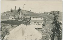
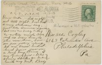



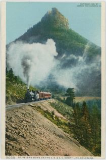
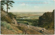
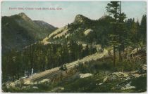
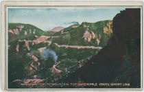
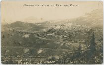
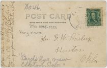
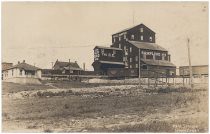

![click to enlarge Broncho Busting Labor Day Victor [Looking Northerly]](http://www.cripplecreekrailroads.com/04library/postcards/p-03139_tbn_broncho_busting_labor_day_victor,view_north_frmd.jpg)
![click to enlarge backside of Broncho Busting Labor Day Victor [Looking Northerly]](http://www.cripplecreekrailroads.com/04library/postcards/p-03139_tbn_broncho_busting_labor_day_victor,view_north_bck.jpg)
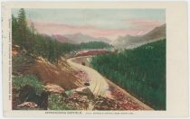

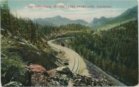
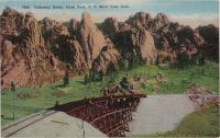
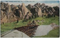
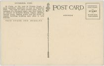
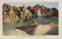
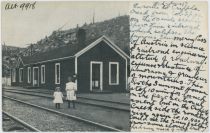
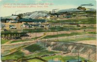
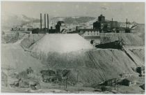
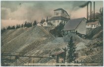
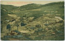
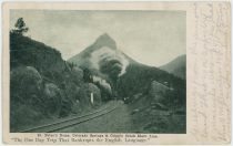
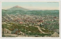
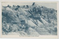
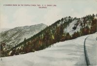
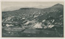
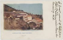
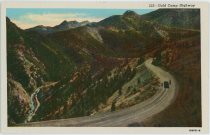
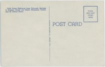
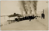

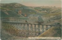
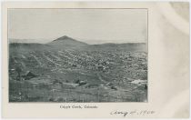
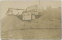
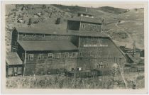
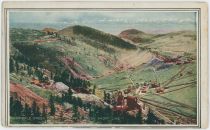
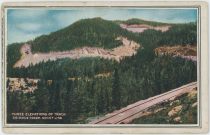


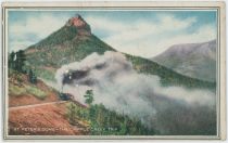

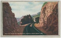
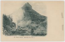
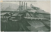
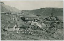
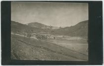
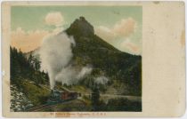
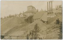
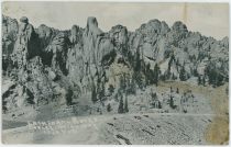
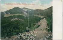
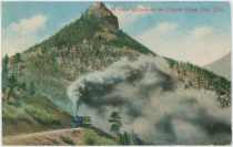
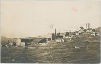
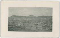
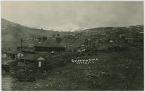
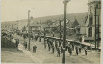
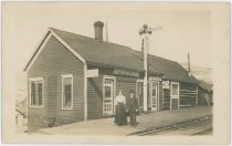
![click to enlarge Steer Roping Contest Victor Colo. [Rodeo and Bronco Riding in Victor Below the Strong Mine]](http://www.cripplecreekrailroads.com/04library/postcards/p-03046_tbn_steer_roping_contest_victor_colo_victor_studio_frmd.jpg)
![click to enlarge backside of Steer Roping Contest Victor Colo. [Rodeo and Bronco Riding in Victor Below the Strong Mine]](http://www.cripplecreekrailroads.com/04library/postcards/p-03046_tbn_steer_roping_contest_victor_colo_victor_studio_bck.jpg)
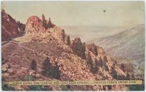
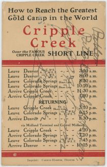
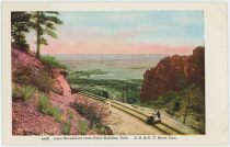


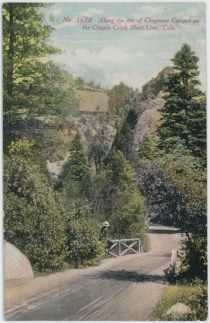
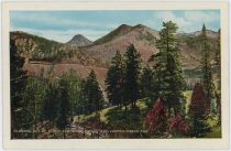
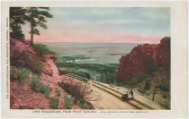
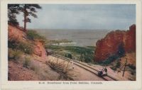

![click to enlarge [B] Observation Point. The Cripple Creek Trip.](http://www.cripplecreekrailroads.com/04library/postcards/p-02988_tbn_observation_point_the_cc_trip_frmd.jpg)
![click to enlarge backside of [B] Observation Point. The Cripple Creek Trip.](http://www.cripplecreekrailroads.com/04library/postcards/p-02988_tbn_observation_point_the_cc_trip_bck.jpg)
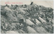
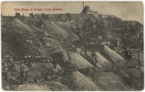
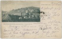
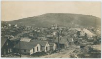
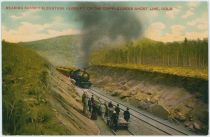
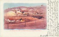
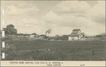
![click to enlarge Early Day Victor, Colorado Scene [error, it is Really a Scene in Cripple Creek, Looking East at Gold Hill]](http://www.cripplecreekrailroads.com/04library/postcards/p-00306_tbn_05_11-12_view-at-lower-gold-hill-from-houses-cc_frmd.jpg)
![click to enlarge backside of Early Day Victor, Colorado Scene [error, it is Really a Scene in Cripple Creek, Looking East at Gold Hill]](http://www.cripplecreekrailroads.com/04library/postcards/p-00306_tbn_05_11-12_view-at-lower-gold-hill-from-houses-cc_bck.jpg)
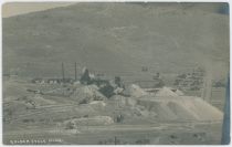


![click to enlarge Trolley on Low Line About 1905 [Near the Big Cut on the Low Line North of Anaconda]](http://www.cripplecreekrailroads.com/04library/postcards/p-00225_tbn_nx2227_trolley_on_low_line_about_1905_frmd.jpg)
![click to enlarge backside of Trolley on Low Line About 1905 [Near the Big Cut on the Low Line North of Anaconda]](http://www.cripplecreekrailroads.com/04library/postcards/p-00225_tbn_nx2227_trolley_on_low_line_about_1905_bck.jpg)
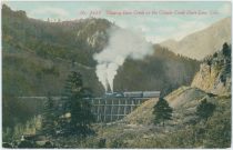

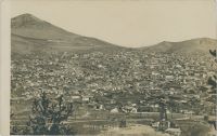
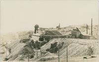
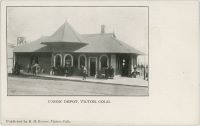
![click to enlarge Cripple Creek, Colo. 9500 Ft., on M.T. and C.S. & C.C.D. Ry. [Looking From North Towards Short Line Yard]](http://www.cripplecreekrailroads.com/04library/postcards/p-03424_tbn_cc_city_view_from_north_to_short_line_yard_frmd.jpg)
![click to enlarge backside of Cripple Creek, Colo. 9500 Ft., on M.T. and C.S. & C.C.D. Ry. [Looking From North Towards Short Line Yard]](http://www.cripplecreekrailroads.com/04library/postcards/p-03424_tbn_cc_city_view_from_north_to_short_line_yard_bck.jpg)
