Scanned items: Postcards from My Collection
This Category: Independence Townsite, has a total of 12 images, as of 21.02.2023 (21:51:32).
Most Recent added/changed image is on top.
Most Recent added/changed image is on top.
Media Info Last Updated:
20.02.2023 (15:08:19)
Title (on) Image:
The Findley MinePhotographer [Date]:
H. & H. Studio [Hileman & Hill]Date Guestimates, Earliest:
Date Guess, No Later Than:
Published By:
Source ID, My Collection:
P-03660 [#6317]
Shareable Link to PC Info:
www.cripplecreekrailroads.com/04library/scnd_postcards_all.php#6317Description:
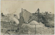
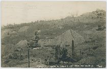
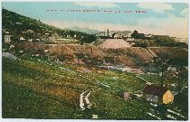
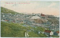
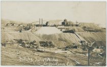
I think this view past the Findley Mine is one great image as it sort of capture the District, as in front lower left you have houses and habitats for humans, you even see at least one outhouse for the toilet need! Then you have the dumps and structures of the reason for the humans to be there, the mining operations footprint so to speak, with many smaller dumps where each mark a mining hole that was someone's dream and hope for a better life, and then you have the large dumps like the Findley one from mines that was in gold and at least impacted some people's life for the better! In background against the sky you see the various dumps and mine structures making up the area around the former town of Altman, still seems to be some structures left of the town up there, and on the slope down towards the photographer there are these smaller log-cabins and homes of miners, among the mining dumps and Gallows-frames and other needed mining structures making up this photo.
 I did procure the colored version of this image, if that is what you see, as I think it is nicer. Source is gray-toned, or in common speech black & white. Used an online service and tweaked and worked with image to get what looks best to my eyes for the moment.
Sorting Categories:
Altman Townsite Independence Townsite Mining Enties visible:
Findley - 216 I've seen copies of this Card sell at eBay on/for:
26.03.2018 at USD 62.0Media Info Last Updated:
15.04.2022 (13:04:24)
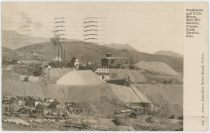
Title (on) Image:
A View at the Vindicator and Lillie Mines on Bull Hill, with the M.T. Independence Depot in Foreground RightPhotographer [Date]:
Julia SkolasDate Guestimates, Earliest:
Date Guess, No Later Than:
1908-07-03; Seen a printed/lithograph type of postcard dated July 10, which gives at least 1 week to process/create, hence the latest date used.Published By:
Source ID, My Collection:
P-03544 [#6189]
Shareable Link to PC Info:
www.cripplecreekrailroads.com/04library/scnd_postcards_all.php#6189Description:
This unmarked postcard view here is the same as marked postcard views by Julia Skolas in my possession, but this seems to be the best of the ones I've seen, even if it is a smaller crop from the source image then the other versions I've seen. In lower left part of the lower Independence town is seen, with the Midland Terminal Depot seen in lower right, and strangely enough, what appears to be dual gauge tracks on the curve closest to the depot structure, wonder if it is true dual or just guard rail for the curve…
 Above the M.T. depot at top right is the old Lillie Mine Shaft Structures seen in all its glory, but I can't tell if this is before or after it was closed as a mine and reused as a Mill for the Vindicator Mine, seen to the left, about center sideways and about 1/3 down from the top. Poking out from the Vindicator Ore-House is seen yet another structure and that leads to a chute down to the M.T. tracks and some form of Ore-Bin down there, presumable some form of mill operations.
 Near upper left a string of railroad cars appearing to be passenger cars can be seen, not quite understanding that as that should be on the High Line grade and if they are parked there, that makes this after the Trolley Services closed in 1919, but I am not sure why they are up there or not. Studying a 1200dpi scan it appears the cars may be located below the High Line tracks as there appears to be a line pole a little bit higher up, so maybe the cars are standing on what was a siding there, after all, the track appears to be level where the cars are standing.
Sorting Categories:
Independence Townsite Midland Terminal Related Short Line Related High Line Mining Enties visible:
Vindicator No. 1 - 233 Lillie - 234 I've seen copies of this Card sell at eBay on/for:
Media Info Last Updated:
10.07.2019 (08:28:10)
Title (on) Image:
Southwest Slope of Bull Hill, Cripple Creek DistrictPhotographer [Date]:
Julia SkolasDate Guestimates, Earliest:
Date Guess, No Later Than:
1914-01-04; Seen a postcard stamped January 5th, so Day Photographed can't be closer than at least one day earlier.Published By:
Source ID, My Collection:
P-03840 [#6515]
Shareable Link to PC Info:
www.cripplecreekrailroads.com/04library/scnd_postcards_all.php#6515Description:
Sadly the paper this postcard is made on is one of those not so good one, and while it scanned useful it is not very good as the dark areas are just dark, and there is some silvery like parts in those darker area, also messing with my scan. The scene itself is an interesting one, as it captures and identifying some of the mines at this area of Bull Hill, also shows the Golden Circle trackage in this area, with lots of small mine operations around on the ground, with homes and houses spread around and growing huge dumps.
 In upper right corner the American Eagle Shaft House and mine operation is seen marked as 'Eagles' while further down along the right-hand side, the Ore-House of the Shurtloff No. 2 Mine is seen about 2/5 down – this had a side-spur, leaving the mainline of the Golden Circle about halfway up the route around Bull Cliffs on the south side, pieces of that spur is seen in lower foreground just above the word 'Cripple' in the card's title text along the bottom of this postcard view.
Extra Image Links:
⊞ Southwest Slope of Bull Hill, Cripple Creek District {Enhanced; Straightened} Sorting Categories:
Golden Circle Related Independence Townsite Mining Enties visible:
American Eagle - 312 Findley - 216 Delmonico Mine [Bull Hill] - 1065 Shurtloff No. 2 - 221 I've seen copies of this Card sell at eBay on/for:
23.06.2018 at USD 35.25Media Info Last Updated:
23.07.2018 (13:46:02)
Title (on) Image:
Hull City Mine, Bull Hill in the 1930-40's ?Photographer [Date]:
Date Guestimates, Earliest:
Date Guess, No Later Than:
Published By:
Source ID, My Collection:
P-03634 [#6291]
Shareable Link to PC Info:
www.cripplecreekrailroads.com/04library/scnd_postcards_all.php#6291Description:
This has always felt like a Bull Hill, eastern slope, type of mine to me, and this being the second version of this view I've seen/got hold of. I been searching high and low to try find proof to that feel though, but all has failed until when I did a comparison with two other images in my collection found at DB-Ref. P-02385 & P-02386. With those, I figured it out! Location is at the place of the former larger Hull City Mine, the cribbing seen further uphill in the background was part of the large Findley Dump and is also found in those two mentioned views. What happened to the much larger and well-known Hull City Mine I have no knowledge about, maybe it burned? Maybe it got tore down?
 Either way, as far as I can tell this view is at that location of the Hull City, so that is how it shall stay until that day someone can point out to me where I got mistaken. :-) But, why someone could mistake this for the Mary McKinney Mine is beyond my ability to understand, but someone wrote sometime in the past of this postcard's history on the backside a handwritten note claiming this to be the Mary McKinney Mine but that is plainly just wrong! That mine looks way different.
 If I compare this to P-02386 I need to look at the 1200dpi scan and there I find it about 1/3 down and about center sideways, where I look direct to the Ore-House part, with the Head-Frame to the right and the cribbing about twice the distance to the right there again – but it is impossible to tell the depth from this postcard view. If I compare the postcard to P-02385 I still need to look at the 1200dpi scan where I find it about 2/5 down from top and about 1/8 from right-hand side. Angle is about the same as on the other photo, can't say I get a better look either, both photographs are not sharp at this resolution.
 Back at the postcard view itself, the old Golden Circle Mainline is seen about 2/5 down from top, entering the view at left-side, climbing a little, hide behind a dump at the crib-wall, then being visible a little again before exiting behind a new dump at the right-hand side. Below the crib-wall, almost at middle down/top is the old grade of the High Line, and the Short Line Portland branch – long gone in this view as I see no line side poles, so this help dating the view to be after the demise of the Trolley Service in late 1919.
  * About 2/7 down from top and nearly 1/7 in from left-hand side, against the sky, is the top of the Head-frame at the Specimen Mine seen with its wheel about center of the top frame from right to left in this view – very hard to make out on the postcard scan, easier to see on my 1200dpi scan.
 * About 1/7 down from top and about 1/7 in from right-hand side is another Head-Frame seen, and I keep wondering if this might not be the eastern Lucky Guess shaft? Very hard to tell, the old shaft house is long gone.
Extra Image Links:
⊞ Hull City Mine, Bull Hill in the 1930-40's ? {Enhanced; Straightened}
⊞ Hull City Mine, Bull Hill in the 1930-40's ? {Cropped; Enhanced; Straightened} Sorting Categories:
Independence Townsite Midland Terminal Related Mining Enties visible:
Hull City placer - 321 Specimen - 412 I've seen copies of this Card sell at eBay on/for:
Media Info Last Updated:
15.07.2018 (14:10:59)
Title (on) Image:
Vindicator Mine, Cripple Creek District, Colo.Photographer [Date]:
Julia SkolasDate Guestimates, Earliest:
Date Guess, No Later Than:
1908-07-03; Seen a printed/lithograph type of postcard dated July 10, which gives at least 1 week to process/create, hence the latest date used.Published By:
Source ID, My Collection:
P-00064 [#68]
Shareable Link to PC Info:
www.cripplecreekrailroads.com/04library/scnd_postcards_all.php#68Description:
This is one of my earliest bought postcards, all the way back to August 2005, and it took till today; July 15, 2018; before I learned a little bit more about it, like the fact this is a Julia Skolas photo! And so far, I know about 19 uses of the base negative/photo, many used for this postcard here in various crop editions, so I think it was a popular view and printed many times by both the same and various postcard publishers as I've seen various versions of this one. There appears to be some form of snow on the ground in the foreground and on the hills and mountains in the distance background right, this gives the impression this might be a late winter photograph, possible 1908 as a year, as this postcard has a date of July 10, 1908 on its text message.
 * About 1/3 down and almost at left-hand edge is the Vindicator No. 2 Shaft-House; in this colored postcard version it is not as white as it is on other colored postcard versions.
 * Vindicator No. 1 is seen also about 1/3 down from top and about 2/5 in from right-hand side, consisting of a Shaft House, large Powerplant, huge Ore-House; and lot of dumps.
 * Just to the right of the Vindicator No. 1 is the (on this view) large dark green with red colored roof Shaft House of the Lillie/Lilly/Lily Mine. This structure of the Lillie was later used as an experimental Mill for the Vindicator mine.
 * In the foreground lower right there is unknown mine structure, which I wish was easy to say which mine it is, but my brain refuses to work, and I do not know currently (15.07.2018]. I been wondering if it might be on the Longfellow claim, but I am not sure, it feels located wrong though, too far south of what is now a reduced Independence Townsite, seen about middle of the image extending uphill towards your left.
Sorting Categories:
Independence Townsite Midland Terminal Related Mining Enties visible:
Vindicator No. 2 - 232 Vindicator No. 1 - 233 Lillie - 234 I've seen copies of this Card sell at eBay on/for:
05.06.2009 at USD 5.5512.07.2009 at USD 9.9917.09.2013 at USD 3.53Media Info Last Updated:
15.07.2018 (13:11:03)
Title (on) Image:
Vindicator Mine, Cripple Creek District, Colo.Photographer [Date]:
Julia SkolasDate Guestimates, Earliest:
Date Guess, No Later Than:
1908-07-03; Seen a printed/lithograph type of postcard dated July 10, which gives at least 1 week to process/create, hence the latest date used.Published By:
Source ID, My Collection:
P-03841 [#6516]
Shareable Link to PC Info:
www.cripplecreekrailroads.com/04library/scnd_postcards_all.php#6516Description:
I never seen this view as anything but as a printed/lithograph type of postcard, or in a postcard type of folder, but when I scanned this one I noticed that this is having the same base image as a couple of photo type of postcards that I have, which I found cool as suddenly I could say this is a Julia Skolas photo! And so far, I know about 19 uses of the base negative/photo, many used for this postcard here in various crop editions, so I think it was a popular view and printed many times by both the same and various postcard publishers as I've seen various versions of this one. Wish it was as easy to say which mine is up front in lower right, but my brain refuses to work, and I do not know currently (15.07.2018]. I been wondering if it might be on the Longfellow claim, but I am not sure, it feels located wrong though, too far south of what is now a reduced Independence Townsite, seen about middle of the image extending uphill towards your left.
 * Known mines count the Vindicator No. 2; the whitish single shaft house far left, about 2/5 down from top and about as much in from left-hand edge as the Shaft-house is wide.
 * Vindicator No. 1 is seen also about 2/5 down from top and about 2/5 in from right-hand side, consisting of a Shaft House, large Powerplant, huge Ore-House; all white in this view; lot of dumps.
 * Just to the right of the Vindicator No. 1 is the (on this view) large red colored shaft house of the Lillie/Lilly/Lily Mine. This structure of the Lillie was later used as an experimental Mill for the Vindicator mine.
 * About center top/down and about 1/5 in from right-hand side is the Midland Terminal Independence Depot and tracks visible. There appears to be some form of snow on the ground in the foreground and on the hills and mountains in the distance background right, this gives the impression this might be a late winter photograph, possible 1908 as a year.
Sorting Categories:
Independence Townsite Midland Terminal Related Mining Enties visible:
Vindicator No. 2 - 232 Vindicator No. 1 - 233 Lillie - 234 Longfellow Mine - 235 I've seen copies of this Card sell at eBay on/for:
23.06.2018 at USD 3.0Media Info Last Updated:
15.07.2018 (12:14:30)
Title (on) Image:
Vindicator Mine and AreaPhotographer [Date]:
Julia SkolasDate Guestimates, Earliest:
Date Guess, No Later Than:
1908-07-03; Seen a printed/lithograph type of postcard dated July 10, which gives at least 1 week to process/create, hence the latest date used.Published By:
Source ID, My Collection:
P-00156 [#181]
Shareable Link to PC Info:
www.cripplecreekrailroads.com/04library/scnd_postcards_all.php#181Description:
This titled postcard view by Julia Skolas is not of Cripple Creek per say, as indicated by the title below the name of the photographer, but of the Vindicator Mine complex, and possible of the Lillie Mine if it still was in operation when this image was photographed, both located on Bull Hill in the Cripple Creek District. In lower left part of the lower Independence town is seen, with the Midland Terminal Depot seen in lower right. Above the M.T. depot at top right is the old Lillie Mine Shaft Structures seen in all its glory, but I can't tell if this is before or after it was closed as a mine and reused as a Mill for the Vindicator Mine, seen to the left, about center sideways and about 1/3 down from the top. Poking out from the Vindicator Ore-House is seen yet another structure and that leads to a chute down to the M.T. tracks and some form of Ore-Bin down there, presumable some form of mill operations.
 Just left of the Vindicator Mine complex, a string of railroad cars appearing to be passenger cars can be seen, not quite understanding that as that should be on the High Line grade and if they are parked there, that makes this after the Trolley Services closed in 1919, but I am not sure why they are up there or not. Studying a 1200dpi scan it appears the cars may be located below the High Line tracks as there appears to be a line pole a little bit higher up, so maybe the cars are standing on what was a siding there, after all, the track appears to be level where the cars are standing.
 In the foreground left, several structures in the town of Independence is seen, and clearly many of them is vacant and not livable so this is clearly a declining town by the time this image was made.
Sorting Categories:
Independence Townsite Mining Enties visible:
Vindicator No. 1 - 233 Lillie - 234 I've seen copies of this Card sell at eBay on/for:
Media Info Last Updated:
21.05.2018 (17:35:00)
Title (on) Image:
Hull City Mine, Bull Hill in the 1930-40's ? [darker]Photographer [Date]:
Date Guestimates, Earliest:
Date Guess, No Later Than:
Published By:
Source ID, My Collection:
P-03546 [#6191]
Shareable Link to PC Info:
www.cripplecreekrailroads.com/04library/scnd_postcards_all.php#6191Description:
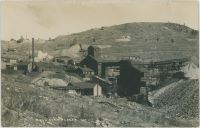
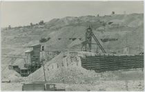
This has always felt like a Bull Hill, eastern slope, type of mine to me, this being the first ever version of this view I've seen/got hold of. I've been searching high and low to try find proof to substantiate that feel though, but all had failed until I did a comparison with two other images in my collection found at DB-Ref. P-02385 & P-02386. With those, I figured it out! :-) Location is at the place of the former larger Hull City Mine, the cribbing seen further uphill in the background was part of the large Findley Dump and is also found in those two mentioned views. What happened to the much larger and well-known Hull City Mine I have no knowledge about, maybe it burned? Maybe it got tore down?
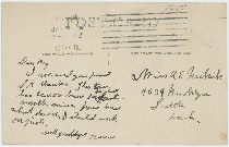
 Either way, as far as I can tell this view is at that location of the Hull City, so that is how it shall stay until that day someone can point out to me where I got mistaken. :-) But, why someone could mistake this for the Mary McKinney Mine is beyond my ability to understand, but someone wrote sometime in the past of this postcard's history on the backside a handwritten note claiming this to be the Mary McKinney Mine but that is plainly just wrong! That mine looks way different.
 If I compare this to P-02386 I need to look at the 1200dpi scan and there I find it about 1/3 down and about center sideways, where I look direct to the Ore-House part, with the Head-Frame to the right and the cribbing about twice the distance to the right there again – but it is impossible to tell the depth from this postcard view. If I compare the postcard to P-02385 I still need to look at the 1200dpi scan where I find it about 2/5 down from top and about 1/8 from right-hand side. Angle is about the same as on the other photo, can't say I get a better look either, both photographs are not sharp at this resolution.
 Back at the postcard view itself, the old Golden Circle Mainline is seen about 1/3 down from top, entering the view at left-side, climbing a little, hide behind a dump at the crib-wall, then being visible a little again before exiting behind a new dump at the right-hand side. Below the crib-wall, almost at middle top/down is the old grade of the High Line, and the Short Line Portland branch – long gone in this view as I see no line side poles, so this help dating the view to be after the demise of the Trolley Service in late 1919.
  * About 5/22 down from top and about 1/7 in from left-hand side, against the sky, is the top of the Head-frame at the Specimen Mine seen with its wheel about center of the top frame from left to right in this view – very hard to make out on the postcard scan, easier to see on my 1200dpi scan.
 * About 1/15 down from top and about 1/7 in from right-hand side is another Head-Frame seen, and I keep wondering if this might not be the eastern Lucky Guess shaft? Very hard to tell, the old shaft house is long gone.
Sorting Categories:
Independence Townsite Midland Terminal Related Mining Enties visible:
Hull City placer - 321 Specimen - 412 I've seen copies of this Card sell at eBay on/for:
Media Info Last Updated:
06.04.2018 (16:30:58)
Title (on) Image:
View East From Upper Independence Town Towards Vindicator MinePhotographer [Date]:
Date Guestimates, Earliest:
1910; As that is the year it is said the Vindicator No. 1 changed to the Steel framed Head-Frame seen in the imageDate Guess, No Later Than:
Published By:
Source ID, My Collection:
P-03538 [#6183]
Shareable Link to PC Info:
www.cripplecreekrailroads.com/04library/scnd_postcards_all.php#6183Description:
For me this was a view I had to get hold of as it is a very informative postcard view showing/sharing many things! There are so many things in this view I have no words, but I shall try my best to talk about them. In foreground right I am pretty certain that the street seen is the continuation of the Montgomery Avenue in Independence town, passing by the High Line Independence Shelter structure seen about 1/4 up from bottom and about 1/5 in from right-hand side, with the High Line seen running through the upper portion of Independence from right to the left going down the grade to a loop not visible in this view, turning 180-degree and running back towards right on the hidden side of the Vindicator No. 1 Shaft which is seen in the distance nearly center/middle of this view – slightly to the right and above center.
 About 1/6 in from left-hand side and about 1/3 up from bottom, crossing the before mention High Line grade, on a curve, is the Craigue Avenue of Independence, running downhill passed the two-story Public School and ending at the intersection with 3rd Street as below that intersection the Hose House and Hall, Fire-station I think, is located on what should have been the street, with railroad spurs connecting to Vindicator shafts beyond/below that.
 The before mentioned Public School is seen just right of the center/middle of image and just below same, with the Hose-house seen with is tower like structure just right of the white large school structure. Beyond the Hose-house one can see the Ore-house of the Vindicator No. 1 Mine, with blackish soot up above the arched opening into the ore-house for train cars and engines as clearly, they have also run into the house or else it would not have been that dirty above the opening.
 Vindicator No. 2 Shaft is seen with its smaller but quite high structure about 1/5 in from right-hand side and about 2/5 up from bottom with the Gloriette/Glorietta/Glorieta Shaft seen just in front and to the right with a Head-Frame seen, easier to see on a higher resolution scan.
 In front of the before mentioned Hose-house there are railroad tracks with dual gauge (3-rails), part of the Golden Circle spur that once served the now gone Lillie Mine seen as a larger Dump beyond the No. 1 Vindicator Shaft structure, and at one time run all the way to the Cripple Creek Sampler on Bull Hill/Victor Pass (Sampler as also know as the Black Sampler). The dual gauge also served Vindicator No. 2 and might possible have gone down to the No. 1 Ore-house, but not sure.
Sorting Categories:
Golden Circle Related Independence Townsite Midland Terminal Related Short Line Related High Line Mining Enties visible:
Vindicator No. 1 - 233 Vindicator No. 2 - 232 I've seen copies of this Card sell at eBay on/for:
Media Info Last Updated:
04.04.2018 (23:38:21)
Title (on) Image:
Vindicator and Lillie Mines, Bull Hill District, Cripple Creek District, Colo.Photographer [Date]:
Date Guestimates, Earliest:
Date Guess, No Later Than:
1907-12-31; The base image appears in a special Postcard folder with a 1907 Copyright to it, so the image can't be photographed later than this date.Published By:
Jas. A. JonesSource ID, My Collection:
P-00468 [#567]
Shareable Link to PC Info:
www.cripplecreekrailroads.com/04library/scnd_postcards_all.php#567Description:
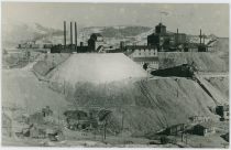
I've seen this image two times, this card and as a small view in a special type of Multiview postcard, that last one has a Copyright date of 1907 so that did help make this image even older than the date on this postcard view did. In foreground left bottom several houses of Independence Town are seen, with the Midland Terminal Depot down at the tracks. The massive dumps of the Vindicator, and the Lillie, dominates the scene, and while the paper and image quality is not that great being a printed card, the huge square like structure of the Lillie Mine is easy to pick out in this view, where it is located about center of the card, with the Vindicator No. 1 Shaft to left with its 3 smokestacks sending darker smoke to the sky.
Sorting Categories:
Independence Townsite Midland Terminal Related Mining Enties visible:
Vindicator No. 1 - 233 Lillie - 234 I've seen copies of this Card sell at eBay on/for:
11.03.2013 at USD 13.0727.12.2017 at USD 8.9905.03.2018 at USD 4.75Media Info Last Updated:
28.03.2018 (12:37:12)
Title (on) Image:
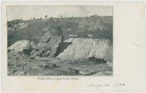
Findley Mine, Cripple Creek DistrictPhotographer [Date]:
Date Guestimates, Earliest:
Date Guess, No Later Than:
1906-08-03; As card is dated on the front with August 4, 1906 it helps date this image to been taken no later then August of 1906.Published By:
Source ID, My Collection:
P-00635 [#925]
Shareable Link to PC Info:
www.cripplecreekrailroads.com/04library/scnd_postcards_all.php#925Description:
I never seen this view as a photograph, only as the printed image used for this postcard and two kind of postcard folders, where there where small images included inside one larger postcard view. This is a nice view of the large operations going down at the Findley Mine, with several smaller dumps seen in the distance, all on Bull Hill, looking westerly. In the foreground several railroad cars on spurs belonging to the Golden Circle 3-foot railroad can be seen, and I would suspect the home seen in lower right is considered to be part of the Independence townsite even if I can't really see the town itself as that is outside the view at bottom.
 The first two tracks from bottom up is sidings used to collect ore from horse run wagons from the many smaller mines in the area, while the spur just going to the bottom part of the right-hand bottom corner is a spur I've seen being connected to mine named Deadwood No. 2 if I've read images I've seen correctly. While the track going of into the right-hand side of the lower right bottom, that is part of the Golden Circle mainline that used to run passed the Independence Depot and unto the end loop at Vista Grande, sort of outside the view twice the width or so of this card to the right, higher up, behind the hill.
Sorting Categories:
Golden Circle Related Independence Townsite Mining Enties visible:
Findley - 216 I've seen copies of this Card sell at eBay on/for:
21.05.2012 at USD 39.004.08.2013 at USD 4.5715.02.2014 at USD 18.4508.03.2017 at USD 13.2812.03.2017 at USD 7.4917.11.2018 at USD 22.72Media Info Last Updated:
14.03.2018 (11:36:51)
Title (on) Image:
Hull City PlacerPhotographer [Date]:
Date Guestimates, Earliest:
Date Guess, No Later Than:
Published By:
Source ID, My Collection:
P-03505 [#6062]
Shareable Link to PC Info:
www.cripplecreekrailroads.com/04library/scnd_postcards_all.php#6062Description:
This was a new angle to me of the Hull City Mine, was very happy when I got a chance to get hold of this one!Sorting Categories:
Golden Circle Related Independence Townsite Midland Terminal Related Mining Enties visible:
Hull City placer - 321 I've seen copies of this Card sell at eBay on/for:
![click to enlarge Hull City Mine, Bull Hill in the 1930-40's ? [darker]](http://www.cripplecreekrailroads.com/04library/postcards/p-03546_tbn_mine_scene,possible_bull_hill,railcars_below_mine_frmd.jpg)
![click to enlarge backside of Hull City Mine, Bull Hill in the 1930-40's ? [darker]](http://www.cripplecreekrailroads.com/04library/postcards/p-03546_tbn_mine_scene,possible_bull_hill,railcars_below_mine_bck.jpg)
