-> HathiTrust Digital Library Site; Link to First page of article.
I replaced source image with a similar from my collection as source was so bad quality
Chlorination has probably seen its best days, and today is practiced only to a limited extent throughout the United States. In most cases it has given place to the cheaper process of cyanidation, or to smelting, whereby a better extraction is obtained, although at a greater cost of treatment. The necessity of roasting before treatment renders the process uneconomical where a good extraction can be obtained by the cyanide process.
In most cases, however, a better extraction is obtained by the chlorination process, and where roasting is necessary in order to render the ore amenable to treatment by either process chlorination will usually give the more economical results; that is, the greater extraction obtained will more than counterbalance the greater cost of treatment.
Also, for certain grades of ore the same reasoning will apply. For instance, suppose we have a $20 ore in which 75% extraction can be obtained by cyanidation, 93% by chlorination and 98% by smelting; and, suppose the cost of treatment in the three cases to be respectively $3, $6 and $8.
In the first case $15 would be obtained by the cyanide process, leaving a profit of $12.
By chlorination $18.60 would be obtained, leaving a profit of $12.60.
By smelting $19.60 would be obtained, leaving a profit of $11.60.
In this case the greater profit would be obtained by the chlorination process.
With a $10 ore, however, with the same cost of treatment and percentage of extraction the cyanide process would give a greater profit by $1.20 per ton.
With a $40 ore under the same conditions, the profits would be the same by smelting or chlorination.
From this it is seen that chlorination has its chief application on ores ranging say from $15 to $35 per ton. The process is applied more extensively to ores from the Cripple Creek districts than to any other district in the United States. Several mills are located at Colorado City, among them the Portland, treating ore from the Portland mine at Victor.
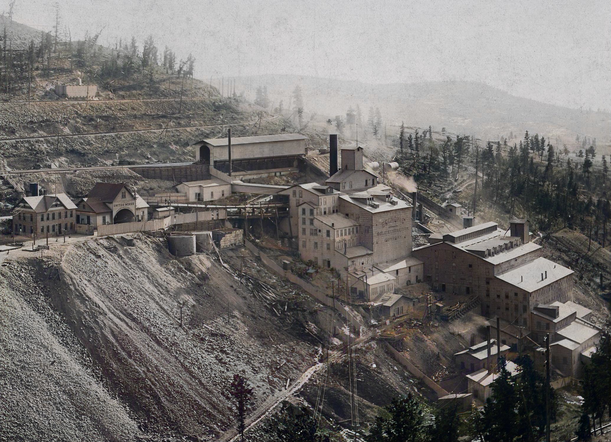
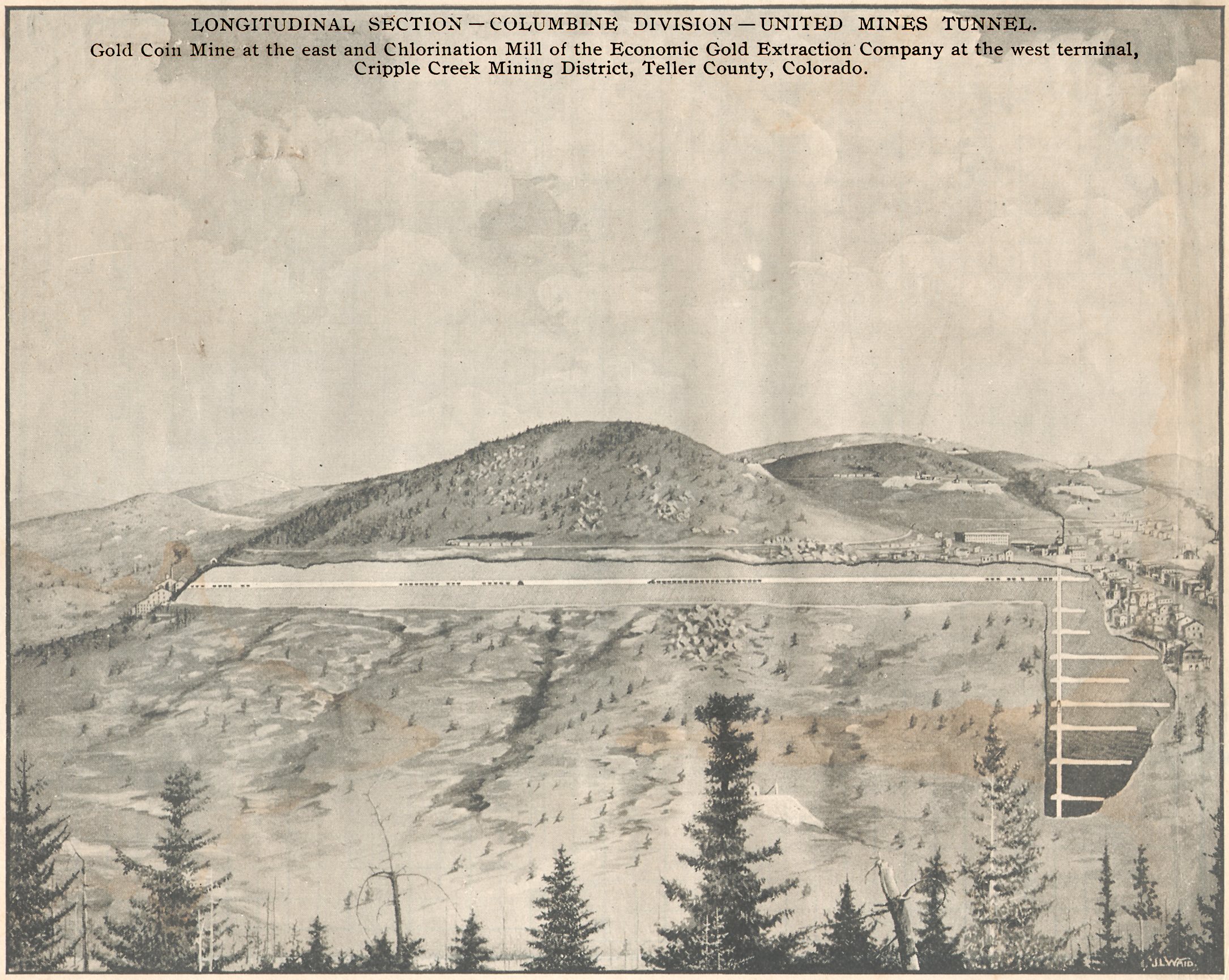
Only one mill is located in the district, the Economic, located about one mile from Victor on the opposite side of Squaw mountain. This mill is owned by the Woods Investment Company and treats principally ores from the company's property.
A large part of the ore at present is obtained through the Gold Coin shaft, in Victor, in which it is raised to the 100-foot level, from which a tunnel leads through the hill to the mill site.
The following shows the general scheme of operations through the crushing department.
Diagram No. 1.
- From the bins the ore goes to the gyratory crusher.
- From the crusher it goes to two coarse rolls.
- The material is elevated and goes to the sampling works, where 1-100 is cut out for hand sampling. The remainder goes by belt conveyor to ore bins.
- From bins it goes to dryers.
- From the dryers by belt conveyors and elevator it goes to coarse rolls.
- From the rolls it goes to four-mesh screens.
- The oversize from screens is returned to coarse rolls; the undersize goes to screens of ten-mesh.
- The oversize goes to medium rolls; the undersize to screens of twelve-mesh.
- The oversize goes to fine rolls; the undersize to bin.
All of the rolls except those in the sampling department are of the same size, sixteen by thirty-six inches, and are located upon the same floor. This allows the shells of the fine rolls when too badly worn to be used upon the coarse rolls.
The heat of the roasters is ingeniously utilized for the drying of the ore. At the bottom of the bins to which the ore passes from the sampling room are hollow rectangular iron bars through which the smoke from the roasters passes on its way to the smokestack.
The ore is dried by passing over and around these hollow bars and is drawn out below by chutes onto a belt conveyor, which carries it to the elevator.
It will be seen from the general scheme that the maximum size of crushed product is twelve-mesh.
The four and ten-mesh screens are stationary inclined screens contained in the same housings and so arranged that the undersize from the four-mesh screens falls directly upon the ten-mesh screen.
The twelve-mesh screens are inclined impact screens as the ore does not pass through the finer screens as readily as through the coarser.
From the fine ore bins the ore is trammed to the roasting department. The following is the general scheme through the roasting, chlorinating and concentrating departments:
Diagram No. 2.
- The crushed product is trammed to roasters consisting of seven Argall roasters and one Pearce Turret roaster.
- The crushed product goes to eight revolving coolers.
- The cooled product is elevated by eight elevators to bins, from which it is trammed to eight chlorination barrels.
- The ore in the barrels is treated with chloride of lime, acid and water.
- The gold solution is conveyed to settling tanks.
- The solution is pumped to precipitating tanks, filter-pressed solution going to waste, gold sulphide precipitates to refinery.
- The leached ore goes to ten Wilfley tables; tails go to waste.
- The concentrates go to two Wilfley tables; tails again going to waste.
- The concentrates from the two Wilfley tables are elevated to one Bartlett concentrator; tails going to waste, and concentrates from barrel go to smelter.
The Argall furnaces have a capacity of thirty-six tons.
Crude oil has been used for fuel for the Argall furnaces at a cost of about 55 cents per ton of ore roasted.
Coal has been used in the Pearce turret and experiments have been introduced looking toward the use of lignite coal.
So far the results seem satisfactory, and the cost of fuel has been reduced to a little over 40 cents per ton of ore.
It is contemplated replacing the oil fuel in the Argall furnaces by lignite if the results warrant it.
The barrels used for leaching are seven by sixteen feet internal diameter and were originally designed for fifteen tons capacity. By the introduction of an improved filter, however, the capacity has been increased to twenty tons.
The old style of filters has been replaced by lead lined iron pipes running the length of the barrels and connected at short intervals with the interior of the barrels by T pipes.
Over the end of the T leading into the barrel the lead lining is slightly raised and perforated with numerous small holes. This is the only filter used and it will be seen that by this method no room whatever is taken up inside of the barrel.
The charge used for the barrels is;
20 tons of ore
600 pounds H2SO4
500 pounds chloride of lime and water to make a thin pulp.
The barrels are revolved for three and one-half hours and then leached until the solution fails to give a precipitate with H2S.
After leaching the ore is assayed before discharging and if the extraction is not sufficient the barrels are recharged. Exact figures as to the value of ore, percentage of extraction, etc., are difficult to obtain from authoritative source, but indirectly the extraction was ascertained to be about 93% and the cost of treatment approximately $6, including crushing, roasting and chlorination.
The total capacity of the mill is about 300 tons of ore per twenty-four hours, but at present is only ran at about one-third capacity.

This 1900 Sanborn Fire Insurance Map for the Economic Mill of the Economic Gold Extraction Co. of Woods Investment Co. fame is the only one that exist with this type of details! The Mill was built in 1899 and burned early in 1907 so sadly this is all I have.
 I have a 1904 claim overview map from an Annual Report which, together with photographs, indicates this Sanborn map to not be fully true in the location of the various structures, but it is the best I have for now. The map is as it was made, except I cropped it out of a larger sheet, and rearranged the location of the Direction Arrow pointing to North, the scale bar and the location info. In addition, I have calculated a scale as per pixels towards meters.

